As climate volatility transitions from a future forecast to an immediate operational reality, municipal infrastructure managers are finding that yesterday's engineering standards no longer guarantee tomorrow's continuity. A drainage system designed for a "1-in-100-year" flood now faces such events every decade, while urban heat islands push electrical grids and road surfaces to their breaking points. In 2026, climate resilience is no longer an optional "green" initiative—it is a core fiduciary responsibility. Building resilience demands a shift from static, reactive maintenance to a dynamic, predictive "Asset Hardening" model. This guide outlines the framework for municipal climate adaptation, leveraging AI-driven risk modeling and real-time sensor networks to protect public assets before the next extreme weather event arrives. Book a free demo to digitize your resilience roadmap.
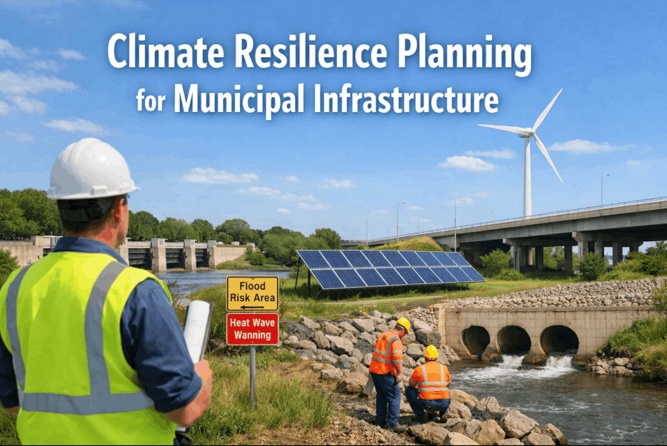
Climate Resilience Planning & Asset Hardening for Municipalities
A comprehensive technical roadmap for deploying AI-powered risk analytics to protect water, transport, and energy infrastructure against extreme weather volatility, flooding, and thermal stress.
Climate Failures Municipalities Cannot Afford to Ignore
Traditional infrastructure was built for a stable climate. Today, managers must defend against six primary climate-driven failure modes that threaten public safety and municipal credit ratings. Schedule a consultation.
Systemic Flash Flooding
Urban drainage systems are overwhelmed by high-intensity "cloudburst" events. iFactory's predictive runoff modeling identifies low-points and potential blockages before the storm hits, allowing for proactive clearing of culverts and mobilization of temporary barriers.
Urban Heat Island (UHI) Stress
Extreme thermal expansion causes road buckling and electrical transformer failures. We use thermal satellite data and city-wide sensors to identify "hot-spots," prioritizing the deployment of cool-pavement technologies and urban greening where they are needed most.
Coastal & Sea-Level Surge
Saltwater intrusion corrodes underground cabling and water pipes long before high tides become visible. Our sensor mesh monitors soil salinity and water table heights, providing an early warning system for the hardening of critical pump stations and utility vaults.
Grid Instability & High-Wind Events
Vegetation-grid interference during extreme wind events is a leading cause of multi-day municipal outages. iFactory's LiDAR-based vegetation management tracks tree growth rates against power-line clearances, predictive-scheduling pruning to prevent outages.
Subsurface Instability (Subsidence)
Drought-thaw cycles cause soil shifting, leading to catastrophic water main breaks and foundation cracks in government buildings. We track moisture volatility in the soil to predict "stress zones," allowing for targeted reinforcement before structural failure occurs.
Nature-Based System Failures
Bio-swales and "Sponge City" assets require precisely tuned maintenance to remain effective. We monitor the saturated-state of green infrastructure to ensure these natural buffers don't become sources of contamination during heavy rainfalls. Book a demo.
Why Legacy "Master Planning" Creates Structural Risk
Traditional 10-year master plans are becoming obsolete due to the speed of climate change. A dynamic, data-driven approach is now required to maintain municipal service levels.
Linear Extrapolation Failure
Old plans assume tomorrow's floods will look like yesterday's. This "Historical Bias" misses the non-linear growth of extreme weather, leading to under-engineered flood walls and drainage pipes that fail during their first major test.
Static Infrastructure Silos
Water, transit, and energy departments rarely share climate risk data. iFactory breaks these silos, showing how a power outage at a specific substation will cascade into a localized water pumping failure, enabling "Holistic Hardening."
The "Reactive Funding" Trap
Municipalities that lack data-backed resilience plans often miss out on federal IIJA/BIL grants. Proactive modeling is now a requirement for non-discretionary funding; without it, you are reliant on high-interest emergency borrowing post-disaster.
Manual Audit Delays
Relying on physical inspections of thousands of assets post-storm takes weeks. iFactory's digital twins provide "Instant Visibility," flagging compromised assets within minutes of a storm passing, prioritizing repair crews to the most critical failures.
Secure Your Municipality's Future with iFactory Resilience AI
iFactory provides the predictive analytics and real-time monitoring required to transform vulnerable infrastructure into climate-hardened assets.
From flood runoff prediction to urban heat island mitigation, our platform integrates directly with your city's SCADA and GIS data to deliver an actionable resilience roadmap. Automate your FEMA and EPA compliance reporting while securing your municipality's credit rating through verified risk reduction. Schedule a resilience audit.
Climate Architecture: Four Deployment Models for Adaptation
Municipalities can deploy resilience technology across four distinct architectural tiers, from purely predictive modeling to fully autonomous adaptive infrastructure.
Predictive Climate Twin
A 4D digital twin of the city that simulates weather scenarios (e.g., 6 inches of rain in 2 hours). It identifies exactly which manholes will overflow and which basements will flood. Book a demo today to see your city's digital twin.
Real-Time IoT Response Mesh
Deployment of low-cost water level sensors and thermal monitors across high-risk zones. This "Live Nervous System" triggers automated emergency alerts and deploys crews to critical assets before they reach failure thresholds.
Nature-Based Asset Management
Monitoring the health and absorptive capacity of "Sponge City" assets (parks, bio-retention ponds). We use multispectral imaging to track plant health and moisture levels, ensuring green infrastructure is always ready for the next event.
Autonomous Hardened Grids
Direct integration with SCADA systems to automatically divert water flow or load-balance electrical grids during a climate excursion. This "Self-Healing" model requires the high-fidelity data iFactory provides. Talk to our engineer.
Regulatory Frameworks Driving Resilience Investment
2026 mandates from federal and international bodies now require verifiable climate risk assessments for almost all infrastructure funding and insurance renewals.
The Evolution of Infrastructure Adaptation
From simple drainage to smart sponges: how the methodology of municipal protection has transformed in the 21st century.
Gray Infrastructure Era
Emphasis on massive concrete culverts and pumping stations. No intelligent monitoring; these systems were often overwhelmed by unexpected "extreme" events that exceeded their static design capacity.
Post-Sandy Hardening
Widespread realization that coastal assets needed physical protection. Installation of flood-gates and elevated control rooms, but still lacking real-time data connectivity between disparate city departments.
The Rise of "Sponge Cities"
First major nature-based initiatives (Green infrastructure). Focus on permeable surfaces and parks, but difficulty in quantifying their actual flood-reduction performance for regulatory audits.
Federal IIJA/BIL Resilience
US Infrastructure Law mandates climate-consideration for all federal funding. Resilience becomes a data task; cities begin integrating GIS and weather patterns to justify project spending.
Autonomous Asset Hardening
The current standard: iFactory AI manages predictive diverting, grid load-balancing, and sensor-based flood warning. 100% data transparency becomes the baseline for insurance and bond-rating agencies.
Static Planning vs. AI-Powered Resilience
A visual comparison of how cities respond to climate excursions using traditional methods versus the iFactory adaptive model.
High-Risk Vulnerability
Continuity Guaranteed
How iFactory Delivers Climate Continuity
iFactory isn't just a dashboard—it's a municipal-wide nervous system designed to withstand the stress of a changing climate. Our platform integrates deep-learning weather models with high-fidelity asset data to provide an objective, real-time view of your city's vulnerability and performance. Book a demo to see how we protect utilities and transit hubs.
From seawall monitoring to urban heat island reduction through nature-based solution tracking, iFactory provides the "Record of Resilience" that bond-rating agencies and federal grant reviewers demand. We ensure that every dollar spent on hardening is measurable, verifiable, and optimized for maximum safety impact.
For large-scale metropolitan areas with multiple municipal departments, iFactory supports a federated resilience model, allowing water, power, and road departments to maintain their specific workflows while sharing a unified climate risk layer. This ensures that no "Siloed Failure" cascades through the city's essential services during an extreme weather event. Talk to our resilience engineer about multi-agency deployment strategies.
Quantifying the Resilience Advantage
Municipalities that have transitioned to AI-driven resilience planning show measurable improvements in post-storm recovery speed and long-term asset lifespan.
Ready to Build a Climate-Hardened Smart City?
Speak with an iFactory resilience specialist today about deploying predictive analytics across your municipality's critical asset network.
Whether you are planning nature-based "Sponge City" assets, hardening coastal utility vaults, or mitigating urban heat effects, iFactory provides the data infrastructure your citizens depend on. Secure your grants, protect your assets, and guarantee continuity for the next century. Book your resilience demo now.
Climate Resilience Planning: Frequently Asked Questions
Q: How does iFactory risk data help with municipal bond ratings?
Bond-rating agencies (Moody's, S&P) increasingly include "Environmental, Social, and Governance" (ESG) risk in their municipal credit assessments. By Providing verified, real-time data on hazard reduction and asset hardening, iFactory allows cities to prove they are less vulnerable to climate-driven default risks, often resulting in lower borrowing costs. Talk to our safety engineer.
Q: Can your flood models integrate with our existing GIS and LIDAR data?
Yes. iFactory is designed to sit on top of your existing city-wide data sets. We ingest ESRI GIS layers, LIDAR topography, and historical storm records to create a "Baseline Resilience Twin." Our AI then layers real-time weather forecasts and sensor data over this baseline to provide dynamic risk alerts. Book a free demo.
Q: What is the difference between "Mitigation" and "Hardening" in your framework?
Mitigation usually refers to broad efforts to reduce the impact of climate change (like sea walls or cool-pavements). "Hardening" refers to specific technical upgrades to assets to ensure they don't fail under stress (like waterproof electrical enclosures or deeper bridge supports). iFactory manages both by tracking the health and performance of every protection layer.
Q: How do sensors survive extreme weather events (floods/hurricanes)?
We specify industrial-grade, IP68-rated sensors and edge computing units designed for "Last Resort" reporting. These devices are self-powered (solar/long-life battery) and use resilient communication protocols (LoRaWAN/Satellite) that remain functional even when the city's power grid or cellular networks fail.
Q: Is iFactory compliant with FEMA's pre-disaster mitigation requirements?
Yes. Our data export formats are specifically tuned to the requirements of the FEMA BRIC (Building Resilient Infrastructure and Communities) program. This ensures that your technical documentation is "Grant-Ready" from day one, saving your planning team hundreds of hours in manual data preparation.