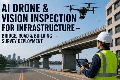
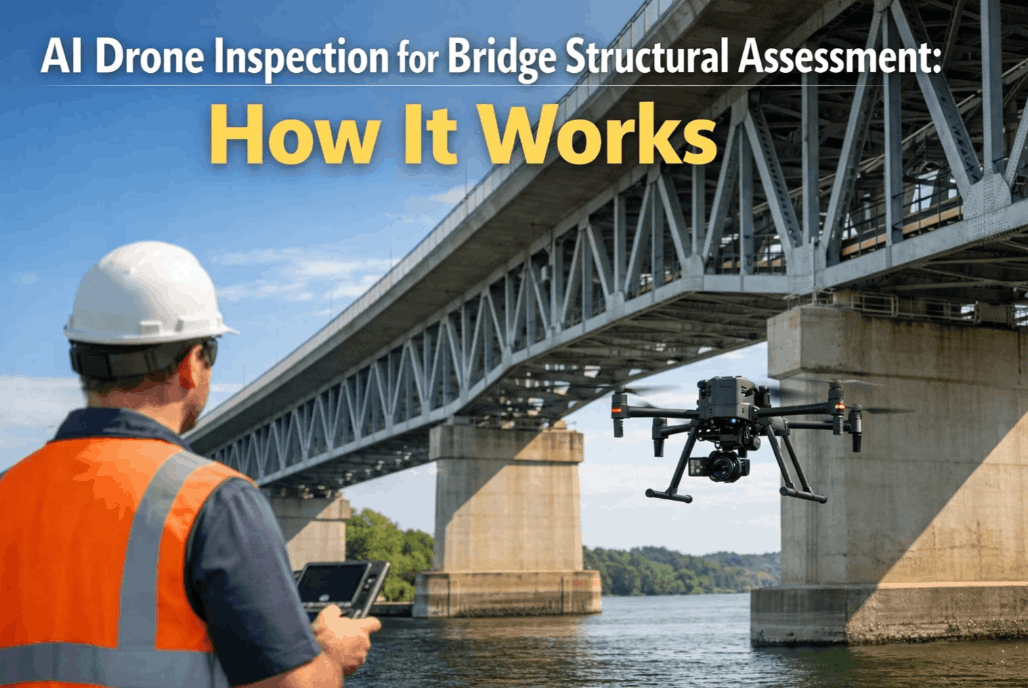
A highway inspector once spent three hours in a harness under a bridge deck to document cracks a camera could now capture in twelve minutes. That trade-off — hours of human risk for minutes of drone flight — is why transport agencies on every continent have stopped asking whether drone inspection programs work and started asking how to scale them. The evidence is in: autonomous UAV programs are cutting inspection time by up to 70%, reducing costs by 40–60%, and surfacing defects that manual crews routinely miss. This is what national programs actually look like in operation — the technology, the outcomes, and the lessons that separate programs that scale from programs that stall.
UAV Inspection · AI Defect Detection · Asset Data Integration · Predictive Maintenance
Drone Programs Generate Data. AI Turns That Data Into Maintenance Decisions.
iFactory's infrastructure AI platform connects directly to drone inspection outputs — processing UAV imagery, LiDAR data, and defect classifications into a ranked maintenance priority queue your team can act on this week.
70%
Reduction in inspection time vs traditional methods
40–60%
Cost reduction reported in DOT pilot programs
46,000+
Structurally deficient bridges in the US alone
$54.6B
Projected drone inspection industry size by 2025
Why the Shift Is Happening Now — Not in Five Years
Highway infrastructure is aging faster than inspection budgets are growing. In the US, FHWA's 2022 National Bridge Inspection Standards explicitly encouraged the use of advanced technologies to supplement inspection — a regulatory signal that drone programs had moved from experimental to endorsed. The same pattern has played out in the EU, Middle East, and Asia-Pacific: regulators recognising that traditional inspection schedules are insufficient and that UAVs offer a practical path to higher frequency, lower cost, and better data without adding headcount.
Traditional Inspection
Snooper trucks, scaffolding, and rope access required for hard-to-reach elements
Multi-lane closures for hours or days — economic disruption per inspection
2-year mandated cycle in the US — defects develop unseen between visits
Inspector fatigue and angle limitations mean some elements go unexamined
Single 2D photograph as documentation — no baseline for comparison over time
Autonomous Drone Inspection
Flies inside trusses and under decks — no climbing, no equipment hire
No lane closures required — traffic flows while inspection runs above
Deployable on-demand — inspections triggered by weather events or anomalies
360° camera coverage, thermal imaging, and millimetre LiDAR in one pass
3D digital twin produced — every inspection compared against baseline automatically
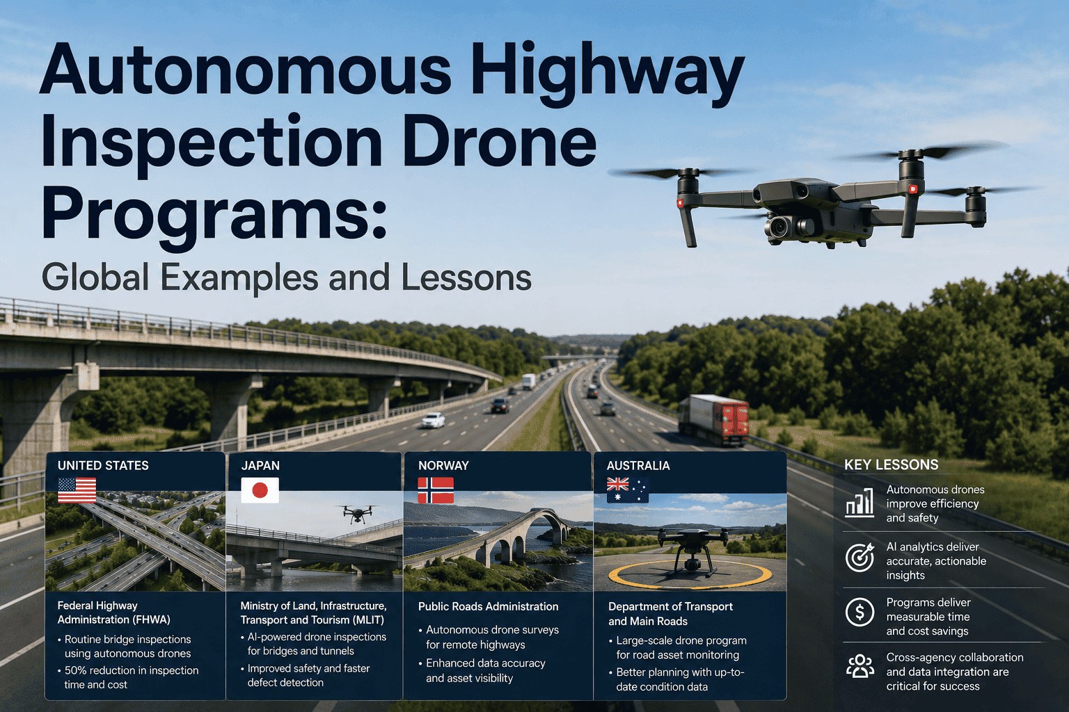
National Programs in Operation: What Each Country Is Running and What It's Returning
These aren't pilot studies — they are operational programs running on live highway networks with documented outcomes. Each represents a different model: some built on existing CCTV and sensor infrastructure, others starting from scratch with BVLOS drone corridors.
United States — Multi-State DOT Programs
Most Extensive Network
The FHWA has built the most comprehensive national UAV infrastructure of any country. Minnesota DOT, Nevada DOT, Utah DOT, Alaska DOT, and Caltrans all run active BVLOS drone programs for bridge and corridor inspection — capturing LiDAR and optical data from elevated structures that previously required lane closures and snooper trucks. Nevada DOT used drones to inspect Interstate 80 near the California border, producing 3D models of bridge structures that gave engineers a baseline for ongoing comparison.
40%
Average cost saving — MnDOT bridge inspection program
75%
Reduction in road closure time — Washington State UAS TIM
16/day
Sign inspections by drone in Utah vs 2–3/day manually
Kuwait — Ministry of Public Works Nationwide Survey
1,000 km in Phase One
In 2024, Kuwait's Ministry of Public Works partnered with drone services provider Zain Drone for a national road survey that stands as one of the most ambitious single-phase deployments globally. Phase one covered 1,000 km of highways and bridges — capturing high-resolution imagery and video and producing detailed 3D models and condition maps of the entire network. No traffic closures were required. The programme is now expanding into secondary road networks in phase two. Saudi Arabia's General Authority for Roads announced a parallel initiative the previous year, specifically citing time savings and thermal imaging for detecting hidden pavement deformations.
Key Lesson
Network-scale deployment is achievable in a single programme cycle. The Kuwait model proves that a national baseline condition map — previously a multi-year project — can be delivered in months with drone-based survey.
Japan — MLIT Metropolitan Expressway Pilots
Submillimetre Precision
Japan's Ministry of Land, Infrastructure, Transport and Tourism (MLIT) runs advanced drone inspection pilots on the Metropolitan Expressway with a focus that distinguishes the programme: structural displacement measurement. Researchers at Japan's National Institute of Advanced Industrial Science and Technology have demonstrated submillimetre displacement accuracy using vision-based methods from drone platforms — tracking how bridge structures move and deform over time at a level of precision previously requiring fixed sensor installations. Japan's programme is also notable for integrating drone inspection outputs directly into digital twin models, enabling changes across survey cycles to be detected automatically.
Key Lesson
Drone inspection value multiplies when outputs feed a persistent digital twin. A single pass captures current condition; the digital twin makes every subsequent pass a comparison — revealing trends that a one-off inspection misses entirely.
South Carolina — Standardised Bridge Inspection Trial
91% Coverage Rate
South Carolina DOT's bridge inspection trial using UAS observed 91% of all inspection points — a coverage rate that compares favourably to manual inspections while delivering an estimated 28% cost saving per bridge. The programme highlighted a finding common across multiple DOT programmes: drone coverage rates depend heavily on flight planning and sensor configuration rather than inherent UAV limitations. Bridges where flight paths were pre-modelled in 3D showed materially higher element coverage than ad-hoc approaches. This result is now informing AASHTO's forthcoming guidelines on element-level data collection standards.
Key Lesson
Pre-flight 3D modelling of structures is not optional — it is the single biggest factor in coverage quality. Agencies that skip this step report lower inspection completeness and must return for re-flights.
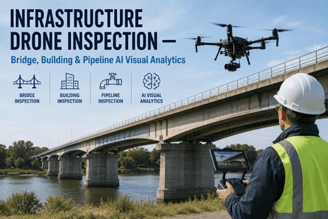
What Sensors Fly on Highway Inspection Drones — and What Each Finds
Drone inspection quality is determined by payload configuration. The right sensor combination for a pavement survey is not the same as for a bridge deck or a tunnel wall. Understanding which sensor answers which question is the foundation of programme design.
| Sensor |
What It Detects |
Best Application |
| High-Resolution RGB Camera |
Surface cracking, spalling, staining, delamination, lane marking degradation |
Pavement condition, bridge deck surface, signage |
| LiDAR |
Rut depth, vertical deflection, 3D geometry change vs baseline, millimetre deformation |
Pavement profiling, bridge structural monitoring, digital twin creation |
| Thermal Infrared Camera |
Sub-surface moisture infiltration, hidden delamination, heat-stress anomalies in pavement |
Bridge decks, tunnel linings, pre-failure pavement assessment |
| Multispectral Camera |
Vegetation encroachment, drainage blockage, surface chemistry changes |
Verge and drainage inspection, large corridor environmental monitoring |
| Dual RGB + Infrared (Combined) |
Combined surface + sub-surface fault detection — highest probability of identification per pass |
Comprehensive bridge and highway inspection where a single pass must cover both modes |
UAV Data Integration · AI Defect Classification · Maintenance Prioritisation
Drone Inspection Creates the Data. iFactory Makes It Actionable.
iFactory ingests UAV imagery, LiDAR outputs, and thermal data — running AI classification and health scoring to produce a ranked maintenance queue from your drone programme's output. Book a Demo to see the pipeline for your network.
Six Lessons From Programs That Scaled vs Programs That Stalled
The agencies that have built sustainable, operationally integrated drone programmes share a set of common practices. The ones that have struggled with adoption — despite the same technology — share a different set of common gaps. These six lessons are drawn directly from NCHRP, FHWA, and DOT programme evaluations.
1
Integrate outputs into asset management — not just a photo archive
Programmes that route drone imagery into a searchable asset management system with defect classification produce decisions. Programmes that create shared drives of unprocessed footage produce storage costs.
2
Build the digital twin from the first flight, not retrospectively
Japan's programme and Nevada DOT's Interstate 80 work both demonstrate that the baseline 3D model created on the first pass is what makes all subsequent passes actionable. Agencies that start without a baseline must fly retrospectively to establish one.
3
Pre-flight 3D modelling of structures is not a nice-to-have
South Carolina's programme data is unambiguous: bridges where flight paths were pre-modelled showed materially higher coverage than ad-hoc approaches. AASHTO is building this into forthcoming inspection guidelines as a required step.
4
Operator certification is the rate limiter — plan for it
NCHRP's guidance makes clear that FAA Part 107 certification combined with structure-specific flight proficiency is the minimum competency standard. Agencies that underestimate the training pipeline end up with certified pilots who lack inspection-specific skills.
5
BVLOS regulation is the critical unlock for corridor-scale programmes
The FAA's August 2025 BVLOS NPRM (Part 108) shifts accountability from individual pilots to operators — enabling large agencies to obtain permits that cover wide programmes rather than seeking individual waivers per flight. This changes the economics of long-corridor highway inspection fundamentally.
6
Drones supplement inspectors — programmes that try to replace them underperform
The WEF review of bridge inspection programmes is explicit: drones empower inspectors to examine areas they couldn't reach safely — they don't eliminate the need for trained inspection judgement. Programmes designed around augmentation outperform those designed around replacement.
"
The question our programme faced wasn't whether to use drones — the cost and safety case was obvious from the first trial. The question was what to do with the data after the flight. We had tens of thousands of images and no pipeline to turn them into maintenance decisions. That gap between capture and action is where programmes fail — not in the air, but in the office afterwards.
— Programme Director, State Department of Transportation — 2,400 bridges under active UAV inspection
The Gap Every Drone Programme Hits: From Raw Imagery to Maintenance Action
Drone programmes generate more data per inspection than any previous method — and that is both the opportunity and the bottleneck. An agency that produces 50,000 high-resolution images from a bridge network survey now needs to turn those images into classified defects, ranked priorities, and maintenance work orders. Without an AI analytics layer, the data either sits unprocessed or requires a team of engineers to manually review footage that a machine could classify in minutes.
From UAV Flight to Maintenance Work Order
1
UAV completes inspection flight
RGB, thermal, and LiDAR data captured across the asset — geotagged and timestamped per frame
2
AI classifies defects across the full image set
Computer vision identifies and labels cracking, spalling, delamination, and structural anomalies — without manual review
3
Health scores generated and compared to baseline
Each asset segment receives a dynamic condition score — changes from the previous inspection flagged automatically
4
Ranked maintenance queue and CMMS work orders generated
Priority list with intervention type, cost estimate, and scheduling window delivered to maintenance team — no manual handoff
Conclusion: The Programme Is the Easy Part. The Pipeline Is What Pays.
The global evidence on autonomous highway inspection drone programmes is consistent: the technology works, the cost savings are real, and the safety case is unambiguous. What separates programmes that deliver long-term operational value from those that generate impressive imagery and modest impact is the analytics pipeline downstream of the flight. A drone that captures a crack is only as useful as the system that classifies it, scores it, and triggers an intervention at the right time.
iFactory's infrastructure AI platform is built to be that pipeline — ingesting UAV imagery and sensor outputs, running AI defect classification and health scoring, and delivering a ranked maintenance priority list that connects directly to your CMMS and maintenance teams. Book a Demo to see how the platform processes drone inspection data for your asset network, or Get In Touch to begin connecting your UAV programme outputs to actionable maintenance decisions.
Frequently Asked Questions
Your drone programme captures the data. iFactory turns it into the maintenance decisions that matter.
iFactory ingests UAV inspection outputs — imagery, LiDAR, thermal — and delivers AI-classified defect data, health scores, and ranked maintenance priorities to your operations team. Book a Demo or sign up to connect your drone programme to the analytics pipeline it needs.