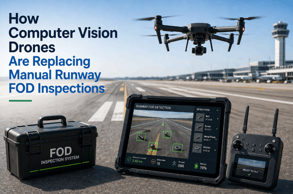
Airport runways and aircraft are inspected thousands of times per year — and in 2026, the majority of those inspections still involve a human walking the runway surface with a flashlight, or maintenance crews manually examining airframe panels from cherry pickers and scaffolding. The approach works until it doesn't: a Foreign Object Debris (FOD) event damages an engine intake because the last manual sweep missed a 2-inch bolt on Runway 27R. A hairline fatigue crack on a wing panel goes undetected because the visual inspector couldn't reach the upper fuselage surface without repositioning scaffolding that takes 45 minutes to move. Drone inspection platforms — equipped with HD cameras, LiDAR, thermal imaging, and AI-powered defect recognition — are eliminating these blind spots entirely. Airports deploying drone inspection programs report 75% faster runway surveys, 90% improvement in FOD detection rates, and seamless integration with CMMS platforms that convert every drone finding into a tracked, prioritized work order automatically. iFactory's AI platform connects drone inspection data to digital twin models, predictive maintenance engines, and autonomous work order dispatch — transforming raw aerial imagery into actionable aviation intelligence. Book a free drone inspection assessment with iFactory to see how aerial intelligence keeps your runways safe and your fleet inspection-ready.
The Rise of Drone Inspections for Runways & Aircraft — 2026
AI-Powered Aerial Intelligence for Runway Safety, Aircraft Maintenance, and Airport Operations
75%
Faster Runway Inspections vs. Manual Walk-Down Surveys
90%
Improvement in FOD Detection Rates with AI-Powered Drone Vision
$4.2B
Annual Global Cost of FOD Damage to Aircraft — Largely Preventable
The Problem with Traditional Runway and Aircraft Inspection
Runway and aircraft inspections are safety-critical obligations governed by FAA, ICAO, and EASA regulations — not optional maintenance activities. But the conventional approach creates compounding safety, operational, and cost problems that drone platforms are purpose-built to eliminate.
Traditional Inspection Workflow — Where Safety Gaps and Time Are Lost
Manual Runway Walk
Inspectors walk the runway surface — limited visibility, weather-dependent, time-intensive
Aircraft Visual Inspection
Cherry pickers, scaffolding, and ladders required to reach upper fuselage and empennage
Paper Documentation
Findings recorded on clipboards — photos stored separately, no digital asset linking
Delayed Corrective Action
Findings transcribed into CMMS manually — hours or days before work orders are created
1
Foreign Object Debris (FOD) — The $4.2 Billion Annual Threat
FOD on runways causes engine ingestion events, tire blowouts, and airframe damage costing the global aviation industry $4.2 billion annually. Manual walk-down inspections can miss objects smaller than 3 inches — while drone-mounted AI vision systems detect debris down to 0.5 inches at full runway sweep speed, covering the entire surface in minutes rather than hours.
Annual Cost
$4.2B Global
2
Runway Closure During Manual Inspections
FAA-mandated runway inspections require surface closure during manual walk-downs — disrupting flight schedules, creating departure queues, and costing airports $15K–$50K per hour in lost slot revenue during peak operations. Drones inspect active-adjacent areas without requiring full runway closure, reducing operational disruption by 60–80%.
Cost per Hour
$15K–$50K
3
Aircraft Inspection Access Limitations
Manual aircraft inspection requires scaffolding, cherry pickers, or boom lifts to access upper fuselage, empennage, and engine nacelle surfaces. Repositioning equipment takes 30–60 minutes per location. Drones equipped with high-resolution cameras and thermal sensors inspect the entire airframe exterior in 15–20 minutes from every angle — including areas humans cannot safely reach.
Time Saved
75% Faster
4
Untracked Pavement Deterioration
Runway pavement condition — cracking, spalling, rubber buildup, and drainage issues — is assessed through periodic visual surveys that cannot track progressive deterioration between cycles. Drone LiDAR and photogrammetry create millimeter-accurate 3D surface models that detect changes between inspection cycles, feeding predictive pavement management programs that schedule repairs before safety thresholds are breached.
Detection
Sub-Millimeter
Drone Inspection Platform Types: Choosing the Right System
No single drone platform solves every airport inspection challenge. Runway FOD sweeps, aircraft pre-flight checks, pavement condition surveys, and airfield lighting audits each require different sensor configurations, flight profiles, and regulatory clearances. Here is how the primary drone categories compare for aviation applications.
Connected Drone Inspection Workflow — Aerial Data to Maintenance Action
Drone Deployed
Automated launch from docking station or manual deployment at inspection zone
AI Vision Processing
HD imagery, LiDAR, and thermal data analyzed by AI defect detection models in real time
Digital Twin Updated
iFactory merges drone data into 3D airport model — defects geo-located precisely
Auto Work Orders
CMMS work orders generated with location, severity, photo evidence, and priority
Best For: Aircraft & Close-Range
✓ Hover capability for detailed airframe panel inspection
✓ HD zoom cameras capture sub-millimeter surface defects
✓ Thermal sensors detect delamination and water ingress
✓ Indoor-capable for hangar ceiling and structure inspection
Best For: Runway & Airfield Surveys
✓ Cover entire runway surface in 8–12 minutes
✓ LiDAR photogrammetry for pavement condition mapping
✓ Extended flight time — 60+ minutes per mission
✓ Orthomosaic imagery for progressive deterioration tracking
Best For: Scheduled FOD Sweeps
✓ Launch automatically from weatherproof docking stations
✓ Pre-programmed flight paths for repeatable FOD coverage
✓ AI FOD detection identifies debris down to 0.5 inches
✓ Zero operator intervention for routine scheduled missions
The shift from manual walk-down inspections to autonomous drone platforms represents the most significant safety and efficiency transformation available to airport operations in 2026. The technology has matured past the proof-of-concept stage — the remaining gap is in the digital infrastructure needed to connect what drones see to what maintenance teams do. Airports that solve the data integration problem — linking drone imagery to CMMS work orders, digital twin models, and compliance records — transform inspection programs from periodic snapshots into continuous, AI-driven safety intelligence.
Drone Sensor Payloads: What Aerial Platforms Can Detect
The inspection value of a drone platform depends entirely on the sensors it carries and the AI models that process the data. Modern aviation inspection drones support multiple sensor modalities simultaneously — combining visual assessment with quantitative measurement in a single flight pass.
HD Optical Camera (50MP+)
Surface cracks, paint damage, dents, FOD, rubber deposits
Aircraft exterior, runway surface, taxiway markers
AI defect recognition processes 10,000+ images per mission automatically
LiDAR (3D Point Cloud)
Pavement profile deviations, drainage slope, surface roughness changes
Runway pavement condition, apron surface mapping
Millimeter-accuracy surface models detect progressive deterioration between cycles
Thermal Infrared (IR)
Delamination, water ingress, hot spots, insulation voids
Aircraft skin panels, terminal roofing, underground utility leaks
Non-contact — identifies subsurface anomalies invisible to optical cameras
Multispectral Imaging
Corrosion detection, coating degradation, material composition changes
Aircraft corrosion mapping, airfield structure assessment
Detects early-stage corrosion before visible surface damage appears
AI FOD Detection Module
Objects as small as 0.5 inches on runway and taxiway surfaces
Runway FOD sweeps, taxiway clearance verification
Real-time alert to ATC and ground crews — 90% detection improvement vs. manual
How iFactory Connects Drone Inspection to Aviation Maintenance
The drone collects the data. iFactory ensures that data drives action. Without a connected maintenance management system, drone imagery sits in separate folders — untracked, un-trended, and disconnected from corrective work orders. iFactory closes this gap across four integrated modules.
Automated Finding Classification
✓ AI processes 10,000+ drone images per mission for defect identification
✓ FOD items classified by size, material type, and runway zone location
✓ Pavement cracks classified by severity, length, and progression rate
✓ Aircraft surface defects geo-located on the airframe 3D model precisely
3D Airport & Airframe Models
✓ Drone LiDAR data merges into live 3D airport digital twin
✓ Progressive pavement deterioration visualized between inspection cycles
✓ Aircraft defect locations mapped onto airframe model for MRO tracking
✓ What-if scenarios model pavement repair timing and budget impact
Finding to Fix — Zero Manual Entry
✓ Every AI-classified defect auto-generates a prioritized CMMS work order
✓ FOD alerts dispatch ground crews with GPS coordinates in real time
✓ Pavement repair WOs include severity photos, location maps, and scope
✓ Aircraft defect WOs linked to MRO task cards and compliance records
FAA / ICAO / EASA Readiness
✓ Every drone mission auto-logged with flight path, sensor data, and findings
✓ Runway inspection compliance tracked against FAA AC 150/5200 requirements
✓ Aircraft inspection records linked to airworthiness documentation
✓ Audit-ready report packages exportable on demand — 100% compliance readiness
The airports achieving the strongest safety outcomes in 2026 are not the ones flying the most drones — they are the ones that have connected drone data to their maintenance management systems. A drone image of a runway crack is useful. A drone image that auto-generates a CMMS work order with severity classification, GPS location, photo evidence, and priority ranking is transformative. That integration layer — connecting aerial intelligence to ground action — is where iFactory's platform delivers its primary value.
Before vs. After: What Drone Integration Delivers
The operational gap between airports running manual inspection programs and those with drone-integrated AI platforms shows up in every safety, compliance, and cost metric that matters.
Runway Inspection Speed
45–90 minutes per runway walk-down
8–12 minutes per full runway drone survey
75% faster — reduced closure time, less schedule disruption
FOD Detection Rate
Human vision limited to 3+ inch objects reliably
AI vision detects objects down to 0.5 inches
90% improvement — prevents engine ingestion events
Aircraft Exterior Inspection
2–4 hours with scaffolding and cherry pickers
15–20 minutes — full airframe coverage from every angle
80% faster — increased hangar throughput per shift
Pavement Condition Tracking
Annual visual survey — no progressive trending
LiDAR 3D models detect sub-mm changes between cycles
Predictive pavement management replaces reactive patching
Corrective Action Speed
Findings transcribed to CMMS hours/days later
Auto-generated work orders with GPS + severity + photos
Zero findings fall through the cracks
Stop Walking Runways. Start Flying Intelligence.
iFactory connects your drone inspection data directly to digital twin models, AI defect recognition, CMMS work orders, and compliance documentation — in one platform built for airport operations in 2026 and beyond.
Regulatory Framework for Drone Inspections at Airports
Drone operations in airport environments must satisfy both aviation safety regulations and drone-specific airspace rules simultaneously. iFactory's compliance module tracks every regulatory requirement and auto-generates documentation that satisfies both domains.
Small UAS Operations & Airport Waivers
Drone operations within controlled airspace require FAA Part 107 waivers (107.41 for Class B/C/D) or LAANC authorization. iFactory's flight management module tracks waiver status, pilot certifications, and airspace authorizations per mission — ensuring every drone flight at your airport operates under documented, current regulatory authorization.
Airport Safety Self-Inspection Standards
FAA Advisory Circular 150/5200-18C requires certificated airports to conduct daily runway inspections and periodic condition surveys. Drone inspection data must satisfy the same documentation standards as manual inspections — timestamped findings, defect classification, and corrective action tracking. iFactory auto-generates AC 150/5200-compliant inspection reports from every drone mission.
International Aerodrome Standards
ICAO Annex 14 establishes global standards for aerodrome design, maintenance, and operational safety — including pavement condition requirements and FOD management programs. Drone LiDAR pavement surveys and AI FOD detection programs generate the quantitative condition data that Annex 14 compliance increasingly demands — moving beyond subjective visual assessment to measurable, repeatable metrics.
European & Canadian Drone Regulations
EASA drone regulations under the Specific Category (SORA) and Transport Canada RPAS rules impose additional operational risk assessments for drone flights in airport environments. iFactory's compliance module manages SORA documentation, TC SFOC applications, and operational risk assessments — maintaining a single audit trail that satisfies the regulatory authority governing your airport's jurisdiction.
The 2026 Context: Why Drone Inspection Adoption Is Accelerating
1
BVLOS Regulatory Expansion — 2025–2026
FAA's evolving Beyond Visual Line of Sight (BVLOS) framework is enabling autonomous drone operations at airports without requiring a visual observer for every flight. This regulatory shift makes scheduled, repeatable drone inspection missions — like daily FOD sweeps — operationally and economically viable for the first time at airports of all sizes.
Impact
Autonomous Ops
2
AI Vision Maturity — 95%+ Defect Recognition Accuracy
AI defect recognition models trained on millions of aviation-specific images now achieve 95%+ accuracy on FOD detection, pavement crack classification, and aircraft surface defect identification. This threshold transforms drone imagery from "data that needs expert review" into "actionable intelligence that triggers maintenance automatically."
Accuracy
95%+
3
Net Zero Aviation Targets — 2026 Milestones
Airports pursuing 2026 sustainability milestones use drone-mounted thermal surveys to identify terminal building insulation failures, detect underground utility leaks, and map solar panel degradation — all from a single aerial platform that replaces multiple manual inspection programs with one efficient flight mission.
Application
Sustainability
4
Workforce Shortage — Fewer Inspectors, More Assets
Aviation maintenance workforce shortages are intensifying in 2026, with experienced inspectors retiring faster than replacements are certified. Drone platforms multiply the coverage capacity of each inspector — enabling one trained operator to inspect what previously required a team of four, while generating higher-quality, more consistent data than manual methods.
Force
4× Coverage
Frequently Asked Questions
Can drones legally fly at airports for inspection purposes?
Yes, with proper authorization. Drone operations in controlled airspace (Class B, C, D, and E surface) require FAA Part 107 waivers or LAANC authorization in the US, SFOC approval in Canada, and SORA-category authorization under EASA in Europe. Many major airports have already established permanent drone operation programs with standing airspace authorizations. iFactory's compliance module tracks waiver status, pilot certifications, and mission authorizations — ensuring every flight operates under documented regulatory approval.
How does AI detect FOD on runways from drone imagery?
iFactory's AI FOD detection module uses convolutional neural networks trained on millions of annotated runway images to identify objects as small as 0.5 inches on pavement surfaces. The AI distinguishes between FOD (bolts, metal fragments, rubber, plastic), normal runway features (markings, lights, joints), and environmental debris (leaves, water). Each detected object is classified by size, estimated material type, and GPS location — then an alert is dispatched to ground crews and ATC with the precise coordinates for removal. Detection rates are 90% higher than manual walk-down inspections.
How does iFactory integrate drone data with existing airport CMMS systems?
iFactory connects via pre-built API connectors with all major airport CMMS and EAM platforms including SAP, Maximo, eMaint, and Infor. When a drone mission identifies a defect — FOD on runway, pavement crack exceeding threshold, or aircraft surface anomaly — the system auto-generates a work order in your CMMS with the specific location (GPS coordinates), severity classification, photo evidence, and recommended corrective action. No manual data entry, no transcription delays, no findings lost between inspection and repair.
Can drone inspections replace manual aircraft pre-flight checks?
For exterior visual inspections, drones are increasingly supplementing and in some cases replacing manual walk-around checks. A multi-rotor drone equipped with a 50MP+ camera can inspect the entire aircraft exterior — including upper fuselage, empennage, and engine nacelle surfaces that are difficult to reach manually — in 15–20 minutes. The key regulatory distinction is that a certified mechanic must still evaluate the findings and sign off on airworthiness — the drone is a data collection platform, not a replacement for human certification authority.
Book a demo to see aircraft inspection drone workflows.
What does deployment look like for an airport drone inspection program?
A typical airport drone program deploys in 8–12 weeks: Phase 1 (weeks 1–3) covers airspace authorization, pilot certification, and flight path planning. Phase 2 (weeks 3–6) configures iFactory's AI recognition models, digital twin integration, and CMMS connectivity. Phase 3 (weeks 6–10) runs supervised missions alongside existing manual inspections to validate AI accuracy. Phase 4 (weeks 10–12) activates autonomous scheduled missions. Visit our
Support Center for detailed deployment documentation and case studies.
Your Runways Deserve Better Than a Flashlight and a Clipboard
iFactory connects drone aerial intelligence to digital twin models, AI defect recognition, predictive maintenance, and CMMS automation — giving your airport the continuous, AI-driven safety intelligence that manual inspections cannot match. See it in action with a free 30-minute demo.