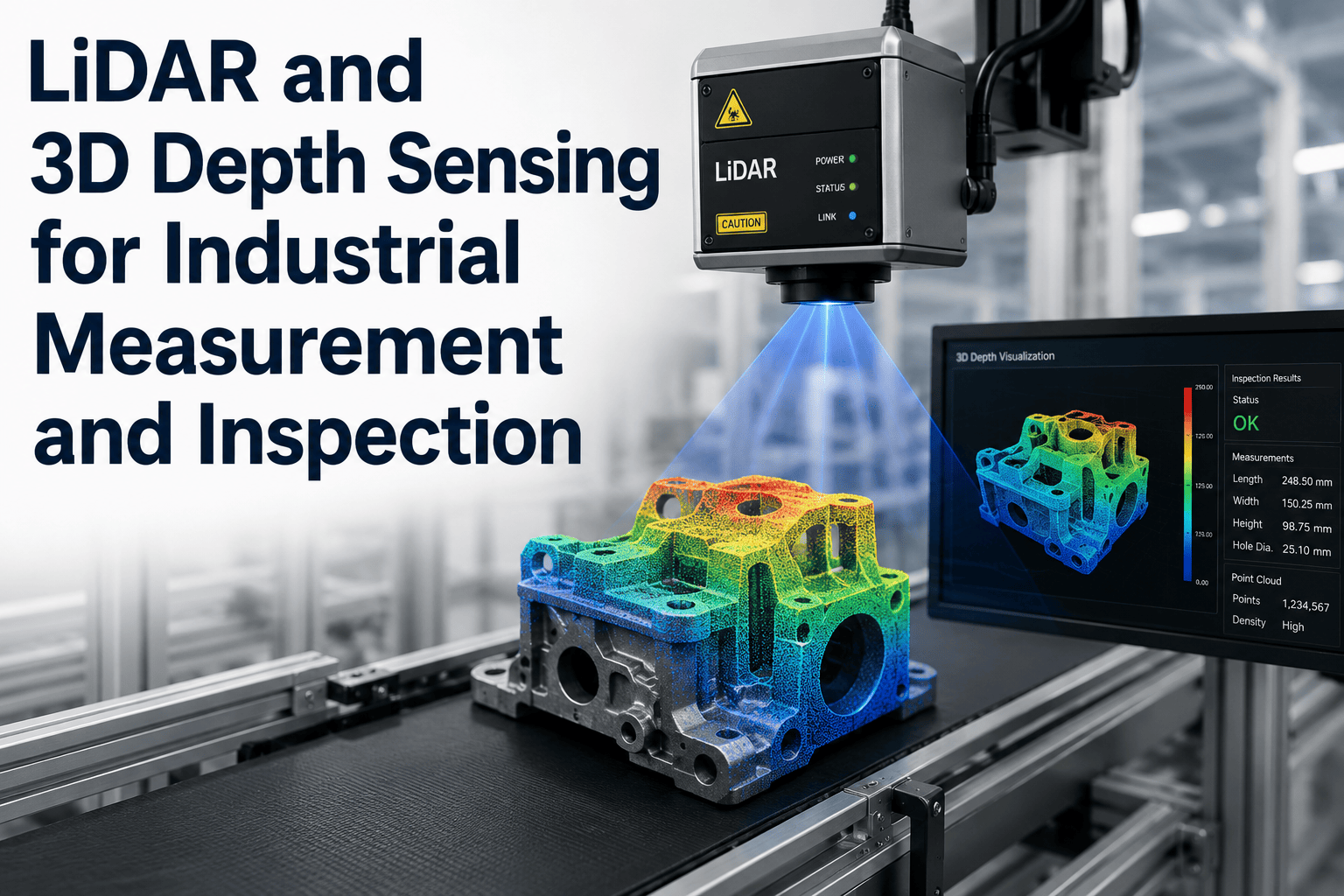
A 2D camera tells you what is there. A 3D sensor tells you where it is, how big it is, and how its surface curves. That difference matters everywhere a decision depends on real geometry — measuring a stockpile, verifying a dimension inside tolerance, confirming a pallet fits a slot, or detecting a warp that never shows up in an intensity image. LiDAR, structured light, and time-of-flight sensors bring true depth to industrial inspection, unlocking measurement classes no 2D system can address. To explore which 3D modality fits your line, Book a Demo with iFactory AI.
Precision 3D Measurement and Inspection Beyond the Limits of 2D Vision.
iFactory AI deploys LiDAR, structured light, and time-of-flight sensors for dimensional measurement, volume estimation, and surface profile inspection — full 3D geometry integrated into your quality and inventory systems.
The Three Ways Industrial Sensors Capture Real Depth
Every 3D depth sensor uses one of three underlying principles. Each principle produces its own accuracy envelope, range window, and cost profile — and the right choice depends far more on the measurement task than on any generic benchmark. The three modalities below cover ninety-five percent of industrial 3D deployments in 2026.
LiDAR
Laser pulses timed to bounce back — direct time-of-flight measurement.
Structured Light
Projected pattern deforms across the surface — triangulation math recovers depth.
Time-of-Flight (ToF)
Full-frame depth measured by phase shift of modulated infrared light.
Choosing the Right 3D Modality for Each Measurement Task
The wrong modality delivers plausible-looking but unreliable data — the failure mode that quality teams pay for months later. The matrix below maps common industrial measurement tasks to the modality that consistently delivers production-grade accuracy, based on real deployment experience across manufacturing, warehousing, and bulk handling environments.
| Measurement Task | LiDAR | Structured Light | Time-of-Flight | Recommended |
|---|---|---|---|---|
| Stockpile volume estimation | Excellent | Poor range | Limited range | LiDAR |
| Sub-millimeter surface defect | Below resolution | Excellent | Adequate | Structured Light |
| Palette / package dimensioning | Overkill | Adequate | Excellent | Time-of-Flight |
| Warehouse fill-level tracking | Excellent | Not suitable | Adequate | LiDAR |
| Bin picking & robotic guidance | Range mismatch | Excellent | Excellent | Structured Light or ToF |
| Outdoor bulk material yard | Excellent | Ambient-light failure | Range limits | LiDAR |
| Precision dimensional QA | Below tolerance | Excellent | Marginal | Structured Light |
| Conveyor part height check | Overkill | Excellent | Excellent | Structured Light or ToF |
Get a 3D Modality Recommendation Sized to Your Measurement Requirement.
iFactory AI's team assesses the measurement task, accuracy target, and environmental constraints — and returns a specific LiDAR, structured light, or ToF configuration with projected accuracy envelope.
What 3D Depth Unlocks That 2D Vision Structurally Cannot
Certain measurement classes are physically impossible on a 2D image, no matter how good the model. Depth data is not an incremental improvement over intensity data — it is a different measurement dimension. The four capability classes below are only accessible once true depth is available in the pixel stream.
True Dimensional Measurement
A 2D camera sees pixels. A 3D sensor sees millimeters. Length, width, height, and diameter measurements against tolerance thresholds require calibrated depth — 2D approximations produce dimensional data that quality auditors will not accept in metrology-critical contexts.
Volume & Fill Level
Integrating depth across an area produces volume. Stockpile tonnage, silo fill level, pallet cage occupancy, and truck load volume are computed directly from point-cloud surface integration — measurements a 2D camera can only guess at through indirect proxies.
Surface Profile & Warp
Flatness, curvature, warp, and step-height defects are surface geometry problems. Structured light captures the gradient across the surface at sub-millimeter resolution — detecting the deviations from spec that a top-down 2D image cannot see.
Robotic Pick Coordinates
A robot needs XYZ, not XY. Bin picking, palletisation, and pick-and-place tasks require the third coordinate to compute grasp pose. 3D depth sensing produces the coordinate frame the robot controller consumes directly — no depth inference, no ambiguity.
Three Application Domains Where 3D Vision Delivers Structural Advantage
Industrial 3D vision groups naturally into three measurement domains, each with its own preferred modality and its own quality-critical use cases. iFactory AI designs and deploys across all three, matching sensor to environment and integrating output directly into quality, inventory, and control systems.
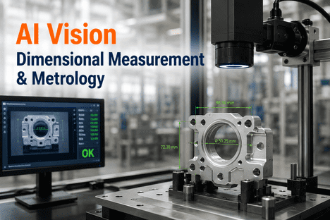
Dimensional Inspection & Metrology
Structured LightSub-millimeter measurement of manufactured parts against engineering tolerances — the highest-accuracy 3D vision task in industrial deployment.
Volume & Fill-Level Measurement
LiDARContinuous volume measurement of bulk materials in stockpiles, silos, warehouses, and trucks — replacing manual survey with automated real-time tonnage tracking.
Real-Time Dimensioning & Robotics
Time-of-FlightHigh-frame-rate depth capture for parcel dimensioning, robotic pick-and-place, and dynamic scene understanding — where speed and moderate accuracy beat static precision.
Where Each Modality Wins on the Accuracy-Range Curve
Every 3D sensing choice is a tradeoff between accuracy and range. The visual below maps where each modality delivers production-grade performance — the zones where the physics of the technology align with the measurement task. Deploying outside these zones is the most common cause of underperforming 3D vision programs.
The envelope map above is the same tool iFactory AI's engineering team uses in every 3D vision assessment. A measurement task at eight metres with a two-millimetre tolerance sits in a zone no single modality serves perfectly — this is where a hybrid deployment or a step-change in accuracy specification enters the design conversation.
From Point Cloud to Production Decision — The iFactory Integration
Raw 3D data is useless without the pipeline that converts it into a decision. iFactory AI structures every 3D vision deployment around a four-stage integration that runs from sensor capture to the CMMS, MES, or WMS system where the measurement outcome actually matters to the business.
Sensor Capture & Point Cloud
Selected sensor captures the scene at production frame rate. Raw point cloud data streams into local edge compute over Ethernet, USB3, or industrial protocols matched to sensor specification.
Filtering & Reconstruction
Point cloud is filtered for noise, aligned to reference frame, and reconstructed into a measurable surface. Multi-sensor deployments merge overlapping clouds into a unified geometry.
Measurement Extraction
The reconstructed surface is measured against target geometry — volume integration, dimensional check, surface profile analysis, or coordinate frame output for robotic downstream tasks.
System Integration
Structured measurement outputs flow into ERP, WMS, CMMS, or MES over OPC-UA and REST. Every measurement becomes an auditable event with timestamp, sensor identity, and computed result attached.
Continuous, Auditable 3D Measurement Instead of Periodic Manual Survey
Bulk material yards moving from monthly drone surveys to continuous LiDAR volume monitoring report eighty percent reductions in inventory measurement labour and complete elimination of the surveyor safety exposure that stockpile walkarounds create. Precision manufacturers deploying structured light metrology in place of manual gauge checks are running one-hundred-percent dimensional inspection instead of five-percent sampling. Logistics operators using time-of-flight parcel dimensioning are billing accurately per cubic metre for the first time, recovering revenue that dimensional estimation historically undercharged.
Every one of these outcomes shares the same structural pattern. A measurement that was episodic, expensive, and error-prone becomes continuous, low-friction, and auditable. iFactory AI packages this transition as a delivered outcome — sensor selection, deployment, integration, and ongoing calibration — sized to the specific measurement domain the customer operates in. The result is a 3D vision capability that pays back inside a single fiscal year and scales cleanly across additional lines and sites.
LiDAR & 3D Depth Sensing for Industrial Measurement — FAQs
How do I know whether LiDAR, structured light, or ToF is right for my application?
The selection comes down to three variables — measurement range, accuracy tolerance, and environmental conditions. LiDAR wins beyond three metres and for outdoor deployments. Structured light wins for close-range sub-millimetre precision. Time-of-flight is the best fit for real-time dimensioning where moderate accuracy at moderate range is enough. iFactory AI's assessment maps your task to the correct modality — Book a Demo to walk through your specific measurement requirement.
Can 3D sensors replace manual dimensional gauging in a precision manufacturing environment?
Yes — structured light 3D metrology delivers sub-millimetre accuracy that matches or exceeds manual gauge measurement, with the added benefit of one-hundred-percent inspection instead of statistical sampling. The transition typically requires calibrated reference geometry, controlled lighting, and integration with the plant's existing quality management system. Once deployed, dimensional QA runs continuously without operator intervention on every part.
How accurate is LiDAR-based stockpile volume measurement compared to a manual drone survey?
Fixed LiDAR installations deliver stockpile volume measurements within one to three percent of ground truth for well-designed deployments, with the advantage of continuous updates rather than periodic surveys. Volume accuracy depends on scanner placement, pile geometry, and calibration — typical deployments achieve accuracy comparable to professional drone photogrammetry while eliminating the scheduling and safety overhead of manual flights entirely.
Do 3D depth sensors work reliably in dusty industrial environments?
LiDAR and ToF sensors handle industrial dust well when properly enclosed, and their active illumination provides tolerance to ambient variability that passive vision cannot match. Structured light is more sensitive to airborne particulates and typically requires ventilated enclosures for use in dust-heavy applications. iFactory AI's deployment engineering handles enclosure and cleaning specifications as part of every industrial 3D vision project — Contact our expert for environment-specific advice.
How does 3D vision integrate with our existing ERP, WMS, or MES systems?
The iFactory 3D vision platform exposes measurement outputs through OPC-UA, REST, and industrial protocol bridges, allowing direct integration with SAP, Oracle, and Microsoft Dynamics ERP systems as well as leading WMS and MES platforms. Structured measurement events — volume readings, dimensional check results, coordinate frames — flow into the target system as auditable records with sensor metadata attached, no custom development required for the standard integrations.
Ready to Move From Manual Measurement to Continuous 3D Inspection?
Book a working session with iFactory AI. We assess your measurement task, match the right 3D modality, size the sensor deployment, and integrate the outputs with the ERP, WMS, or MES system that consumes the data.