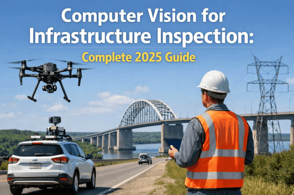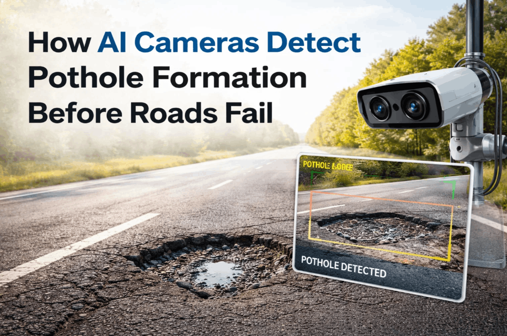
Potholes are not sudden events; they are the final stage of long-term structural failure beneath the road surface. By the time a driver's wheel hits a crater, the underlying sub-base is often already compromised, leading to repair costs that are 10x higher than early-intervention sealing. How AI cameras detect pothole formation before roads fail is a question of sub-millimeter visual analysis and high-speed predictive modeling. By utilizing edge AI cameras mounted on transit fleets and municipal vehicles, highway agencies can now map 'alligator cracking' and longitudinal fissures in their infancy, triggering maintenance work orders before the first freeze-thaw cycle initiates a collapse. Schedule a pavement monitoring demo to see how iFactory's infrastructure AI platform automates roadway health audits natively.
PREDICTIVE PAVEMENT ANALYTICS
Detect Road Surface Degradation Before the Pothole Appears.
Integrate high-speed AI cameras to identify pavement distress, crack trajectories, and moisture hotspots. Shift from reactive paving to precise, data-driven preventive maintenance.
The Anatomy of AI Pothole Detection: An Edge-to-Cloud Pipeline
How AI cameras detect pothole formation before roads fail relies on a complex multi-stage image processing pipeline. Standard 'detect-and-alert' systems react to existing holes; proactive AI examines the surrounding pavement texture for micro-anomalies. Using high-resolution 4K sensors and LiDAR-assisted mapping, AI models segment the road surface into 'Healthy', 'At-Risk', and 'Failed' zones. This allows agencies to prioritize 'crack sealing'—the most cost-effective maintenance action—over expensive full-depth asphalt replacement.
The transition to proactive road monitoring is driven by Edge AI—processing the video feed directly on the vehicle in real-time. This eliminates the need to upload petabytes of raw video to the cloud, instead only transmitting high-fidelity telemetry and 3D GPS coordinates of detected defects. This high-efficiency architecture allows entire city road networks to be audited weekly using existing transit buses and utility vans.
The AI model classifies every square inch of the asphalt, identifying the exact boundary of 'ravelling' or 'stripping'—the earliest indicators that the top-layer binder is failing due to oxidation or traffic load.
By fusing camera data with high-precision GNSS/IMU sensors, every detected crack is assigned a unique spatial ID. This ensures maintenance teams can navigate directly to the defect without hunting during night shifts.
Utilizing IR-enhanced cameras to detect temperature variations that indicate water ponding beneath the surface. Catching 'pumping' moisture failure points prevents sudden sub-base collapse during freeze cycles.
The AI algorithm doesn't just find cracks; it assigns a Pavement Condition Index (PCI) score to every segment. This allows the system to prioritize 'Class 3' hairline cracks that will expand within 30 days.
Implementation Steps: From Raw Feed to Maintenance Action
Deploying a proactive pavement AI platform requires a structured approach that integrates with existing municipal fleet infrastructure. Agencies that book a roadmap review follow this proven deployment sequence to ensure zero-gap roadway oversight.
Fleet-Scale Camera Integration
Mounting ruggedized AI-vision modules to existing transit buses, garbage trucks, and municipal vans. These vehicles become 'passive sensors' that audit the road network continuously during their normal operational routes with zero added labor cost.
Digital Twin Network Baselining
The platform captures a full visual baseline of the entire road network. The AI establishes a 'healthy state' for every segment, allowing future audits to identify even the smallest changes in pavement texture or localized sinking.
Automated Inference & Shadow Filtering
Advanced ML models process the video at the edge, utilizing 'shadow filtering' and 'glare correction' to ensure that tree shadows or tar-sealed cracks aren't incorrectly identified as new pothole threats.
CMMS Integration & Automated Work Orders
Confirmed high-risk defects are pushed directly to maintenance systems like SAP or Maximo. A work order is generated with the exact GPS coordinates and high-res imagery attached, reducing response time from weeks to hours.
Proactive Road Surface Monitoring Core Capabilities
Computer vision for road health is a high-density analytics tool that provides deeper insights than standard visual surveys. Book a demo to explore these features in an active roadway environment.
Detecting defects across three lanes of traffic simultaneously, providing a comprehensive view of the roadway health without requiring multiple passes.
Measuring the exact width and depth of longitudinal cracks to determine the correct sealant volume required for repair before crews leave the yard.
Comparing today's scan to data from six months ago to calculate the exact 'rate of decay' for specific road segments and pavement materials.
Identifying sunken utility covers or loose manhole lids that create localized impact stresses which accelerate surrounding pavement failure.
Using light-sensitive sensors and IR-illumination to audit the road network during low-traffic night hours without sacrificing detection accuracy.
Automatically identifying and logging road markings, lane reflectors, and curb health alongside pavement defects for a complete asset management view.
Market Comparison: Manual Surveys vs. AI Pavement Audits
Evaluating the shift to AI road health monitoring is critical for municipal budgeting. Schedule a benchmarking session to see how iFactory compares to traditional survey methods.
| Maintenance Parameter | Manual Road Survey Model | iFactory AI Monitoring | Impact |
|---|---|---|---|
| Audit Frequency | Annual or Biennial | Continuous (passed weekly) | +50x Visibility |
| Defect Detection Threshold | Visible Potholes (Lagging) | Hairline Seams (Leading) | Predictive |
| Labor Requirement | High (Specialized Crews) | Near-Zero (Passive Fleet) | -80% Labor |
| Data Accuracy | Subjective/Manual Logs | Objective/GPS-Validated | Certified |
| Repair Logic | Reactive Pothole Filling | Targeted Crack Sealing | -10x Unit Cost |
| Asset Life Extension | Limited (Structural Decay) | Maximized (Preventive) | +10 Years |
ROI and Capital Preservation: The Pavement Business Case
How AI cameras detect pothole formation before roads fail is primarily a financial strategy. The ROI on pavement AI is driven by the 'pavement lifecycle curve'—where sealing a crack at Year 3 avoids a $500,000 repaving project at Year 8. Book a demo to review our latest municipal ROI datasets.
Catching cracks early eliminates the need for expensive 'mill and overlay' procedures, preserving municipal capital for other critical projects.
Eliminating existing potholes and preventing new ones reduces the legal exposure to city departments from wheel and suspension damage lawsuits.
Cities can audit their entire roadway footprint 3x faster than traditional methods, ensuring no defect goes unlogged for more than 7 days.
High-precision GPS tagging ensures crews stop once and repair once, eliminating the time lost searching for reported craters.
Technical Challenges in Pavement AI — and Their Resolutions
Shadow and Glare Interference
Tree shadows and low-angle sun frequently cause 'false-positive' detections on traditional CV models. iFactory utilizza multi-spectral filtering and temporal cross-verification to ensure a shadow is never mistaken for a catastrophic crack.
Variable Road Surface Textures
AI models often struggle switching between aged asphalt, fresh concrete, and chip-seal surfaces. Our models are trained on specific regional geographic pavement datasets to ensure accuracy across all material types natively.
Fleet-Scale Data Management
Streaming 4K video from 100 buses is impossible on LTE/5G. We process 100% of the video at the edge, only transmitting the metadata of the 'detects'—reducing bandwidth requirements by 99.9% while maintaining oversight.
Frequently Asked Questions: AI Pavement Monitoring
Can the system detect cracks during heavy rain or snow?
The sensors ignore surface water to focus on structural cracks, but severe snow and ice accumulation will block the visual pavement layer. Most audits are scheduled for clear-road conditions to ensure maximum structural visibility.
Does the camera need to be mounted at a specific height?
No, our models are self-calibrating. Whether mounted on a van windshield or a transit bus bumper, the AI automatically adjusts for the perspective and angle to ensure measurement precision.
Is the pothole detection data compatible with our existing mapping software?
Yes. All detections are exported as standard GeoJSON or Shapefiles, integrating natively with ArcGIS, Google Maps, and all enterprise-level CMMS and Asset Management platforms.
How fast can the vehicle drive while still capturing accurate data?
Our high-speed shutter systems and global-exposure sensors maintain full detection accuracy at highway speeds up to 100km/h, allowing transit fleets to audit the network during normal service.
READY TO ELIMINATE THE POTHOLE CRISIS
Demand Proactive Road Health Instead of Reactive Crisis Management.
iFactory's pavement AI platform delivers the continuous visibility and predictive modeling required to arrest road failure in its infancy. Protect your budget and your travelers with the world's most advanced roadway monitoring technology.