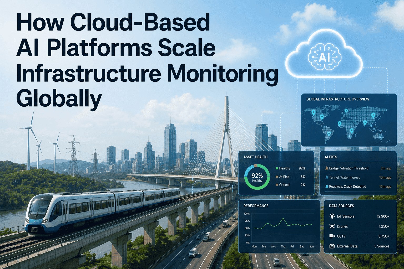
A single Sentinel-1 satellite passes over almost every kilometre of land on Earth every six days, carrying a synthetic aperture radar that sees through cloud, smoke, and darkness. Stack a few years of those passes, run them through interferometric processing, and millimetre-scale ground movement reveals itself across continents — bridge settlements, mining subsidence, dam deformation, pipeline-corridor heave, urban infrastructure sinking under groundwater extraction. For decades this data sat in academic archives. In 2026, deep-learning models on top of Sentinel-1, Sentinel-2, TerraSAR-X, COSMO-SkyMed, and the rapidly growing commercial constellations have turned satellite imagery into a continuous, operational, automatable infrastructure-monitoring layer. Models like SeMo-YOLO and modified YOLOv5 architectures now detect localised subsidence funnels in InSAR interferograms with measured precision, while CNNs on Sentinel-2 optical imagery classify urban structures with over 90% accuracy. Operators that schedule a demo are finding they can monitor hundreds of thousands of square kilometres for the cost of a single ground crew — flagging deformation hotspots months before they become field-visible damage. This article walks through how satellite AI is actually transforming infrastructure monitoring at scale — the sensor types, the resolution trade-offs, the deep-learning architectures, and the realistic deployment outcomes from working operator programmes.
Monitor Every Kilometre of Your Network — From Orbit.
iFactory fuses Sentinel-1 InSAR, Sentinel-2 optical, and commercial high-resolution satellite imagery with deep-learning change-detection — purpose-built for transport authorities, pipeline operators, dam owners, and urban infrastructure managers.
1. Why Satellite Monitoring Now — and What It Replaces
Conventional infrastructure monitoring runs on ground-based instruments: GNSS receivers, level surveys, total stations, and walk-down inspections. These deliver excellent accuracy at specific points but provide only sparse, episodic coverage of vast linear assets. A highway authority responsible for 8,000 km of road, or a pipeline operator running 15,000 km of trunkline, cannot instrument every kilometre. Conventional in-situ techniques provide point-wise information of displacement activity, but they often lack efficient and timely updates across the network.
Satellite-based monitoring inverts the trade-off. Synthetic Aperture Radar (SAR) sensors carried by ESA's Sentinel-1, JAXA's ALOS PALSAR, TerraSAR-X, and COSMO-SkyMed image continents every few days with all-weather, day/night, high-spatial-resolution, wide-area coverage. Two decades of accumulated archive data mean baseline behaviour for any asset can be reconstructed retrospectively. Layered with deep learning, this becomes continuous, automated, network-wide monitoring — exactly what no ground-based programme can match. Operators that book a demo see how this changes inspection economics fundamentally.
2. The Satellite Data Stack — What Each Sensor Class Actually Sees
No single satellite serves every monitoring task. Production satellite AI programmes blend three sensor families — each tuned to a different infrastructure question.
| Sensor Class | Example Missions | Resolution | Best For |
|---|---|---|---|
| SAR (C-band) | Sentinel-1A / 1C, Radarsat-2 | 5–20 m, mm deformation via InSAR | Ground motion, subsidence, dam & bridge deformation |
| SAR (X-band) | TerraSAR-X, COSMO-SkyMed | 1–3 m, sub-cm deformation | High-resolution urban & transport assets |
| SAR (L-band) | ALOS PALSAR, NISAR | 3–10 m, vegetated terrain | Forested corridors, soil-penetrating monitoring |
| Optical Multispectral | Sentinel-2, Landsat-9 | 10–30 m, 13 spectral bands | Land-cover change, vegetation stress, water bodies |
| Commercial Very-High-Res | Maxar, Planet, Airbus Pléiades | 0.3–3 m optical | Targeted high-detail asset inspection |
| Methane / Gas-Tuned | GHGSat, MethaneSAT, Sentinel-5P | 25 m to 7 km plume detection | Pipeline fugitive emission monitoring |
3. The Deep Learning Models Doing the Heavy Lifting
Satellite AI is not one model — it is a layered stack, each layer solving a different problem. At the bottom, InSAR processing chains generate interferograms from successive SAR acquisitions. On top of those, deep-learning detectors find anomalies. Modified YOLO architectures including YOLOv5, SeMo-YOLO, and combined SBAS-InSAR + YOLO pipelines have been demonstrated to detect landslides and mining-induced subsidence funnels in interferograms with high accuracy and lower memory consumption than conventional time-series analysis. CNNs running on Sentinel-2 multispectral imagery classify urban infrastructure with over 90% accuracy in published studies. U-Net and DeepLabv3+ segmentation models extract roads, water bodies, vegetation, and buildings from optical imagery for change-detection workflows.
The highest-leverage layer, however, is temporal change detection. Self-supervised pre-training methods such as feature-differencing networks now learn what "normal" looks like for any pixel on Earth, flagging deviations without requiring labelled training data for every infrastructure type. ResNet variants applied to Sentinel-1 and Sentinel-2 imagery have demonstrated strong land-use and land-cover classification performance, while newer transformer-based architectures are now setting state-of-the-art benchmarks on satellite imagery tasks. Operators that book a strategy session see how these layers stack together into one continuous monitoring service.
4. From Orbit to Operator Dashboard — The Six-Stage Pipeline
Satellite AI for infrastructure is a fully automated chain. The asset manager enters only at the alarm-verification and response step — every prior stage runs autonomously across the entire network footprint.
5. Where Satellite AI Is Already Working on Real Infrastructure
Satellite AI is no longer experimental. Sentinel-1 InSAR has demonstrated proven capability for capturing both regional-scale and localised displacement at transport infrastructure including railway and highway bridges, which are particularly vulnerable due to material ageing and environmental hazards including land subsidence, mining-induced ground motion, and landslides. Commercial platforms now run automated MT-InSAR services that continuously update deformation results over critical infrastructure, supporting on-time situational awareness and early warning. Dam-safety teams, mining operators, property insurers, and urban infrastructure managers are all in production deployments today.
Six asset classes drive the largest current deployments, and each comes with its own combination of sensors and models. The strength of the satellite-AI approach is that the same Sentinel-1 acquisition simultaneously serves a national highway authority monitoring bridge deformation, a transmission operator watching pylon-foundation subsidence, and a pipeline operator screening corridors for ground movement — at zero incremental capture cost. Asset managers that schedule a demonstration can see how a single satellite programme serves every long-linear and area-distributed asset in their portfolio.
6. Realistic Resolution, Revisit & Accuracy Benchmarks
Published satellite AI studies and operator field data consistently report the following figures. The honest reading: resolution and revisit are trade-offs against cost — and the right sensor depends on the asset.
| Monitoring Task | Typical Sensor | Detection Metric | Real-World Range |
|---|---|---|---|
| Bridge / dam deformation | Sentinel-1 InSAR + TerraSAR-X | Vertical precision | 1–5 mm/year |
| Localised subsidence detection | SBAS-InSAR + YOLO ensemble | Detection accuracy | 88–94% |
| Urban infrastructure classification | Sentinel-2 + ResNet / CNN | Top-1 accuracy | 90–95% |
| Land-cover change detection | Sentinel-1/2 + self-supervised CNN | Mean IoU | 0.78–0.88 |
| Methane plume detection | GHGSat / MethaneSAT | Minimum emission rate | 100–500 kg/h |
| Coastal infrastructure change | CNN object detection on optical | Change-detection F1 | 0.82–0.91 |
7. Five Realities Asset Teams Hit on Day One
Satellite AI Infrastructure Monitoring — Frequently Asked Questions
Tap any question to reveal the answer.
What exactly can satellites monitor on infrastructure?+
How accurate is satellite-based deformation monitoring really?+
How often do we get fresh data — what is the revisit cadence?+
Can satellite AI replace our ground-based inspection programme?+
What infrastructure types are best suited to satellite monitoring?+
How does iFactory's satellite layer integrate with our existing EAM?+
Turn 28 Years of Satellite Archive Into Tomorrow's Inspection Plan.
iFactory orchestrates Sentinel-1 InSAR, Sentinel-2 optical, commercial high-resolution imagery, and methane satellites into one infrastructure intelligence layer — giving asset owners continuous, automated, network-wide visibility on every change that matters.