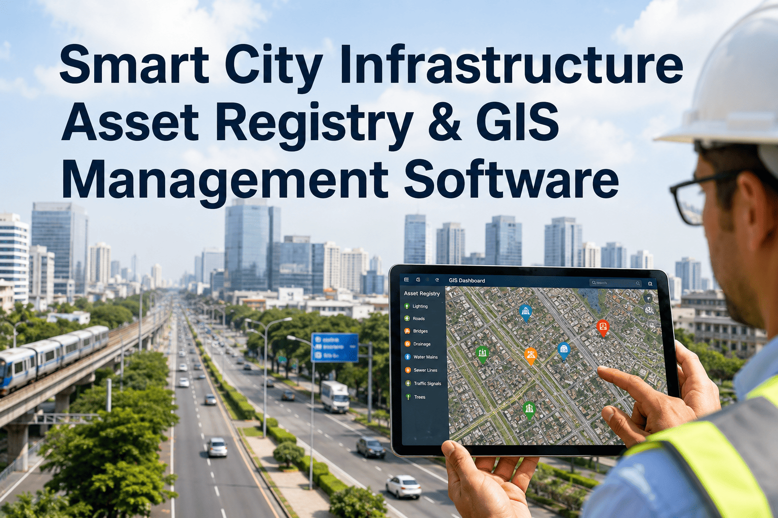
Ask five different departments in a mid-size city where their assets are, and you will likely get five different answers, spread across a GIS shapefile nobody updates, a spreadsheet on someone's desktop, a paper binder in a filing cabinet, and a system a contractor set up years ago that nobody currently working there fully understands. A centralized asset registry replaces that patchwork with one spatially accurate record for every road segment, structure, utility line, and facility a city owns, so any department can answer where an asset is, what condition it is in, and what it is worth without hunting across five systems. To see how your city's existing GIS and spreadsheet data would map into a single registry, book a demo.
SMART CITY INFRASTRUCTURE · GIS ASSET REGISTRY · MUNICIPAL PLATFORM
One Map, One Record, Every Public Asset Your City Owns
iFactory's GIS asset registry brings roads, structures, utilities, and facilities into a single spatially accurate database, so capital planning, compliance reporting, and field crews are all working from the same current information.
THE PROBLEM MOST CITIES ARE ACTUALLY SOLVING
Why "We Have a GIS System" Doesn't Mean a City Has an Asset Registry
Most municipalities already own GIS software. That is rarely the gap. The gap is that the GIS layer shows where a manhole or a signal box sits on a map, while the condition, installation date, replacement value, warranty status, and maintenance history for that same asset live somewhere else entirely, often in a format that cannot be searched, filtered, or reported against. A map without connected asset data answers "where," but not "what shape is it in" or "what should we budget for it next year."
A county technical services director quoted in recent municipal asset-management coverage described the reality plainly: hundreds of spreadsheets, fragmented data, and no reliable answer to which assets the department even has or who is responsible for them. That is not an unusual situation, it is close to the norm once a city's asset count moves into the thousands and departments have been operating independently for years.
1
Duplicate and Conflicting Records
The same hydrant, culvert, or streetlight listed three different ways across three different department systems, with no single record anyone trusts as current.
2
Missing Installation and Condition History
Assets with no recorded install date or last inspection, making it impossible to forecast remaining useful life or flag what is approaching end of service.
3
Field Crews Working From Outdated Maps
Printed or cached maps that do not reflect the most recent inspection, repair, or replacement, so crews arrive without the context they actually need.
4
Audit and Grant Reporting Becomes Reconstruction
When auditors or grant reviewers request a capital asset schedule, staff spend weeks rebuilding records from scratch instead of exporting a report.
WHAT GOES INTO THE REGISTRY
Six Infrastructure Categories, One Searchable, Mappable Record
A useful registry does not treat every asset category the same way, since a road segment, a lift station, and a municipal building carry different attributes and different lifecycle logic. iFactory's registry structures each category with its own attribute set while keeping every asset queryable from the same map and the same search bar.
Roads and Pavement
Segment length, surface type, last resurfacing date, pavement condition index, and traffic classification, mapped as continuous linear assets rather than isolated points.
Structures and Bridges
Span, load rating, inspection cycle, and structural condition rating, tracked against the inspection intervals most transportation departments are required to report.
Water and Sewer Utilities
Pipe material, diameter, installation year, and break or repair history, connected spatially to valves, hydrants, and lift stations along the same network.
Stormwater Systems
Catch basins, culverts, and outfalls mapped with drainage direction and capacity data, supporting flood-risk and maintenance planning together.
Public Facilities and Buildings
Building-level records that break down into floors, rooms, and the equipment inside them, so a single facility record still answers space and asset questions.
Traffic and Signal Infrastructure
Signals, signs, and traffic control devices tracked with equipment age and controller type, supporting both maintenance scheduling and safety compliance reviews.
Import your existing GIS layers instead of starting over
iFactory's registry is built to ingest your city's existing shapefiles, ArcGIS layers, and department spreadsheets rather than requiring a rebuild of data you already collected.
HOW A RECORD MOVES THROUGH THE SYSTEM
From Field Inspection to Capital Plan, Without Re-Entering Data Twice
The registry's value shows up in the workflow around it as much as in the database itself. A single condition rating captured in the field should update the map, feed the capital plan, and stay available for the next audit, without a staff member manually copying the same number into three different spreadsheets.
1
Field Inspection Captured on Mobile
An inspector records a condition rating, GPS location, and photos directly against the asset's existing registry record, working offline where signal is unreliable and syncing once reconnected.
2
Condition Score Updates the Map in Real Time
The asset's color-coded condition marker on the shared map updates immediately, so any department viewing that layer sees the current status without waiting for a manual refresh.
3
Threshold Triggers Route to Capital Planning
Assets crossing a defined condition threshold are flagged into the capital improvement pipeline automatically, replacing the manual review cycle many departments still run by memory.
4
Audit and Grant Reports Export on Demand
Capital asset schedules, condition summaries, and inspection histories are exportable directly from the registry, turning what was a weeks-long reconstruction into a report generated in minutes.
CONDITION RATING FRAMEWORK
A Shared Rating Scale So Every Department Means the Same Thing
One of the most common sources of inconsistent asset data is a condition scale that means something different depending on who is filling it in. Standardizing the rating definitions across departments is a small step that removes a large source of disagreement during capital planning meetings.
| Rating | Condition | Planning Implication |
|---|
| Excellent | New or like-new, no visible deterioration | Routine maintenance only, full remaining useful life |
| Good | Minor wear within normal range | Preventive maintenance keeps it here, cheapest point to intervene |
| Fair | Moderate deterioration visible | Planned rehabilitation window opens, deferral cost rises each year |
| Poor | Significant deterioration, function impaired | Major rehabilitation or replacement planning required soon |
| Critical | Failure imminent or occurring | Public health, safety, or compliance risk, immediate action |
WHAT CHANGES IN THE FIRST YEAR
What a Structured Registry Typically Replaces
The improvements below are not universal guarantees, since every city starts from a different baseline of data quality and department coordination, but they reflect the pattern documented across recent municipal asset-management implementations moving from fragmented systems to a structured registry.
Before: Fragmented Records
Asset data spread across spreadsheets, paper logs, and disconnected GIS layers, duplicate entries for the same asset, missing install dates, and capital decisions made on incomplete information or institutional memory that leaves when staff turn over.
After: One Registry, One Map
Every asset with a single trusted record, condition history visible to every department that needs it, capital planning driven by actual condition data, and audit or grant documentation available as a direct export rather than a reconstruction project.
GETTING THE REGISTRY LIVE
A Phased Path That Starts With What You Already Have
Cities do not need clean, complete data to begin. The build process is designed to absorb existing GIS layers and department spreadsheets as-is, then close data gaps through field verification rather than requiring a perfect starting dataset before day one.
1
Data Consolidation and Deduplication
Existing GIS shapefiles, department spreadsheets, and paper records are imported and reconciled, with duplicate and conflicting entries flagged for review rather than silently merged.
2
Attribute Standardization by Asset Category
Each infrastructure category is mapped to a consistent attribute schema, so a road segment in one department's old system and another's match up correctly in the unified registry.
3
Field Verification of Gaps
Missing condition ratings, install dates, or location accuracy issues are closed through targeted field inspections rather than city-wide re-surveys, prioritized by asset criticality.
4
Go-Live With Department Access and Reporting
The registry goes live with role-based access per department, shared map views, and the audit and capital planning reports configured against your city's own reporting requirements.
A mid-size city managing between five thousand and twenty thousand assets typically moves through this process in four to eight weeks, depending on data volume and how much of the existing records need reconciliation before go-live. To scope a timeline against your own city's asset count and current systems, contact our support team.
WHY THIS MATTERS BEYOND OPERATIONS
The Financial and Compliance Case for a Structured Registry
A registry is easy to justify as an operational convenience, but the stronger case for most cities is financial and regulatory. Documented municipal case studies on the shift from fragmented systems to structured asset management report reductions in emergency spending in the range of forty to fifty percent, driven by the same underlying mechanism: capital dollars move toward assets flagged by actual condition data rather than toward whichever failure generated the most recent complaint. Reactive spending on a burst pipe or a collapsed culvert costs meaningfully more per repair than the same work done on a planned schedule, and a registry is what makes the planned schedule possible in the first place.
The compliance angle carries its own weight, particularly as federal infrastructure funding tied to programs like the Infrastructure Investment and Jobs Act increasingly requires documented condition data and audit trails rather than a simple count of assets owned. A city that cannot produce a defensible capital asset schedule on request is not just facing an uncomfortable audit conversation, it may be limiting its own eligibility for the grant funding that would otherwise offset the cost of addressing the very infrastructure gaps the registry surfaces. Getting the underlying data right is as much a funding strategy as it is an operational one.
1
Emergency Spend Trends Downward
Capital dollars shift toward condition-flagged assets ahead of failure, reducing the share of the budget consumed by unplanned emergency repairs each year.
2
Grant Eligibility Strengthens
Documented condition histories and audit trails support funding applications that increasingly require asset-level data rather than department estimates.
3
Staff Turnover Stops Erasing Institutional Knowledge
Asset history lives in the registry rather than in a retiring employee's memory, so continuity survives personnel changes across departments.
4
Council and Public Trust in the Numbers
Capital requests backed by consistent, exportable condition data hold up better in budget review than estimates that shift depending on who is presenting them.
FREQUENTLY ASKED QUESTIONS
What City Departments Ask Before Building a Shared Registry
Do we need to replace our existing ArcGIS or Esri system to use this?
No, the registry is built to integrate with existing GIS platforms including Esri ArcGIS rather than replacing them outright. Most cities already have significant investment in spatial data and staff trained on their current GIS tools, so the registry connects through open APIs to bring that spatial layer together with asset condition, maintenance, and lifecycle data rather than asking a city to migrate off tools it already relies on. Where a city has no existing GIS platform at all, the registry can also serve as the primary mapping layer.
Book a demo to see how it would connect to your specific GIS setup.
Our department data is really messy. Is that a reason to wait before starting?
No, messy or incomplete data is the normal starting point for nearly every city that begins this process, not an exception. The consolidation phase is specifically designed to work with spreadsheets that have duplicate entries, missing fields, and inconsistent naming conventions, since that is what most departments are actually working with after years of independent systems. Waiting for perfect records before starting usually means waiting indefinitely, while the underlying compliance and planning risk continues to grow in the meantime.
Contact our support team to review what your current data would need before import.
How is this different from a maintenance or work order system we might already use?
A maintenance or work order system tracks what happened to an asset after a problem is reported, while an asset registry establishes the foundational record of what the asset is, where it sits, and what condition it is in, which the maintenance system then references. Without a structured registry underneath it, a work order system has no reliable asset list to route requests against, which is why cities often find their maintenance software underperforming once they realize the underlying asset data was never actually complete. The registry and maintenance workflows connect directly, but they solve two different problems.
Book a demo to see how the registry and maintenance workflows work together.
Can different departments control access to their own asset data within one shared system?
Yes, role-based access control lets each department manage and edit its own asset categories while still allowing cross-department visibility into the shared map and condition data that everyone needs for planning and emergency response. A water department can retain ownership of its utility records while a public works director still has visibility into overall city-wide condition without needing separate login credentials into five different systems. This balances the governance departments want to keep with the shared visibility that makes a registry valuable in the first place.
Contact our support team to review access control options for your department structure.
Does this help with grant compliance and audit documentation, or is it purely operational?
It directly supports both. Grant programs and capital reporting increasingly require documented condition data and audit trails rather than a simple asset count, and a registry with consistent condition ratings, inspection history, and installation records generates that documentation as a standard export rather than a special project each time it is requested. Departments that have struggled to reconstruct capital schedules for auditors typically find that the same underlying data gap was also limiting their eligibility for infrastructure funding tied to documented asset condition.
Book a demo to see the audit and grant reporting exports available in the registry.
START WITH THE ASSETS YOU ALREADY HAVE MAPPED
Bring Every Department Onto the Same Map and the Same Record
Your city already has GIS layers, spreadsheets, and years of inspection history scattered across departments. iFactory's registry consolidates what exists into one spatially accurate, continuously updated source of truth.