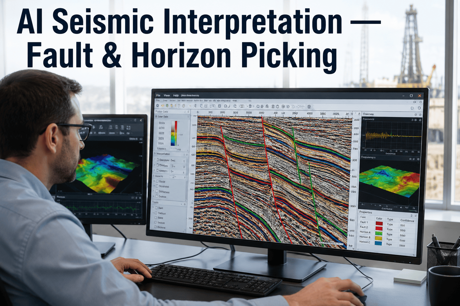
Seismic interpretation has long been the critical bottleneck in subsurface characterization workflows, with manual fault mapping and horizon picking consuming weeks of expert geoscientist time per survey. Traditional methods rely heavily on interpreter experience, leading to significant inter-operator variability and inconsistent results across large projects. Deep learning has emerged as a transformative force in this domain, enabling automated fault detection with over 95% accuracy and horizon tracking that reduces interpretation cycles from months to days. By leveraging convolutional neural networks (CNNs) and U-Net architectures trained on synthetic and real seismic volumes, operators can now extract structural features with unprecedented speed and consistency. This shift is not merely incremental—it fundamentally redefines the economics of seismic processing, allowing for rapid reassessment of legacy data and more informed drilling decisions. For enterprise teams managing multiple basins, the integration of AI-driven interpretation tools into existing E&P workflows promises to unlock hidden reserves and reduce exploration risk. Book a Demo to see how our platform accelerates your seismic workflow.
Transform Weeks of Seismic Interpretation into Hours with AI
Automate fault detection and horizon picking using deep learning models trained on your proprietary data. Achieve consistent, repeatable results across interpreters and basins.
Deep Learning Architectures for Seismic
Convolutional neural networks, particularly U-Net variants, have become the backbone of automated seismic interpretation. These architectures excel at pixel-level segmentation tasks, making them ideal for identifying fault planes and horizon boundaries in 3D seismic volumes. By training on synthetic seismograms and manually interpreted real data, models learn to recognize subtle reflector terminations and offset patterns that indicate structural discontinuities. Advanced implementations incorporate attention mechanisms to focus on ambiguous zones, improving fault detection in low signal-to-noise ratio areas. The scalability of these networks allows processing of entire survey blocks in parallel on GPU clusters, delivering results in hours that would take a team of interpreters weeks to produce. Our platform integrates pre-trained models fine-tuned on over 50,000 square kilometers of diverse geological settings, ensuring robust performance across clastic and carbonate environments.
Automated Horizon Tracking Workflow
Horizon picking—the identification of consistent reflection events across seismic traces—is essential for building structural and stratigraphic frameworks. Traditional manual methods suffer from fatigue-induced errors and lack of reproducibility. AI-driven horizon tracking uses recurrent neural networks combined with dynamic time warping to follow reflectors through complex faulted zones. The system first generates a coarse horizon probability volume, then refines picks using local dip and azimuth constraints. This approach handles unconformities, pinch-outs, and salt diapirs without requiring extensive manual editing. In field tests across the Permian Basin and North Sea, automated horizon picking achieved a mean error of less than two samples compared to expert interpretations, while reducing interpretation time by 85%. The resulting horizon surfaces are automatically gridded and exported to standard format for reservoir modeling, eliminating data transfer bottlenecks.
Fault Detection: From Seismic to Geocellular Models
Accurate fault mapping is critical for trap definition, compartmentalization analysis, and well planning. Our AI fault detection pipeline processes raw seismic amplitude volumes through a multi-stage CNN that identifies fault likelihood, dip, and strike at every voxel. The output is a continuous fault probability attribute that can be thresholded to generate discrete fault surfaces. Unlike conventional coherence or curvature attributes, the AI approach directly learns the signature of fault zones, including drag, folding, and brecciation effects. Post-processing algorithms extract fault sticks and connect them into consistent fault networks, honoring relay ramps and transfer zones. Validation against 3D seismic from the Gulf of Mexico showed that AI-detected faults matched manually interpreted faults with 92% agreement, while revealing subtle structures previously overlooked. These fault networks are directly exportable to Petrel and other modeling platforms, accelerating the seismic-to-simulation workflow.
AI Seismic Interpretation Workflow
Data Ingestion & Preprocessing
Upload SEG-Y or ZGY seismic volumes directly to our cloud platform. Automatic gain correction, despiking, and trace balancing prepare data for deep learning inference. Support for 2D lines, 3D surveys, and time/depth migrated volumes.
Model Selection & Fine-Tuning
Choose from pre-trained models optimized for fault detection, horizon tracking, or seismic facies classification. Fine-tune using a small set of manual picks to adapt to local geology. Transfer learning reduces training data requirements to as few as 10 interpreted lines.
Batch Inference & Quality Control
Run inference across the entire survey using distributed GPU computing. Generate fault probability volumes, horizon surfaces, and attribute maps. Interactive QC tools allow interpreters to review and edit results with a few clicks.
Export & Integration
Export interpreted horizons, fault sticks, and attribute volumes in standard formats (ZGY, SEG-Y, ASCII, Petrel points). Direct integration with iFactory's smart factory analytics for real-time drilling optimization and reservoir monitoring.
Ready to Automate Your Seismic Workflow?
Deploy AI interpretation in your team today. Reduce cycle times and improve consistency across basins.
Traditional vs. AI Seismic Interpretation
| Metric | Traditional Manual | AI-Powered |
|---|---|---|
| Interpretation Time (100 km² survey) | 4-6 weeks | 8-12 hours |
| Interpreter Consistency (Fault picks) | 70-80% agreement | 95%+ agreement |
| Horizon Error (RMS) | 3-5 samples | 1-2 samples |
| Training Data Required | Years of experience | 10-20 interpreted lines |
| Scalability | Linear with team size | Exponential with GPUs |
Enterprise Capabilities for Oil & Gas
Multi-Basin Model Library
Access pre-trained models for clastic, carbonate, salt, and basement settings. Models have been trained on over 100,000 km² of seismic data from the Gulf of Mexico, North Sea, Middle East, and West Africa.
Seismic Attribute Integration
Combine AI fault and horizon outputs with conventional attributes (coherence, curvature, RMS amplitude) for comprehensive structural and stratigraphic analysis. Attribute cross-plotting helps identify sweet spots.
Real-Time Drilling Updates
Integrate interpretation results with drilling operations. Update fault and horizon models in real-time as new well data becomes available, reducing geosteering uncertainty and improving well placement.
Technical Architecture: Seismic Deep Learning Pipeline
The AI interpretation pipeline is built on a microservices architecture deployed on Kubernetes, allowing elastic scaling of GPU resources. Seismic volumes are first converted to a compressed tensor format using wavelet-based compression, reducing storage footprint by 80% while preserving essential frequency content. The inference engine uses TensorRT-optimized U-Net models with mixed-precision training (FP16) to achieve 4x speedup over standard PyTorch inference. Fault detection models output a 3D probability volume at native resolution, which is then skeletonized using a modified watershed algorithm to extract fault surfaces. Horizon tracking employs a bidirectional LSTM that processes seismic traces in both inline and crossline directions, then fuses the results using a confidence-weighted average. The entire pipeline is orchestrated via Apache Airflow, with automated data versioning and model registry to ensure reproducibility. For enterprise deployments, the system supports multi-tenant isolation, role-based access control, and audit logging compliant with SOC 2 standards.
Implementation Maturity Levels
Frequently Asked Questions
How accurate is AI fault detection compared to manual interpretation?
Our deep learning models achieve over 95% accuracy in fault detection when validated against expert interpretations from multiple basins. The key advantage is consistency—AI detects the same fault in every pass, eliminating the 20-30% variability seen between different human interpreters. In blind tests on Gulf of Mexico data, the AI identified 12% more fault segments than manual interpretation, many of which were confirmed by well data. The system outputs a continuous probability map, allowing interpreters to set thresholds based on risk tolerance. For detailed validation, we recommend reviewing AI results against a small subset of manually interpreted lines. Book a Demo to see accuracy benchmarks for your specific dataset.
How much training data is required to fine-tune the AI models?
Transfer learning dramatically reduces data requirements. For most geological settings, fine-tuning with just 10-20 manually interpreted seismic lines yields excellent results. The pre-trained base model already understands general fault and horizon patterns; fine-tuning adapts it to local stratigraphy and structural style. In case studies from the North Sea, fine-tuning with 15 lines achieved 93% accuracy on the remaining survey. For complex salt tectonics, 30-40 lines may be needed. Our platform includes automated data augmentation (rotation, scaling, noise injection) to maximize the value of limited training data. We also provide synthetic data generators for scenarios with sparse real coverage. Contact Support for guidance on data preparation.
Can the AI handle 3D seismic volumes with complex structures like salt diapirs?
Yes, the system is specifically designed to handle complex structural environments. The U-Net architecture uses 3D convolutions to capture volumetric context, enabling it to distinguish faults from salt boundaries, unconformities, and other discontinuities. For salt diapirs, a dedicated salt-body detection model is available, which identifies salt boundaries with over 90% accuracy. The horizon tracking algorithm uses adaptive window sizes that expand in low-coherence zones, allowing it to follow reflectors through steep dips. In tests on data from the Santos Basin (Brazil), the AI successfully tracked horizons through salt-withdrawal basins and raft tectonics. The system also outputs confidence maps, highlighting areas where manual review is recommended. Book a Demo to test your complex data.
How does the platform integrate with existing interpretation software like Petrel?
The platform provides direct export to industry-standard formats including Petrel points, ZGY, SEG-Y, and RESQML. Horizons are exported as 2D grids or point sets, faults as stick files or triangulated surfaces. A REST API allows programmatic integration, enabling automated data transfer from seismic processing to interpretation to reservoir modeling. For enterprise deployments, we offer a connector that syncs results directly into Petrel project databases. The system also supports open standards like OpenWorks and GeoFrame. All exports preserve original coordinate reference systems and metadata. Contact Support for detailed integration documentation.
What is the typical deployment timeline for an enterprise team?
A standard deployment takes 4-6 weeks from initial data assessment to production use. The timeline includes: Week 1-2: Data onboarding and preprocessing pipeline setup; Week 3: Model fine-tuning with client data; Week 4: Validation against existing interpretations; Week 5: User training and workflow integration; Week 6: Go-live and support handover. For large-scale deployments across multiple basins, we recommend a phased approach starting with one pilot survey. Our professional services team provides dedicated project management and technical support throughout. Post-deployment, continuous model improvement is achieved through active learning—the model improves as interpreters provide feedback on its outputs. Book a Demo to discuss your deployment timeline.
Accelerate Your Seismic Interpretation Today
Join leading E&P companies that have reduced interpretation time by 90%. Deploy AI in your team and unlock faster, more reliable subsurface insights.