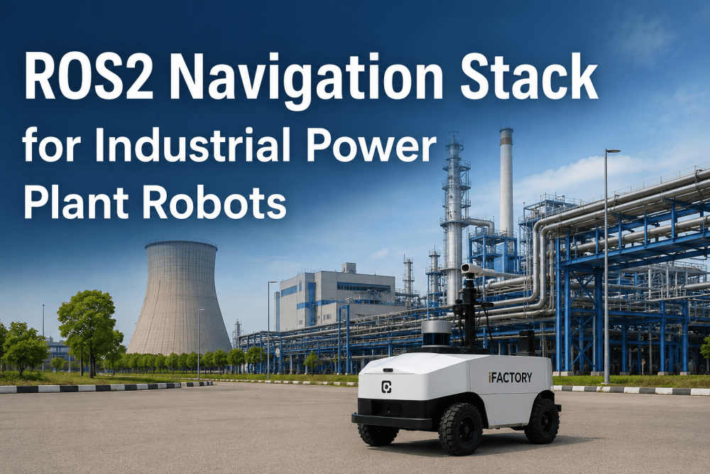
Autonomous mobile robots operating in power plant environments face navigation challenges that consumer-grade robotics platforms are not designed to handle — metallic structures that distort LiDAR point clouds, GPS-denied indoor environments spanning turbine halls, boiler buildings, and pipe racks, dynamic obstacles including personnel and mobile equipment, and multi-floor layouts with stairs, gratings, and elevation changes that complicate localization and path planning. iFactory AI's integrated platform, spanning predictive analytics, digital twin simulation, AI vision, robotics orchestration, CMMS, and automated compliance management, provides power plant operators with the unified technology stack needed to deploy and manage Nav2-equipped robots across their generation assets. Book a Demo to see the platform configured for your power plant robotics deployment.
Deploy Autonomous Robots in Your Power Plant with ROS2 Nav2
iFactory AI integrates the ROS2 Navigation Stack with power plant-specific map management, multi-floor navigation, and safety-rated zone control — giving operators a production-grade autonomous navigation platform purpose-built for the unique challenges of power generation facilities.
The Navigation Challenge for Power Plant Robots
Power plants present a uniquely demanding navigation environment for autonomous mobile robots. Unlike structured warehouse or factory floor environments, power generation facilities combine large open turbine halls with narrow pipe rack corridors, multi-level mezzanine structures, outdoor switchyards, and hazardous area zones requiring certified safe operation. Uneven flooring, grating, and expansion joints challenge odometry estimation. And the presence of personnel, mobile cranes, and maintenance equipment requires robust dynamic obstacle handling that must never compromise safety. Book a Demo to see how iFactory AI configures Nav2 for power plant environments.
Complex Metallic Environments & Sensor Degradation
Power plant environments are constructed predominantly from carbon steel, stainless steel, and concrete — materials that cause LiDAR beam scattering, multipath reflections, and absorption that degrade point cloud quality and challenge occupancy grid mapping. Turbine halls with large rotating equipment, boiler buildings with complex piping networks, and electrical switchyards with high-voltage equipment all present unique sensor challenges that standard Nav2 costmap configurations are not tuned to handle without environment-specific parameter optimization.
GPS-Denied Indoor Localization at Scale
Power plant navigation occurs entirely without GPS availability inside turbine buildings, boiler houses, coal handling facilities, and containment structures. AMCL-based localization must operate reliably across large indoor spaces spanning hundreds of meters with feature-sparse areas — wide turbine halls with few distinguishing geometric features — and feature-dense areas such as pipe racks with repetitive geometric patterns that cause particle filter degeneracy. Multi-floor operation adds the complexity of elevation change detection and floor map switching.
Dynamic Obstacles & Personnel Safety
Power plants are active work environments with personnel performing rounds, maintenance crews moving equipment, mobile cranes operating in turbine halls, and forklifts transporting materials. Nav2 must differentiate between static infrastructure, semi-static obstacles (temporary barriers, maintenance stands), and dynamic obstacles (personnel, vehicles) while maintaining safe following distances and emergency stop behaviors that comply with ANSI/ISO safety standards for industrial mobile robots.
Multi-Floor, Multi-Zone Operational Complexity
Power plants span multiple floors, elevation changes via ramps and industrial elevators, and distinct operational zones — turbine hall, boiler area, coal yard, cooling tower, switchyard, control room, and hazardous classified areas. Each zone requires different navigation behaviors, speed limits, clearance requirements, and authorization levels. Nav2 must manage seamless transitions between zones while maintaining accurate global localization across floor transitions and enforcing zone-specific operational constraints.
Core Components of the ROS2 Nav2 Stack for Power Plant Navigation
The ROS2 Navigation Stack provides a modular, composable architecture that can be configured for the specific requirements of power plant environments. Each component in the stack can be independently tuned, replaced, or extended to address the unique challenges of power generation facility navigation. The table below details the principal Nav2 components, their functions, and the power plant-specific configuration considerations that enable reliable autonomous operation. Book a Demo to discuss which Nav2 configuration matches your power plant layout.
| Nav2 Component | Primary Function | Power Plant Configuration | Key Parameters |
|---|---|---|---|
| SLAM Toolbox | Real-time mapping and lifelong SLAM for changing environments | Optimized for high-reflectivity metallic environments with selective beam filtering and scan matching tuned for large open spaces with sparse features | scan_matcher_max_iterations, minimum_travel_distance, map_update_rate |
| Nav2 Planner (Smac2D) | Global path planning using hybrid-A* with 2D and 3D collision checking | Configured with custom costmap layer for restricted zones, minimum clearance enforcement in narrow corridors, and alternative path generation for dynamic obstacle avoidance | max_iterations, minimum_turning_radius, analytic_expansion_ratio |
| AMCL | Adaptive Monte Carlo Localization for GPS-denied pose estimation | Tuned for feature-sparse turbine halls with adaptive particle resampling, beam-skip model for metallic reflective surfaces, and floor-transition detection for multi-level plants | min_particles, max_particles, laser_likelihood_model, beam_skip_distance |
| Behavior Trees (BT.CPP) | Navigation logic, recovery behaviors, and state machine management | Custom behavior trees for power plant zones — different recovery behaviors for turbine hall vs. pipe rack vs. outdoor yard, with zone-specific speed limits and clearance requirements | Custom XML trees per zone, recovery behavior sequencing, fallback timeout values |
| Costmap2D Layers | Static, obstacle, inflation, and voxel layer management for collision avoidance | Multi-layer costmap with static layer for plant infrastructure, obstacle layer for dynamic objects with persistent marking for semi-static objects, and custom zone layer for restricted-area enforcement | obstacle_layer observation_sources, inflation_radius, footprint_padding |
| MPPI Controller | Model Predictive Path Integral control for smooth trajectory execution | Configured with power plant-specific acceleration limits, trajectory smoothing for grating and expansion joint crossings, and speed scaling based on zone proximity to personnel or equipment | model_prediction_frequency, trajectory_feather, temperature, motion_model_type |
Nav2 Configuration Patterns for Power Plant Zones
Each distinct zone within a power plant requires a different Nav2 configuration profile tuned to the zone-specific geometry, sensor characteristics, dynamic obstacle density, and safety requirements. The configuration patterns below map common power plant zones to their optimal Nav2 parameter sets and behavior tree configurations. iFactory AI's platform provides zone-based configuration management that enables seamless robot transition between zones with automatic parameter switching based on robot localization within the facility map. Book a Demo to see zone-based Nav2 configuration management configured for your plant.
Large open space (50-100m span) with metallic turbine housings causing LiDAR multipath. Use beam-skip AMCL model with selective beam filtering. Smac2D planner with hybrid-A* for efficient global paths. Reduced inflation radius for wide areas but increased clearance around turbine pedestals
Dense piping networks with repetitive geometric features causing AMCL particle filter degeneracy. Use increased particle count (2000+) with augmented MCL for recovery from localization loss. Voxel layer costmap for 3D obstacle detection of overhead piping and platforms. Custom recovery behavior for tight clearance passages
Narrow corridors (1.2-2.0m width) surrounded by piping on both sides requiring centimeter-precision navigation. Reduced footprint padding (2cm), tight inflation radius (0.15m), and Smac2D planner with conservative path smoothing. MPPI controller configured with high trajectory weight for precise path following.
Clean indoor environments with raised floors, cable trays, and sensitive electronic equipment. Strict speed limits (0.2 m/s), maximum inflation radius for equipment clearance (0.5m), and conservative stopping distance (0.3m). Static costmap layer includes no-go zones around electrical panels and server racks.
Outdoor environments with variable lighting, weather exposure, and uneven terrain. GPS-assisted AMCL with GPS-to-map transform for global localization initialization. 3D costmap voxel layer for overhead conductor clearance detection. Different inflation parameters for outdoor vs indoor zones — larger minimum clearance (0.8m) from energized equipment. Weather-adaptive speed scaling based on precipitation sensors and wind speed input.
ATEX/IECEx classified areas requiring certified safe robot operation with restricted navigation parameters. Explosion-proof sensor housings and purged enclosures affect sensor placement and field of view — costmap observation sources must account for occluded sensor arcs. Maximum speed limited to 0.25 m/s with enforced minimum following distance of 2.0m from any personnel.
iFactory AI's zone-based configuration management enables automatic parameter switching as robots transition between plant zones — turbine hall to pipe rack to switchyard — with no interruption in navigation continuity. Book a Demo to see zone-based Nav2 configuration management configured for your power plant layout.
Industry Expert Perspective on ROS2 Nav2 for Power Plant Robotics
"I have spent eleven years developing and deploying autonomous mobile robot navigation systems for industrial environments, with the last six years focused specifically on power generation facilities across combined-cycle gas turbine plants, coal-fired stations, and nuclear generating stations. The navigation requirements across these facility types are surprisingly different — a gas turbine plant has large open turbine halls with sparse geometric features, a coal plant has dense, cluttered environments with fine particulates that affect sensor performance, and a nuclear plant has shielded containment structures that degrade wireless communications and complicate multi-floor localization. Before ROS2 Nav2, we were building custom navigation solutions for each facility type using a mix of open-source libraries stitched together with proprietary middleware. A Nav2 configuration that works in a gas turbine hall deploys to a coal plant boiler room with parameter changes rather than code changes, and our deployment timeline dropped from six months per facility to approximately six weeks. The behavior tree architecture has been particularly valuable for power plant work — we encode zone-specific safety behaviors directly into the navigation logic, so the robot's response to a dynamic obstacle or localization uncertainty changes automatically based on whether it is in a turbine hall, a pipe rack corridor, or a hazardous classified area."
Conclusion — Deploying Production-Grade Navigation with ROS2 Nav2
The ROS2 Navigation Stack provides power plant operators with a production-grade, modular navigation framework that addresses the unique challenges of autonomous mobile robot deployment in power generation facilities. Nav2's behavior-tree-based architecture enables zone-specific safety behaviors that would require custom development with alternative navigation frameworks. Its multi-layer costmap management handles the complex geometry of turbine halls, boiler buildings, pipe racks, and outdoor switchyards within a single unified navigation configuration. AMCL provides reliable GPS-denied localization across large indoor spaces spanning hundreds of meters. Book a Demo to discuss your power plant robotics navigation requirements.
Deploy ROS2 Nav2 Across Your Power Plant Fleet
iFactory AI integrates ROS2 Nav2 with power plant-specific zone management, multi-floor navigation maps, and safety-rated behavior trees — enabling autonomous robots to navigate turbine halls, boiler buildings, pipe racks, and switchyards with 99.5% localization reliability.
ROS2 Navigation Stack for Power Plant Robots — Frequently Asked Questions
What makes ROS2 Nav2 better suited for power plant navigation than consumer robotics frameworks?
ROS2 Nav2 is designed for production-grade industrial deployment with modular architecture that allows each navigation component — global planner, local controller, costmap layers, recovery behaviors, and localization — to be independently configured, replaced, or extended for specific power plant environments. Consumer robotics frameworks lack the behavior-tree-based safety logic needed for hazardous area operation, the multi-layer costmap management required for complex power plant geometry, and the deterministic lifecycle management that ensures predictable startup and shutdown sequences in safety-critical applications.
How does Nav2 handle localization in GPS-denied power plant environments with metallic interference?
Nav2's AMCL (Adaptive Monte Carlo Localization) module can be configured with a beam-skip likelihood model that accounts for LiDAR beam penetration and reflection from metallic surfaces — preventing the reflective artifacts caused by turbine housings, piping, and structural steel from corrupting the pose estimate. The beam-skip model allows AMCL to discard a configurable fraction of the most unlikely beam measurements, effectively ignoring LiDAR returns that are inconsistent with the expected geometry.
Can Nav2 handle multi-floor power plant navigation with elevators and ramps?
Yes — Nav2 supports multi-floor navigation through a combination of map management and behavior tree custom behaviors. Each floor of the power plant is represented as a separate map with known transform relationships between floor coordinate frames. When the robot approaches an elevator or ramp transition point, a custom behavior tree node triggers the floor transition sequence — requesting elevator call, monitoring door status, entering the elevator, detecting floor arrival via barometric pressure change or floor marker detection, and loading the new floor map with the correct initial pose estimate.
What sensor configuration is recommended for Nav2 deployment in power plant environments?
The recommended sensor configuration for power plant Nav2 deployment includes a primary 2D or 3D LiDAR (Velodyne Puck, Ouster OS-series, or Hokuyo UST-series) for mapping and localization, with the beam-skip AMCL model configured for the specific metallic reflectivity characteristics of the plant environment. A secondary short-range LiDAR or depth camera at the robot base provides low-height obstacle detection for uneven flooring and small debris that primary LiDAR may miss. Wheel encoders with 0.1mm resolution provide odometry in turbine halls where metallic interference may temporarily degrade LiDAR-based localization.
What is the typical timeline and process for deploying Nav2 in a power plant?
A typical Nav2 deployment for a power plant follows a six-phase process. Phase 1 (Weeks 1-2): Facility survey and sensor configuration — mapping LiDAR placement, identifying high-interference zones, and establishing communications infrastructure. Phase 2 (Weeks 2-4): SLAM mapping of all plant zones — generating base maps for each floor and zone with labeled no-go areas, speed zones, and transition points. Phase 3 (Weeks 4-6): Nav2 configuration tuning — optimizing AMCL parameters for each zone, configuring behavior trees for zone-specific safety behaviors, and tuning MPPI controller for smooth trajectories. Phase 4 (Weeks 6-8): Validation testing across all zones — stress-testing localization recovery in metallic-interference zones, validating emergency stop distances, and confirming safe behavior tree execution. Phase 5 (Weeks 8-10): Integration with plant systems — connecting Book a Demo to discuss your specific power plant deployment timeline and configuration requirements.
Deploy ROS2 Nav2 with iFactory AI's Integrated Platform
Power plant operators across North America trust iFactory AI's integrated platform to deploy ROS2 Nav2-equipped robots for inspection, monitoring, and maintenance tasks across turbine halls, boiler buildings, and switchyards.