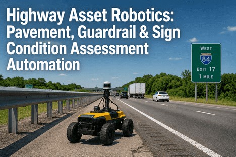
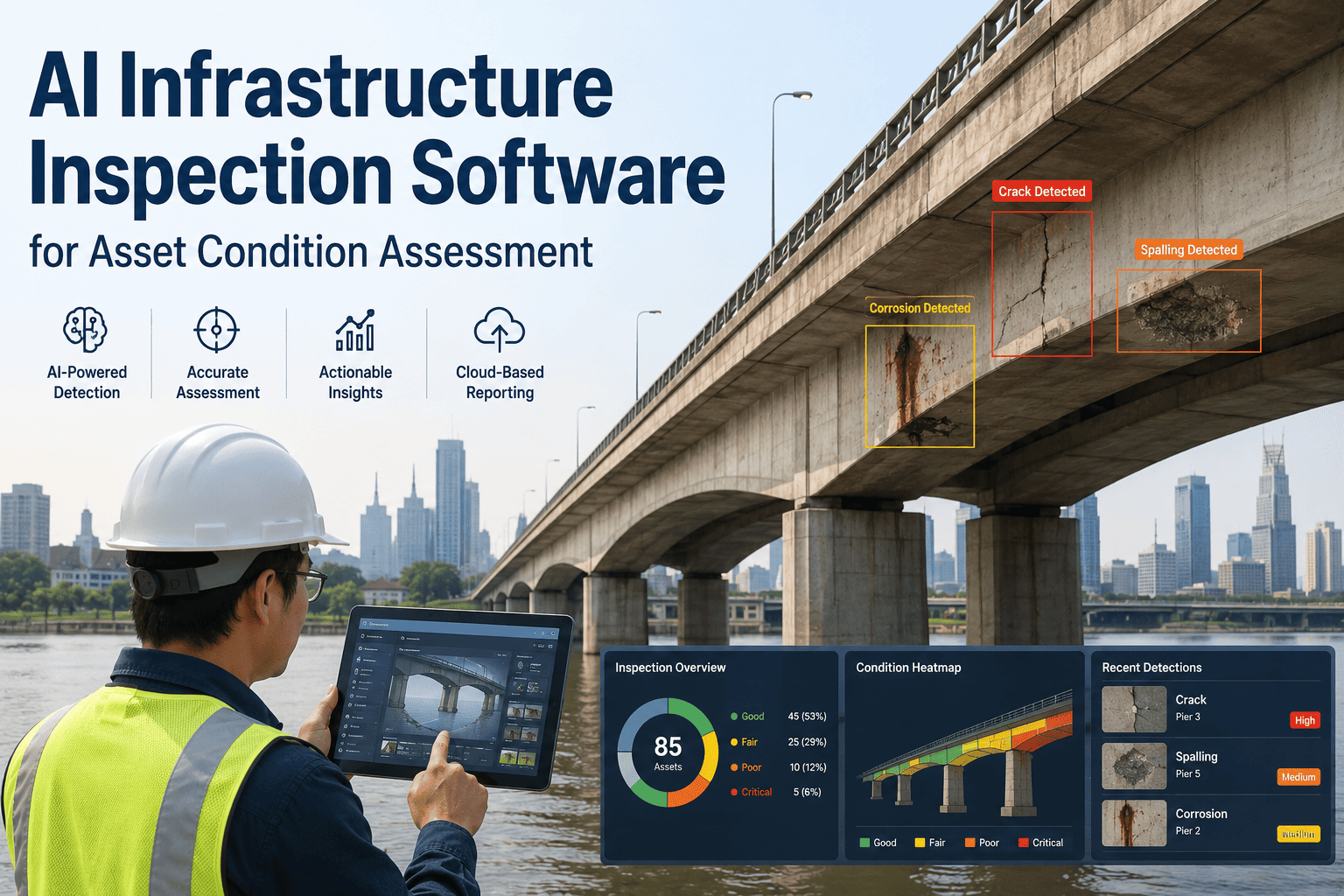
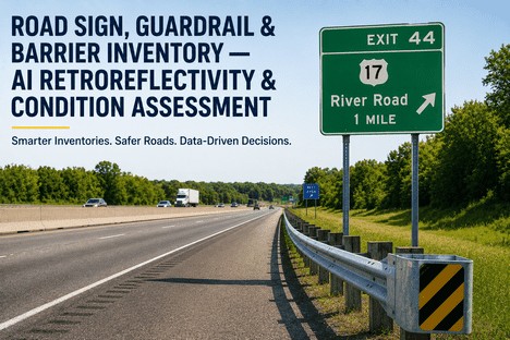
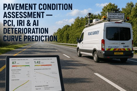
A state DOT's highway network is not a single asset. It is thousands of kilometres of pavement, hundreds of thousands of signs, millions of metres of guardrail, and an endless ribbon of lane markings, shoulders, and barriers — each degrading on its own schedule, each invisible to the maintenance system until a driver reports it, a crash occurs, or a crew drives past and spots it. For decades, the solution was the same: send inspectors in trucks, quarterly if the budget allows, and fix what they find. That model is being replaced by something fundamentally different. AI vision systems mounted on ordinary fleet vehicles, LiDAR-equipped survey platforms, and semi-autonomous ground robots are now inspecting every metre of highway pavement, every guardrail panel, and every traffic sign — continuously, at traffic speed, and with defect recall that exceeds human inspection. This is the technical guide to how highway asset robotics for pavement, guardrail, and sign condition assessment actually works, and why state DOTs deploying it are cutting inspection costs, extending asset life, and closing the maintenance gap that manual methods leave open.
HIGHWAY ASSET INTELLIGENCE PLATFORM
See How iFactory Connects Vehicle-Based AI Inspection With Your DOT Asset Management Workflow
One platform fuses pavement condition AI, guardrail defect detection, sign retroreflectivity scoring, and CMMS integration. No dedicated survey vehicles required. Value from your first patrol pass.
99%
AI detection accuracy for damaged signs (Honda/ODOT PRMS pilot)
93%
Guardrail damage detection accuracy over 3,000 miles of road
$4.5M
Projected annual savings for ODOT from automated inspection
1mm
Pavement crack detection resolution at traffic speed (LCMS-2)
THE THREE ASSET CLASSES
Pavement, Guardrails, and Signs — Each Needs a Different AI
Highway assets fail in different ways at different rates. Pavement develops cracks, rutting, and potholes from traffic load and weather cycling over years. Guardrails sustain impact damage that appears instantly and worsens with corrosion over months. Signs lose retroreflectivity gradually and suffer mechanical damage from vehicles, storms, and vandalism at any time. An effective automated inspection system must detect each of these defect types at the appropriate scale, using the appropriate sensing modality, and route the findings into the appropriate maintenance workflow.
P
Pavement Condition
IRI roughness
Crack detection
Rut depth
Pothole mapping
PCI scoring
AI systems like YOLOv11, PaveGPT, and Crack-YOLO detect and classify cracks, potholes, raveling, and bleeding from 2D and 3D imagery. Pavemetrics LCMS-2 captures full-lane 3D profiles at 1mm resolution at highway speed. Vibration data from vehicle accelerometers predicts IRI within Class 1 profiler accuracy. The PaveInstruct dataset trains vision-language models to produce ASTM D6433-compliant Pavement Condition Index ratings from single images — replacing multiple specialised tools with one unified model.
G
Guardrail & Barrier Condition
Rail deformation
Missing beam sections
Post lean angle
Corrosion mapping
MASH compliance
Vision-language models evaluated by UDOT classify guardrail defects — rust, spalling, deflection, leaning — and assess design compliance against MASH standards. YOLO-based detection identifies missing beam sections, deformed rail faces, and compromised end terminals. Rail-mounted inspection robots with LTV-MPC control navigate W-beam guardrails continuously, achieving 0.415% overshoot in tracking accuracy. LiDAR point cloud fusion enables sub-centimetre deformation measurement and post-lean angle calculation not achievable with camera-only systems.
S
Traffic Sign Condition
Retroreflectivity scoring
Tilt & lean angle
Vegetation occlusion
Physical damage
MUTCD compliance
Mobile retroreflectometry systems capture sign visibility from the driver's perspective at traffic speed, measuring all colour channels simultaneously. OBB-based tilt estimation achieves 92% accuracy in detecting misaligned signs. Mask coverage analysis identifies vegetation occlusion with 85% accuracy. LiDAR retro-intensity normalisation enables daytime retroreflectivity estimation without nighttime surveys. The Honda/ODOT PRMS pilot achieved 99% accuracy for damaged or obstructed sign detection across 3,000 miles of highway.
THE INSPECTION PIPELINE
From Sensor Pass to Work Order: How Automated Highway Asset Inspection Flows
The value of automated inspection is not in detection alone. It is in the pipeline that converts a sensor reading into a scheduled repair — without a person reviewing footage, filling a form, or manually entering a work order. The pipeline has four stages.
1Data Capture
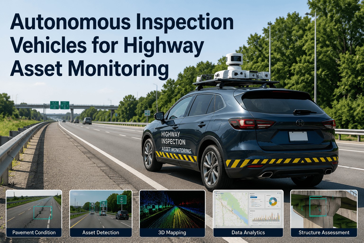
Cameras, LiDAR, and accelerometers mounted on standard fleet vehicles or dedicated survey platforms collect continuous data during normal patrol operations. The Honda/ODOT PRMS system used two CR-Vs with retrofit vision sensors and LiDAR, covering 3,000 miles over six weeks. Pavemetrics LCMS-2 captures full-lane 3D profiles at highway speed. XenomatiX XenoTrack mounts on any vehicle in 45 minutes.
2Edge AI Detection
Onboard Edge AI models process sensor streams in real time. YOLOv11 identifies pavement distress types and guardrail defects at 30+ fps. Retroreflectivity is computed from calibrated camera imagery using MUTCD-compliant thresholds. Tilt and occlusion classifiers run per-sign in under 100ms. Only metadata — defect type, severity, GPS coordinate, timestamp — is transmitted to the cloud, not raw footage.
3Cloud Analysis & Routing
The cloud platform — Parsons iNET Asset Guardian, iFactory, or equivalent — cross-references detections against asset inventory, applies severity scoring, groups defects by proximity for efficient route-based repair, and generates prioritised work orders. ODOT used a real-time web dashboard to review deficiencies flagged by the AI and cross-reference against its regular visual inspection program.
4CMMS Work Order & Close
Work orders are pushed directly to the agency's CMMS — Maximo, SAP PM, or equivalent — with asset ID, defect photo, GPS location, and recommended action. Repair crews receive the order on mobile devices. When the next patrol pass confirms the defect is resolved, the work order closes automatically. No manual entry. No paper trail.
DEPLOYMENT PROGRAMS
Real Highway Asset Inspection Programs Running Today
These programs represent the current operational state of the art — not laboratory prototypes, but systems deployed by state DOTs and highway operators with measurable outcomes in detection accuracy, cost savings, and maintenance workflow integration.
Honda / DriveOhio PRMS
Ohio, USA
PavementGuardrailSigns
Honda's Proactive Roadway Maintenance System, piloted with ODOT from 2021-2026, equipped two CR-V test vehicles with advanced vision and LiDAR sensors. Over 3,000 miles of central and southeastern Ohio roads, the system detected 99% of damaged or obstructed signs, 93% of damaged guardrails, and 89% of potholes. Edge AI models processed data onboard; results streamed to a Parsons iNET Asset Guardian dashboard that generated prioritised work orders. ODOT estimates automated inspection could save over $4.5 million annually through reduced manual inspection, optimised maintenance schedules, and prevention of costly deferred repairs. The pilot validated that production vehicle sensors — originally designed for ADAS — can double as continuous infrastructure monitoring tools.
UDOT VLM Barrier Assessment
Utah, USA
GuardrailBarriers
The Utah Department of Transportation developed an AI-driven framework using YOLO11n and vision-language models (Gemma 3, Llama 3.2) to assess primary assets — guardrails, cable barriers, concrete barriers — and secondary assets including curbs, gutters, retaining walls, and shoulder edge drop-offs. VLMs were tested for defect classification (rust vs spalling), condition rating via text prompts, and design compliance checks against MASH standards. The framework leverages Pathway Services street-level image data and demonstrates that VLMs can replace multiple specialised models with a single contextual reasoning engine. Gemma 3 offers the best accuracy; Llama 3.2 delivers the best speed-performance balance.
PaveGPT / PaveInstruct
Research — Multi-Agency
Pavement
PaveInstruct, a dataset of 278,889 image-instruction-response pairs spanning 32 task types, was created from nine heterogeneous pavement datasets. PaveGPT, a pavement foundation model trained on this dataset, achieved improvements exceeding 20% in spatial grounding, reasoning, and generation tasks — producing ASTM D6433-compliant Pavement Condition Index outputs. The model unifies distress identification, severity assessment, PCI estimation, and maintenance recommendation in a single conversational framework. This enables transportation agencies to replace multiple specialised pavement tools with one unified AI that accepts natural language queries about pavement condition.
AUTOMATE YOUR HIGHWAY ASSET INSPECTION
Your Crews Can Only See What They Drive Past. AI Sees Everything.
iFactory fuses pavement AI, guardrail defect detection, sign retroreflectivity scoring, and CMMS routing into one platform. Works with your existing fleet vehicles. No dedicated survey trucks required.
OUTCOMES & DATA
Measurable Results From Highway Asset Automation
99%
Sign damage detection accuracy
Honda/ODOT PRMS — 3,000-mile pilot
93%
Guardrail damage detection accuracy
Honda/ODOT PRMS — vision + LiDAR fusion
89%
Pothole detection accuracy
Honda/ODOT PRMS — across all road types
92%
Sign tilt detection accuracy
OBB-based estimation — field validated
90%+
Combined sign & pavement defect precision
CNN models — CTE Molise research project
$4.5M
Projected annual ODOT savings
Reduced manual inspection + optimised scheduling
FREQUENTLY ASKED QUESTIONS
What Highway Asset Managers Ask About Automated Inspection
What sensors are needed on fleet vehicles for AI highway asset inspection?▼
The minimum viable configuration is a forward-facing camera with GPS timestamping. This alone enables YOLO-based sign and guardrail defect detection at highway speed. Adding LiDAR enables sub-centimetre deformation measurement and retroreflectivity estimation. Adding accelerometer or IMU data enables IRI prediction for pavement roughness assessment. The Honda/ODOT PRMS system used retrofit cameras and LiDAR on standard CR-V SUVs. XenomatiX XenoTrack mounts on any vehicle in 45 minutes. Pavemetrics LCMS-2 integrates into dedicated survey vehicles for network-level 1mm-resolution 3D pavement profiling.
How accurate is AI pavement crack detection compared to manual inspection?▼
AI crack detection consistently exceeds human visual inspection recall when operating on high-resolution 2D or 3D pavement imagery. Pavemetrics LCMS-2 achieves 95% accuracy in crack classification vs manual survey across 9,000km of network-level data. PaveGPT improved spatial grounding in pavement assessment by 20%+ over zero-shot baselines. Crack-YOLOv11 achieves mAP improvements of 11.7% over baseline YOLOv11 on tunnel crack datasets. The key advantage is consistency — AI applies the same detection threshold to every metre of pavement, whereas human inspectors vary in attention and judgement over long survey routes.
Can automated retroreflectivity measurement replace handheld inspection?▼
Mobile vehicle-mounted retroreflectivity systems like VISUALISE can screen network-level sign condition at traffic speed, measuring all colour channels simultaneously from the driver's perspective. A 2026 study comparing mobile vs handheld measurements across 248 highway signs found a reasonable correlation (R2 = 0.504) with a +24.79 cd/lx/m2 mean bias in mobile readings. The recommended approach is two-tier: mobile systems serve as network-wide screening tools, with handheld measurements reserved for signs whose mobile-measured retroreflectivity falls within a defined margin around the regulatory threshold. This achieves the efficiency of automated screening with the precision of standards-compliant point measurement.
How does the system handle different environmental conditions and lighting?▼
Modern inspection systems are designed for all-weather, all-light operation. LiDAR-based systems operate identically day or night and are unaffected by shadows or glare. Retroreflectivity measurement requires controlled nighttime conditions but achieves consistent results at traffic speed. Thermal cameras detect pavement delamination and subsurface moisture not visible in the visible spectrum. The Honda PRMS pilot operated across multiple road types, varied weather, and different times of day — including rural and urban environments — and maintained consistent detection accuracy. Edge AI models can be retrained on regional data to adapt to local pavement materials, sign types, and climate conditions.
What is the typical integration timeline and data pipeline into existing CMMS?▼
Integration with existing asset management platforms typically takes 30-60 days. The pipeline works as follows: vehicle-mounted sensors collect data during normal patrol routes. Edge AI processes sensor streams onboard, transmitting only detection metadata (defect type, severity, GPS coordinates, timestamp, annotated image). The cloud platform cross-references against asset inventory, applies proximity-based grouping, and generates work orders. These are pushed to the agency's CMMS — IBM Maximo, SAP PM, or equivalent — via standard API connectors. The Honda/ODOT pilot used a real-time web dashboard built on Parsons iNET Asset Guardian that ODOT operators used to review deficiencies and cross-reference manual inspections. Platforms like iFactory provide the middleware layer that connects any sensor configuration to any CMMS.
HIGHWAY ASSET INTELLIGENCE PLATFORM
Stop Inspecting by Calendar. Start Inspecting by Condition.
iFactory connects your existing fleet vehicles, AI vision models, pavement analytics, and asset management system into one unified highway inspection workflow. No dedicated survey trucks. No rip-and-replace. Results from your first patrol pass.