Ask three different departments where a given valve, manhole, or streetlight actually sits, and there is a real chance you get three different answers. One record has it fifteen feet from its true location because it was digitized from an old paper map, another has the attribute field for material left blank, and a third hasn't been touched since the asset was last inspected years ago. None of this is anyone's fault exactly, it's just what happens when a GIS layer grows for a decade across different staff, different software versions, and different data entry habits. The problem only becomes visible when someone tries to use that layer to plan a capital project or respond to an emergency, at which point bad asset data turns into a real operational risk.
Infrastructure Data Management · Data Quality Software
Find and Fix the Asset Records Your GIS Has Been Quietly Getting Wrong
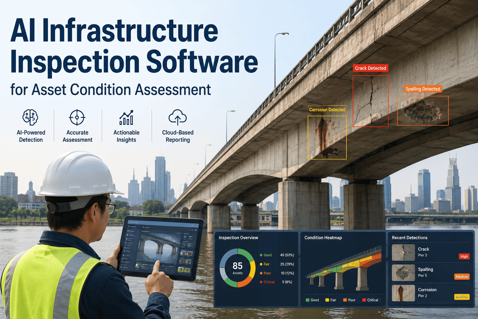
Mislocated points, duplicate assets, missing attributes, and stale inspection history accumulate in every infrastructure GIS over time. iFactory scans your asset register against spatial rules, attribute standards, and inspection history to flag exactly which records need correction before they cause a planning or field mistake that costs far more to fix later.
Automated
Validation across location, attributes, and history
Cross-Layer
Checks that span multiple GIS layers and source systems
Prioritized
Correction list ranked by operational impact
How This Happens
Four Ways Infrastructure Asset Data Quietly Goes Bad
Digitized From Inconsistent Sources
Older assets were often digitized from paper as-builts, hand-drawn sketches, or GPS units with meter-level accuracy, so their mapped location can be meaningfully off from where the asset actually sits in the ground, sometimes by tens of feet on assets that predate modern survey equipment.
Duplicate Records From Repeated Imports
The same hydrant or manhole gets entered twice after a data migration or a field survey that didn't check for an existing record first, and both copies keep getting updated independently from then on, so reports built from the layer quietly double-count the same physical asset.
Attribute Fields Left Incomplete
Material, install date, diameter, and condition fields are often left blank at the point of entry because the field crew didn't have the information on hand, and nobody circles back to fill the gap later, leaving planning models to run on incomplete inputs for years.
Inspection History Falls Out of Sync
A work order gets closed in the maintenance system, but the corresponding condition field in the GIS layer never gets updated, so the map keeps showing an outdated condition rating indefinitely, long after the actual repair has already taken place in the field.
What Good Data Actually Means
Five Dimensions of Asset Data Quality iFactory Checks
Positional Accuracy
How closely a mapped asset location matches its true position, checked against survey-grade reference points and known as-built distances.
Completeness
Whether required attribute fields like material, size, and install date are populated for every record in the layer.
Consistency
Whether values follow the same standard across the layer, so "PVC" and "pvc pipe" aren't treated as two different materials.
Timeliness
Whether condition, inspection, and status fields reflect the most recent known state of the asset rather than a value from years ago.
Uniqueness
Whether each physical asset appears exactly once in the register, with duplicate entries from past imports identified and merged.
Manual Audit vs. Automated Validation
Why Spreadsheet Audits Don't Scale to a Full Asset Register
| Aspect | Manual Spot-Check Audit | Automated Validation |
| Coverage |
A sample of records reviewed by hand |
Every record in the register checked against rules |
| Consistency of criteria |
Varies by which staff member performs the review |
Same rule set applied uniformly across the entire layer |
| Cross-layer checks |
Rarely compared against other systems of record |
Cross-references GIS against work order and inspection systems |
| Time required |
Weeks to months for a full register review |
Runs continuously as new records are added or edited |
| Output |
A general sense of how clean the data is |
A specific, ranked list of records needing correction |
Who This Serves
Departments That Rely on a Clean Asset Register Every Day
Water and Wastewater Utilities
Valve, hydrant, and pipe records feed directly into emergency shutoff planning, so a mislocated valve isn't just a data annoyance, it's a real delay during a main break when every minute matters to limiting property damage and restoring service to affected customers.
Public Works and Streets Departments
Sign, sidewalk, and pavement condition records shape both compliance reporting and multi-year paving programs, and a register full of stale condition ratings quietly skews which streets get funded first, sometimes ahead of streets in worse actual shape.
Electric and Gas Utilities
Transformer, meter, and line records support load planning and outage response, where a duplicate or missing asset record can genuinely slow down a crew trying to isolate a fault in the field during a widespread outage.
GIS and IT Teams
The team responsible for the enterprise GIS platform is usually the one fielding complaints about bad data from every other department, without a systematic way to find and fix the underlying records causing those complaints in a reasonable amount of time.
What's Included
The Core Capabilities Behind Asset Data Validation
Multi-Source Ingestion
GIS layers, CAD exports, spreadsheets, and work order databases are pulled in from wherever they already live, so a validation project doesn't stall waiting on a data migration to happen first.
Configurable Validation Rules
Positional tolerance, required attribute fields, and standard vocabulary lists are configured to match the standards your department already uses, rather than forcing a generic rule set onto every asset class.
Duplicate Detection and Merge Review
Likely duplicate records are surfaced with their full attribute and edit history side by side, so staff can confirm the correct record before anything is merged or removed.
Correction Tracking and Export
Every flagged record and its resolution status is tracked over time, and the ranked correction list exports in a format that fits directly into existing field crew work order workflows.
See What's Actually in Your Register
Run a Sample Validation Against Your Own Asset Layer
Bring an export of one asset layer and we'll show you the kinds of gaps, duplicates, and stale records a full validation would surface across your entire register, along with a rough sense of scope for a full rollout.
How Validation Runs
From Raw Asset Layer to Corrected Register
1
Ingest the Asset Register
GIS layers, CAD exports, and any associated work order or inspection databases are pulled in as they currently exist, without requiring a reformat before the first check can run.
2
Run Spatial Checks
Asset locations are compared against reference geometry, known network topology, and survey control points to flag positions that fall outside expected tolerance.
3
Run Attribute Checks
Required fields are checked for completeness and format consistency, and free-text values are matched against the standard vocabulary used across the department.
4
Cross-Reference Against Other Systems
Inspection and work order history is compared to the condition fields already stored in the GIS layer, surfacing any record where the two have fallen out of sync.
5
Publish a Ranked Correction List
Flagged records are ranked by how much the error affects planning or field operations, so staff time goes to fixing the issues that actually matter first.
A Composite Scenario
A Public Works Department With a Twenty-Year-Old GIS Layer
Before
The water utility's valve layer had been built up over two decades through a mix of paper digitization, field GPS surveys, and vendor as-built imports, with no single validation pass ever run across the whole thing. A capital project team discovered mid-construction that a valve marked on the plans was actually forty feet from its mapped location, delaying the crew for the better part of a day while the real position was located in the field and the schedule was rearranged around it.
After
A full validation pass flagged several hundred valves with positional accuracy outside tolerance, a smaller set of duplicate records left over from a prior migration, and a batch of records where material and install date fields were blank. Field crews corrected the highest-impact positional errors first, and new capital projects now start with a validated export instead of a layer nobody fully trusts, cutting out the informal double-checking that used to happen on nearly every project before construction could even move forward with confidence.
Where It Applies
Asset Types Where Data Quality Errors Cause the Most Damage
Water and Sewer Networks
Mislocated valves, hydrants, and manholes cost field crews time during emergency response and can lead to excavation in the wrong spot entirely.
Roads and Signage
Incomplete sign inventory records make it hard to demonstrate MUTCD compliance or plan a reflectivity replacement program with any confidence.
Bridges and Structures
Stale condition ratings that don't reflect the latest inspection can lead a capital planning team to under-prioritize a structure that actually needs attention sooner.
Electric and Gas Utility Assets
Duplicate or missing transformer and meter records complicate outage response and make load planning calculations less reliable than they should be.
What Changes Downstream
The Practical Difference a Validated Register Makes
Field Crews Stop Losing Time to Bad Locations
When a valve or vault is mapped within a reliable tolerance of its true position, a field crew responding to an emergency spends less time searching for it in the field and more time actually resolving the underlying issue, which matters most during exactly the events where speed counts.
Capital Planning Starts From Numbers People Trust
A planning team building a multi-year rehabilitation program can rely on condition and age fields without first spending weeks manually checking whether the underlying data is even accurate, which shortens the planning cycle considerably and frees up staff time for the actual analysis work.
Compliance Reporting Gets Easier to Defend
Regulatory reports built from a validated register hold up better under audit or public scrutiny than ones built from a register with known gaps, since every figure in the report can be traced back to a specific, checked record instead of an unverified assumption.
New Data Entry Stops Repeating Old Mistakes
Once validation rules are running continuously, new records that violate a positional or attribute standard get flagged immediately at the point of entry, rather than blending in quietly with existing errors and waiting years to be noticed by anyone.
Common Missteps
Where Asset Data Quality Programs Fall Short
Cleaning Data Once and Never Again
A one-time cleanup project restores the register to good condition, but without ongoing validation the same categories of error start accumulating again within a year or two, largely erasing the value of the initial cleanup effort.
Validating Location but Not Attributes
Teams often focus heavily on fixing spatial accuracy while leaving incomplete or inconsistent attribute fields unaddressed, which causes just as many downstream problems for reporting, planning, and maintenance scheduling even after the map itself looks accurate.
No Cross-Check Against Work Order Systems
GIS condition fields and maintenance system records are treated as separate systems of truth instead of being reconciled, so the two quietly drift apart over time until nobody is entirely sure which one reflects the asset's actual current condition.
Fixing Everything at Once Instead of by Impact
Staff time gets spread evenly across every flagged error rather than being directed first at the records most likely to cause a field or planning mistake, which means the highest-risk errors often take just as long to get fixed as the trivial ones.
Before You Start
Preparing for an Asset Data Quality Validation Project
Export a current copy of each GIS layer you want validated, along with any linked work order or inspection databases
Identify the attribute fields your department actually relies on for reporting and planning, as a starting scope for completeness checks
Note any known problem areas, such as a layer imported from a past migration that was never fully reviewed
Decide which asset classes carry the highest operational risk if their data is wrong, to prioritize the first validation pass
Common Questions
Infrastructure Asset Data Quality — FAQ
Do we need to switch GIS platforms to use this?
No, validation runs against the exports and data connections from whatever GIS platform your department already uses, whether that's Esri ArcGIS, an open-source system, or a mix of different tools across departments. The goal is to check and correct the data you already have rather than requiring a platform migration first, since most departments have too much invested in their current systems to justify switching just to get clean data.
Our team can confirm compatibility with your specific setup before a project begins.
How does positional accuracy actually get checked without resurveying every asset?
Mapped locations are compared against available reference geometry such as known network topology, survey control points, and as-built distances rather than requiring a full physical resurvey of every asset. This catches the majority of significant positional errors, and the records that remain genuinely uncertain after that comparison are flagged for a targeted field check instead of a blanket resurvey of the entire layer.
What happens to the duplicate records once they're identified?
Identified duplicates are presented side by side with their full attribute and edit history so staff can confirm which record is the authoritative one before merging, rather than the system automatically deleting a record without any human review of what's actually being removed. This keeps a person in the loop for any change that affects the permanent asset register, while still automating the much harder task of finding the duplicates in the first place.
Can this reconcile our GIS with our separate work order and maintenance systems?
Yes, cross-referencing inspection and work order history against the condition fields stored in the GIS layer is one of the core checks, since these two systems commonly fall out of sync when a work order is closed but the map is never updated. Reconciling them gives planning teams a single trustworthy condition value per asset instead of two systems that quietly disagree.
Book a demo to see how this works against your own systems.
How often should asset data validation run once the initial cleanup is done?
Most departments run validation continuously or on a regular schedule after the initial cleanup, since new records and edits introduce the same categories of error over time even in a well-maintained register. Continuous validation catches these issues while they're still small and easy to correct, rather than letting them accumulate back into the kind of large-scale cleanup project that started the process in the first place.
Stop Planning Around Data You Don't Fully Trust
Validate Your Infrastructure Asset Register Against Real Rules
iFactory checks location, attributes, and inspection history across your entire GIS asset layer, then delivers a ranked correction list so your team fixes what actually affects operations first.