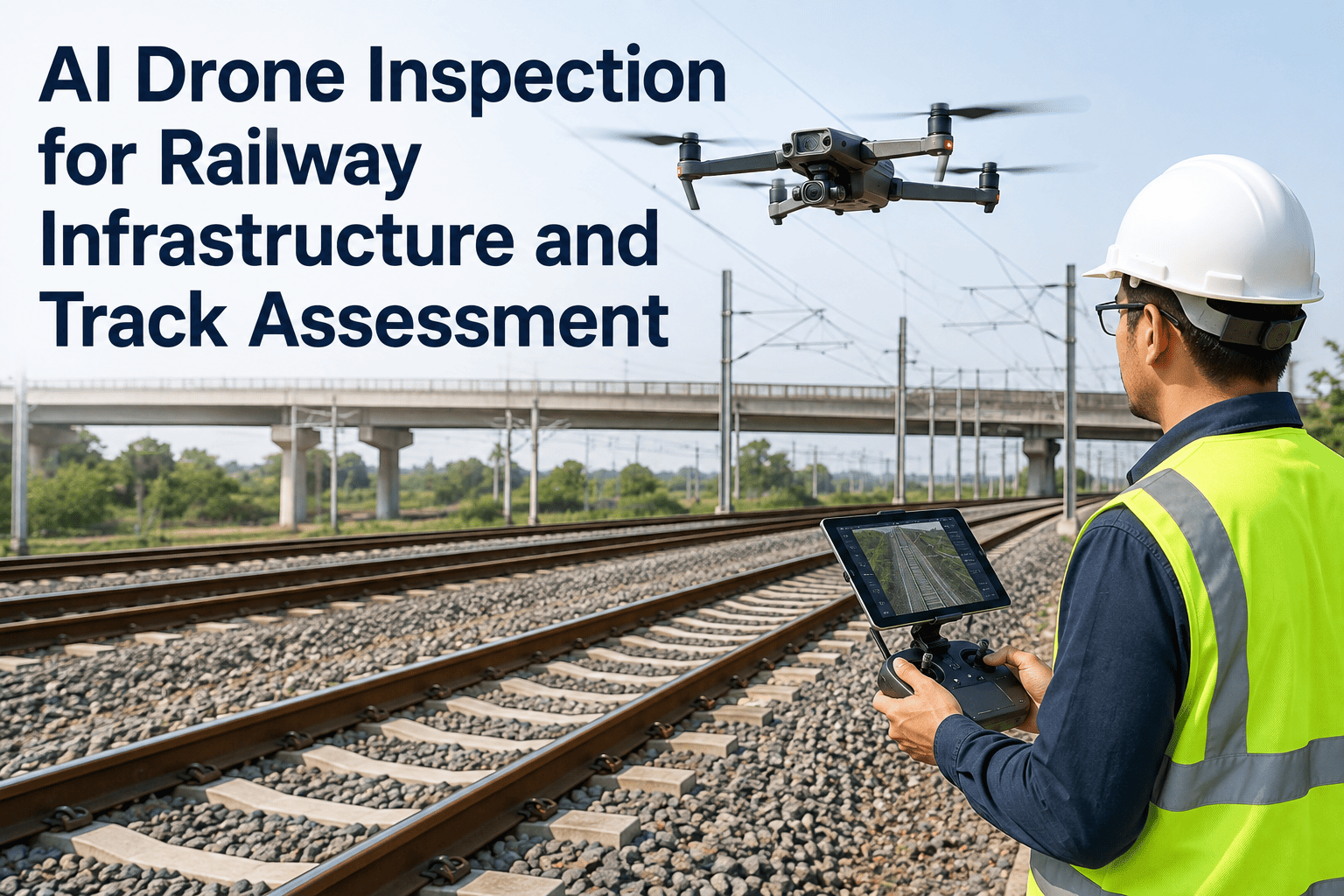
A track walker covers roughly five miles in a shift, on foot, in weather that ranges from July heat to January ice, scanning ballast and rail for the kind of hairline defect that precedes a derailment. A bridge inspection under FRA rules happens on a fixed calendar, not because the bridge asked for it that week, but because the calendar said so — regardless of the flood that hit it last month or the freight tonnage that crossed it yesterday. This is the inspection model most rail networks still run on, and it was never built for a network that stretches thousands of route-miles through terrain no ground crew can safely reach every week. AI-equipped drones change the coverage math entirely — hundreds of kilometers of track, catenary, and bridge structure surveyed per day, with consistent image quality a fatigued inspector two hours into a shift cannot match. iFactory's rail inspection engineering team maps drone flight corridors, sensor payloads, and defect classification models to your specific network.
Drone Inspection · Railway Infrastructure
AI Drone Inspection for Railway Infrastructure and Track Assessment
AI-equipped drones inspect rail bridges, signal structures, overhead catenary systems, and track bed condition across the full corridor. Hundreds of kilometers covered per day, consistent image quality on every pass, and defect classification that flags what a ground crew would miss until it became an outage or a service disruption.
50mi
Track surveyed per shift vs. 5mi on foot
30min
Bridge inspection vs. 3 days manual
±0.1mm
Contact wire wear measurement accuracy
24/7
Corridor monitoring capability
The Coverage Gap
Calendar-Based Inspection Cannot Keep Pace With a Modern Rail Network
Traditional rail infrastructure inspection runs on fixed schedules — a bridge gets walked every so many months regardless of the flood, freight surge, or freeze-thaw cycle it experienced since the last visit. Track walking covers a handful of miles per worker per shift, which means a network spanning thousands of route-miles gets each segment's eyes-on attention only a few times a year. The gap between inspection cycles is exactly where undetected defects build — micro-cracks that widen under repeated load, corrosion that spreads through a connection, ballast that shifts after heavy rain — until a scheduled inspection happens to catch it, or a train doesn't.
The economics of manual inspection compound the coverage problem. Rope-access bridge inspection, tunnel crawls, and catenary climbing all require possessions — track closures that interrupt service and cost the network revenue for every hour crews are on site. A bridge that takes three days to inspect manually is three days of reduced capacity or full closure on that corridor. Multiply that across a network with hundreds of bridges, and manual inspection alone becomes the constraint on how often any single structure actually gets assessed.
AI drone inspection doesn't replace manual inspection entirely — regulatory frameworks still require certain assessments to be performed or verified by a qualified inspector. What it does is compress the interval between meaningful looks at every asset from months to days, and it does so without closing the line. A drone flies above or alongside active track without requiring a possession, capturing consistent, quantitative imagery that a human eye — tired, distracted, or simply not looking at the right angle — would miss.
Asset Coverage
What AI Drones Actually Inspect Across the Rail Corridor
A rail corridor is not one asset, it's a system of structurally distinct components, each with its own failure modes and its own sensor requirements. The asset categories below cover the standard scope of a rail drone inspection program, from the rail itself to the overhead systems that power the trains running on it.
A1
Bridges and Viaducts
High-resolution and thermal cameras capture girder condition, bearing wear, deck cracking, and pier erosion. Stereo digital image correlation makes noncontact measurements of deformation and stress, replacing rope-access inspection that takes days with a flight that takes thirty minutes.
A2
Overhead Catenary Systems
Drones inspect catenary wire sag, mast corrosion, registration arm geometry, and cable tray condition across the entire corridor. Contact wire wear measurement reaches sub-millimeter accuracy without requiring the line to be de-energized or a possession taken.
A3
Track Bed and Ballast
Multispectral and high-resolution imagery track ballast displacement, rail surface defects, fastener condition, and gauge irregularities along the full length of the corridor. Change detection between survey flights flags emerging track geometry issues before they trigger a speed restriction.
A4
Signal Structures and Cable Trays
Signal head alignment, mast condition, and cable tray integrity are verified visually against engineering baseline. Misaligned or obstructed signal heads are a direct safety risk that drone imagery catches on the same pass as the catenary and track survey.
A5
Embankments and Drainage
Multispectral cameras monitor embankment stability, slope erosion, drainage channel blockage, and vegetation encroachment. These geotechnical risks develop slowly and are exactly the class of defect that infrequent manual inspection is most likely to miss until it threatens track integrity.
A6
Tunnels and Confined Structures
Tunnel-specific drones use simultaneous localisation and mapping to navigate the bore without GPS, capturing sub-millimeter crack imagery on the lining and identifying water infiltration zones in a single deployment instead of a multi-week rope-access survey.
See Corridor-Scale Drone Inspection Live
Watch AI Classify a Bridge Defect From Drone Footage in Real Time
iFactory's rail inspection team walks you through a live demo — flight planning across your corridor, sensor payload selection, and AI defect classification running against real bridge and catenary footage. Bring your network map and we'll scope the flight coverage and regulatory path together.
The Sensor Payload
Why One Camera Is Never Enough for Rail Infrastructure
Different rail defects reveal themselves to different sensors. A hairline crack in a bridge girder is a visible-light problem. A resistance failure building in a catenary connection is a thermal problem, invisible until it fails. A structural deformation under load is a stereo-imaging problem that a single flat photograph cannot capture. Mature drone inspection programs fly with a multi-sensor payload precisely because no single sensor sees the whole picture.
01
High-Resolution Visual Cameras
The baseline sensor for crack detection, corrosion, spalling, and general structural condition. AI-powered defect classification runs against this imagery to flag anomalies at a resolution fine enough to catch surface-level defects that a human eye would need to be inches away to see.
02
Thermal Imaging
Detects hot spots in electrical connections along the catenary system that indicate a resistance failure building before it causes an outage. Thermal signatures also reveal moisture intrusion in bridge decks and tunnel linings that visible light alone cannot show.
03
LiDAR
Generates precise 3D point clouds of track geometry, clearance envelopes, and structural profiles. LiDAR is what makes contact wire wear measurement and structural deformation tracking possible at the sub-millimeter accuracy that engineering assessment requires.
04
Stereo Digital Image Correlation
A stereo camera pair makes noncontact measurements of deformation and stress on bridge structures under live load — a capability validated in FRA-supported research on railroad bridge inspection, replacing instrumentation that would otherwise require physical sensor placement.
05
Multispectral Imaging
Captures vegetation health, moisture content, and material composition data beyond what visible light shows. Used for embankment stability, drainage assessment, and vegetation encroachment monitoring across the corridor right-of-way.
Defect Detection Reference
What the AI Actually Flags on Each Asset Type
The value of drone inspection isn't the imagery alone — it's the AI classification layer that turns thousands of images per flight into a prioritized defect list an engineer can act on. The reference below maps common rail defect types to the sensor that detects them and the severity response they typically trigger.
| Defect Type |
Asset Class |
Primary Sensor |
Typical Response |
| Girder or Deck Cracking |
Bridges |
Visual + stereo DIC |
Engineering review, load restriction if severe |
| Catenary Connection Hot Spot |
Overhead systems |
Thermal imaging |
Scheduled maintenance before failure |
| Contact Wire Wear |
Overhead systems |
LiDAR |
Wire replacement scheduling by wear curve |
| Ballast Displacement |
Track bed |
Visual + multispectral |
Track maintenance work order |
| Rail Surface Defect |
Track bed |
High-resolution visual |
Speed restriction pending inspection |
| Slope Erosion / Drainage Blockage |
Embankments |
Multispectral |
Geotechnical assessment scheduling |
| Tunnel Lining Crack |
Tunnels |
Visual + LiDAR (SLAM) |
Structural engineering review |
| Signal Head Misalignment |
Signal structures |
High-resolution visual |
Immediate maintenance dispatch |
Every flight generates a georeferenced defect log that feeds directly into the maintenance workflow, not a folder of unreviewed photographs. That's the difference between a drone survey that produces data and one that produces action.
Coverage Economics
Why BVLOS Flight Is the Real Unlock for Rail Networks
A standard visual-line-of-sight drone flight requires an operator to keep the aircraft in sight, which limits coverage to whatever stretch of track the operator can see and walk alongside — not much different in practice from the ground inspection it's replacing. Beyond visual line of sight operation removes that constraint entirely, and it's what turns drone inspection from a spot-check tool into a corridor-scale monitoring capability.
Visual Line of Sight
Operator maintains direct visual contact with the aircraft throughout flight. Coverage is limited to the operator's sightline and walking pace along the corridor — practical for spot inspections and targeted bridge surveys, but not for continuous network-wide monitoring.
Extended Visual Line of Sight
Visual observers positioned along the route extend the operator's effective range beyond direct sightline. Useful for longer bridge structures and tunnel portals, but still requires personnel stationed at intervals along the flight path.
Beyond Visual Line of Sight
The drone operates remotely without requiring visual contact, covering dozens of miles of continuous corridor in a single mission. This is the operational mode that makes daily or near-daily full-network monitoring economically realistic, and the mode rail authorities worldwide are actively building regulatory pathways to expand.
Research modeling BVLOS drone coverage of a major commuter rail network found that a fleet of drones with autonomous recharging bases could achieve complete daily monitoring of the entire track network — a level of inspection frequency that would be economically prohibitive using conventional ground-based methods. Regulatory frameworks are actively evolving to support this: rail authorities in the UK, EU, and US are running structured BVLOS trials specifically for linear infrastructure inspection, with railways among the leading use cases because the corridor itself provides a natural, low-conflict flight path.
Turnkey Deployment
Live Corridor Monitoring in 6–12 Weeks
iFactory ships rail drone inspection as a turnkey program — pre-configured AI analysis server, drone fleet and payload selection matched to your corridor, software pre-loaded with rail-specific defect classification models. Rack the analysis server, plug in power and network connectivity, and AI defect classification is live against your first survey flights.
Weeks 1–4
Corridor Mapping and Regulatory Scoping
Network segmented by asset criticality and inspection priority. Flight corridors mapped against airspace restrictions and current VLOS, EVLOS, or BVLOS regulatory status for your jurisdiction. AI analysis server shipped racked and ready, sensor payload matched to asset mix.
Weeks 5–8
Baseline Survey and Model Training
Initial full-corridor survey flights capture baseline imagery across bridges, catenary, track bed, and structures. AI defect classification models trained and validated against known asset conditions, with results compared to existing manual inspection records.
Weeks 9–12
Go-Live and Recurring Flight Schedule
Recurring flight schedule established per asset class and criticality tier. Defect logs feed directly into the maintenance work order system. Engineering and operations teams trained on the dashboard, and 24×7 remote monitoring support begins.
1000+Clients on iFactory platform
99.9%Platform uptime SLA
24×7Remote AI monitoring
6–12wkLive deployment timeline
Field Perspective
"
The thing that convinced our board wasn't the defect detection accuracy, though that mattered. It was the coverage frequency. We used to see each bridge on our network maybe three or four times a year, and everything between those visits was a blind spot we hoped nothing happened in. With drone survey flights running on a weekly corridor schedule, we're now looking at every major structure fifty-plus times a year instead of four. The AI classification means our engineers aren't wading through raw footage — they get a prioritized defect list with severity scoring, and they spend their time on the assets that actually need attention instead of scanning imagery that turns out clean. Six months in, we caught a catenary connection hot spot that thermal imaging flagged two flights before it would have caused an outage. That single catch paid for a chunk of the program.
Marcus Delarosa-Whitfield
Director of Infrastructure Asset Management · 18 years in rail engineering, bridge management, and condition-based maintenance programs
Common Questions
Frequently Asked Questions
Does drone inspection replace manual inspection entirely, or work alongside it?
Drone inspection augments manual inspection rather than fully replacing it. Regulatory frameworks in most jurisdictions still require certain structural assessments to be performed or certified by a qualified inspector, and drones don't change that requirement. What changes is the interval and the data quality between those certified inspections — instead of a bridge going months between any kind of assessment, drone flights provide frequent, quantitative monitoring that catches developing issues early and gives inspectors better information when they do conduct the required manual review.
Talk to rail inspection engineering about how this fits your specific regulatory framework.
Can drones fly along active track without disrupting train operations?
Yes, this is one of the core operational advantages over manual inspection. Drones can fly above or alongside the track corridor without requiring a possession or line closure, and inspection can proceed while trains remain in service on the line being surveyed. Flight planning accounts for clearance envelopes, overhead catenary energization, and applicable airspace coordination, but the fundamental advantage — no service disruption for routine inspection — is what makes frequent monitoring economically viable at network scale, unlike rope-access or track-walking methods that typically require some form of possession or safety exclusion zone.
What's the difference between VLOS and BVLOS operation, and which do we need?
Visual line of sight requires the drone operator to maintain direct visual contact with the aircraft, which limits coverage to roughly the operator's sightline and walking range — workable for targeted bridge or structure inspections. Beyond visual line of sight removes that constraint, allowing a single mission to cover dozens of miles of continuous corridor, which is what makes daily or weekly full-network monitoring realistic. Most rail networks start with VLOS or extended VLOS operations on critical structures while pursuing the regulatory approvals needed for BVLOS corridor-scale monitoring, since BVLOS approval processes vary significantly by jurisdiction and airspace class.
Book a demo to discuss the regulatory pathway for your network.
How does the AI avoid flooding engineers with false positives across a full network survey?
Defect classification models are trained on labeled examples specific to rail infrastructure — not generic anomaly detection — and each flagged defect carries a confidence score and severity classification rather than a simple binary alert. Low-confidence detections route to a review queue instead of triggering an immediate work order, and the system tracks defect progression across repeated flights, so a hairline crack that isn't growing gets a different priority than one that's widening between surveys. Engineers see a prioritized list ranked by severity and trend, not an undifferentiated flood of every anomaly the model noticed, which is what makes the frequent flight schedule practical to actually act on.
How does defect data get into our existing maintenance and asset management systems?
Every flight generates a georeferenced defect log with asset ID, defect classification, severity score, and image reference that integrates with standard maintenance management and GIS platforms through API connections. Defects above a configured severity threshold can automatically generate a maintenance work order rather than sitting in a report someone has to manually transcribe. The integration scope is defined during the deployment phase as part of the turnkey engagement, matched to whatever asset management or CMMS platform your team already uses, so the drone program becomes a data source feeding your existing workflow rather than a parallel system to manage separately.
Cover the Whole Network, Not Just the Scheduled Miles
Turnkey AI Drone Inspection, Live in 6–12 Weeks
iFactory's rail drone inspection platform ships as a pre-configured turnkey bundle — AI analysis hardware racked and ready, defect classification models pre-loaded, flight corridor and sensor payload scoped to your network, and 24×7 remote monitoring included. Get a turnkey AI quote with the twelve-week delivery timeline, or start with a focused pilot on your highest-priority corridor to prove the coverage before scaling network-wide.