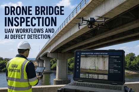
Drone Bridge Inspection UAV Workflows and AI Defect Detection

By Grace on June 18, 2026

drone-bridge-inspection-uav-defect-detection-ai

Every bridge inventory manager knows the math. A 200-metre multi-girder bridge takes a four-person crew with an under-bridge snooper two full days to inspect — if traffic can be diverted, if the weather holds, and if the hydraulic arm can reach every bearing and diaphragm from the shoulder. The same bridge flown by a qualified drone operator with a Part 107-certified pilot, a high-resolution RGB sensor, and an RTK-correction stream can be fully documented in under 90 minutes with zero lane closures and zero personnel working over traffic. The gap between those two inspection timelines is not just a scheduling difference. It is the difference between inspecting 12 bridges per season and 60 — and between catching a corrosion pattern at the coating stage versus finding it when section loss is already reportable.

FAA Part 107 · BVLOS Part 108 · AI Crack Detection · RTK Photogrammetry
Drone Bridge Inspection UAV Workflows and AI Defect Detection
iFactory integrates qualified inspector review, AI-powered crack detection, and FAA-compliant drone workflows into a single inspection platform — cutting bridge inspection field time by up to 60% while improving defect documentation accuracy.
60%
Reduction in bridge inspection field time when drones replace snooper-based visual inspection for routine NBIS element-level documentation
100%
Of bridge superstructure surfaces — including bearing seats, diaphragm connections, and underside girder webs — reachable by a skilled drone pilot without traffic control or lane closures
99%
Mean average precision achieved by YOLOv8-based AI crack detection models on concrete bridge deck imagery — matching human inspector sensitivity in controlled conditions
90%+
Of routine NBIS fracture-critical and fatigue-prone member inspections achievable with drone-deployed visual and thermographic sensors, per DOT pilot programmes

Why Bridge Inspection Is Broken — and How Drones Fix the Workflow

The United States inventory includes over 617,000 bridges, and approximately 36% of them are older than 50 years. Federal regulations require element-level inspection every 24 months, with fracture-critical and fatigue-prone members requiring hands-on inspection at intervals as short as 12 months. The traditional inspection workflow — mobilise a crew with an under-bridge snooper truck, close one or two lanes, set up traffic control, and work through the structure span by span — delivers the required data but at a cost structure that is becoming unsustainable as inspection backlogs grow and experienced bridge inspectors retire at rates the pipeline cannot replace.

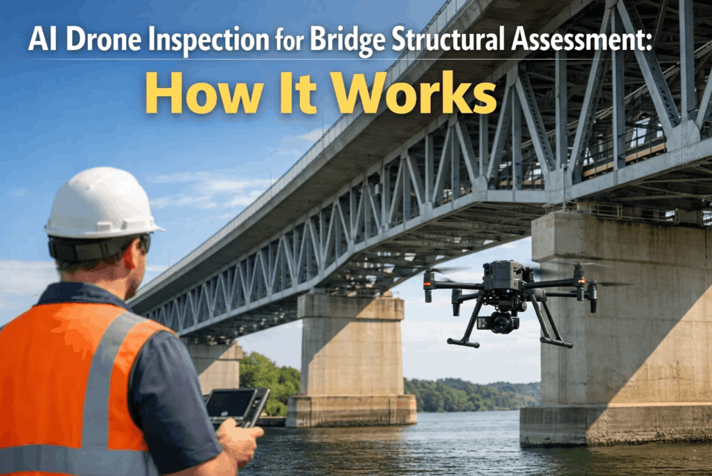
Drone bridge inspection replaces the snooper truck's hydraulic arm with a multi-rotor UAV carrying a stabilised camera payload, an RTK GNSS receiver for centimetre-level positioning, and — where required — a thermal or LiDAR sensor. The drone operator, working from a safe position on the shoulder or approach, flies pre-programmed inspection grids that cover every structural element: deck surface, girder webs and flanges, diaphragm connections, bearing assemblies, and substructure units. The pilot maintains visual line of sight under Part 107 or operates under a BVLOS waiver (or the emerging Part 108 framework) for longer-span or elevated structures. Every image and video frame is geotagged with RTK-accurate coordinates, creating a spatially precise digital record that the qualified inspector reviews remotely rather than from a bucket 20 metres above traffic.

Inspection Method Comparison

Snooper Truck
Rope Access
Drone + AI
Field time per span
45-90 min
60-120 min
8-15 min
Traffic control
Required (1-2 lanes)
May require shoulder closure
None
Crew size
3-5
2-4
1-2
Underside access
Limited by arm reach
Full with rigging
Full
Defect geolocation
Approximate (manual sketch)
RTK: +/- 2.5 cm

The Four Drone Inspection Modalities Every Bridge Programme Needs

No single sensor captures every defect type on a bridge. Cracks in the concrete deck, corrosion at steel girder ends, delamination in the wearing surface, and scour around the pier foundation each require a different combination of resolution, spectral sensitivity, and spatial accuracy. The most effective drone bridge inspection programmes deploy a layered sensor strategy — matching the sensor to the defect mode and the inspection interval.


Sensor Layer 1
High-Resolution RGB
A 20 MP or higher stabilised camera with a mechanical shutter captures visible-light images at sub-millimetre ground sampling distance from 10-15 metres. Used for crack mapping, spall documentation, coating condition assessment, and element-level NBIS condition rating. The baseline sensor for every bridge inspection — no thermal or LiDAR payload required.
Crack detection
Coating assessment
NBIS element rating

Sensor Layer 2
Infrared Thermography
A radiometric thermal camera (typically 640x512 or higher) detects subsurface delamination, moisture intrusion, and debonding in concrete bridge decks by measuring surface temperature differentials during diurnal heating and cooling cycles. Effective on asphalt-overlaid decks where visual cracks are hidden and on post-tensioned concrete where tendon duct voids create thermal signatures.
Deck delamination
Moisture mapping
PT tendon voids

Sensor Layer 3
LiDAR
A UAV-mounted LiDAR scanner produces a dense 3D point cloud of the bridge structure with accuracy typically within 2-5 cm without ground control and sub-centimetre with RTK integration. Used for clearance verification, deflection profiling under load, as-built verification against design drawings, and volumetric change detection at scour-critical piers and abutments over successive inspection cycles.
Clearance verification
Deflection profiling
Scour monitoring

Sensor Layer 4
RTK Photogrammetry
Structured photogrammetric capture using RTK-corrected position data produces orthorectified 2D maps and textured 3D mesh models with absolute accuracy of 2-3 cm without ground control points. Enables precise defect measurement — crack width, spall area, section loss — directly from the 3D model, and provides the spatial context for AI defect detection to output geolocated damage maps.
3D mesh modelling
Defect measurement
Change detection

FAA Regulatory Framework: Part 107 Today, Part 108 Tomorrow

Every commercial bridge inspection drone flight in the United States operates under FAA Part 107 — the regulatory framework that governs small unmanned aircraft systems under 25 kg for non-recreational use. Part 107 requires the pilot to hold a Remote Pilot Certificate obtained by passing an aeronautical knowledge test, to maintain visual line of sight with the aircraft at all times, to fly at or below 400 feet above ground level, and to comply with airspace authorisation requirements in controlled areas via the LAANC system. Remote ID has been mandatory since March 2024 for all drones requiring FAA registration, covering the vast majority of inspection platforms.

For bridge inspection applications that require the drone to operate beyond the pilot's unaided visual range — such as long-span cable-stayed bridges, crossings over wide river channels, or viaducts extending more than a few hundred metres — a BVLOS waiver under Part 107 has historically been required, involving a lengthy application and case-by-case approval. The FAA's proposed Part 108 rule, published as a Notice of Proposed Rulemaking in August 2025 and expected to be finalised in 2026, creates a standardised approval pathway for routine BVLOS operations. When Part 108 takes effect, bridge inspection programmes will be able to plan BVLOS missions under a predictable regulatory framework rather than the current waiver-by-waiver model, enabling corridor-scale inspections of multiple structures in a single flight operation.

Current Standard
Part 107
Remote Pilot Certificate required
Visual line of sight mandatory
400 ft AGL ceiling
LAANC for controlled airspace
Remote ID (mandatory March 2024)
BVLOS via individual waiver only
Active for all commercial ops
Emerging Framework
Part 108 (2026)
Standardised BVLOS approval pathway
Corridor-scale inspection authorisation
Drones up to 110 lbs permitted
DAA and communications requirements
Recurrent training and record-keeping
Replaces the individual waiver process
NPRM Aug 2025 — Final rule expected 2026

AI Defect Detection: How Computer Vision Finds Cracks the Human Eye Misses

The drone captures the images. But the inspection value is created when those images are processed into actionable defect data. AI-powered computer vision models — trained on tens of thousands of labelled bridge defect images — detect, classify, and measure cracks, spalls, corrosion, and exposed reinforcement across the full bridge surface in a fraction of the time required for manual photo review.

The AI Defect Detection Pipeline — from Image to Condition Report
Capture
Geotagged RGB, thermal, and LiDAR frames from structured flight grid at 10-15m stand-off
Detect
YOLOv8 CNN model classifies each frame: crack, spall, corrosion, exposed rebar, coating failure. 99% mAP at 7ms per frame.
Measure
RTK-accurate pixel-to-world scaling: crack width (+/- 0.3 mm), spall area, section loss percentage per element
Classify
Severity level assigned per element per defect type, with confidence score and NBIS condition state mapping
Report
Geolocated defect map, element-level condition ratings, and repair priority list delivered to the qualified inspector for review

The model used most frequently for bridge deck crack detection is YOLOv8 — a single-shot object detection architecture that processes each inspection image in approximately 7 milliseconds on a GPU, achieving a mean average precision of 99.1% at the standard 640-pixel input resolution. When deployed on the inspection data stream, this means the AI processes the 3,000-5,000 images from a typical bridge inspection flight in less than 30 seconds, outputting a geolocated defect map overlaid on the bridge orthophoto with each crack and spall tagged by type, severity, and RTK coordinate. The qualified inspector — the NBIS-certified engineer who ultimately signs off on the condition ratings — reviews the AI detection output, validates or corrects the findings, and publishes the element-level condition assessment. The AI does not replace the inspector. It replaces the hours of manual image review that currently occupy the inspector's analytical time.

Confined Space and Under-Deck Inspection: Where Drones Replace the Snooper Entirely

One of the highest-value drone inspection applications is the confined-space under-deck environment — the zone between girder webs and beneath the deck overhang where snooper truck arms have limited reach and rope access rigging takes significant setup time. A small collision-tolerant drone equipped with a cage or propeller guards and an upward-facing camera can fly the full length of every girder bay, capturing the bearing seats, diaphragm connections, cross-frame members, and the underside of the deck itself at a distance of 1-2 metres. The pilot operates from the shoulder or the bridge approach, maintaining line of sight around the substructure elements while the drone navigates the girder grid using a pre-programmed waypoint path generated from the bridge as-built model.

For steel bridge superstructures, the drone's visual inspection captures coating breakdown at bolt connections, section loss at bearing stiffeners, corrosion at diaphragm-to-girder connection plates, and fatigue crack initiation at weld details — all from an observation distance that matches or exceeds the proximity achievable by an inspector in a snooper bucket. The difference is that the drone covers every girder line in a single flight without repositioning the snooper truck span by span, without closing additional lanes, and without exposing personnel to fall or traffic hazards. The cost saving is not marginal. For a typical five-girder bridge, the snooper inspection requires the truck to be repositioned for each girder line — typically 10-15 repositioning cycles per structure. The drone inspection requires one take-off and one landing.

FAA Part 107 · AI Defect Detection · RTK Photogrammetry · NBIS Workflow
Inspect More Bridges, Better Data, Zero Lane Closures. iFactory Connects the Drone to the Inspection Report.
From flight planning to AI-powered defect detection to NBIS-ready condition reports — iFactory is the inspection platform built for the bridge programmes that are moving from snooper to drone.

From Flight Deck to Maintenance Deck: The Complete Drone Inspection Workflow

A drone bridge inspection programme is only as effective as the workflow that connects the flight data to the maintenance action. The iFactory platform structures the end-to-end process across five stages that map directly to the NBIS inspection cycle and the bridge management system workflow.

Stage 1
Flight Planning

Mission designed from bridge as-built or LiDAR model. Waypoints, overlap, sensor settings, and airspace authorisation configured before mobilisation. LAANC approval obtained through automated filing for controlled airspace. RTK base station or NTRIP correction stream verified.

Duration
15-20 min
Stage 2
Field Capture

Automated flight execution with real-time telemetry monitoring. Pilot maintains VLOS or BVLOS watch. Images, thermal frames, and LiDAR data captured with RTK geotags. On-board quality check ensures coverage completeness before landing.

Duration
60-90 min
Stage 3
AI Processing

Images ingested by YOLOv8-based defect detection model. Cracks, spalls, corrosion, and exposed rebar classified at 7ms per frame. Thermal anomalies correlated with visual defects. Defect map georeferenced to bridge coordinates.

Duration
5-10 min
Stage 4
Inspector Review

Qualified NBIS inspector validates AI detection output, assigns element-level condition ratings, adds notes on non-visual findings. Defect map accepted or corrected. Report generated in NBIS-compliant format.

Duration
30-60 min
Stage 5
Maintenance Action

Defects with priority ratings generate work orders in the connected maintenance management system. Repair progress tracked against inspection findings. Next inspection interval updated in the bridge file.

Duration
Ongoing

Conclusion

The bridge inspection industry is at a regulatory and technological inflection point. The FAA is moving towards routine BVLOS authorisation through Part 108. AI defect detection models have reached production-grade accuracy levels. Sensor payloads — RGB, thermal, LiDAR — are smaller, lighter, and more capable than ever. And the pressure on bridge programmes to inspect more structures with smaller budgets and fewer qualified inspectors is not easing. The combination of these forces means that the question for bridge inventory managers is no longer whether drone inspection will become the standard method for routine element-level bridge inspection. It is how quickly their programme can transition from the snooper-based workflow to the drone-based one.

The transition does not require replacing the qualified inspector with a drone pilot. It requires replacing the manual field inspection process with a data-driven workflow that captures higher-quality imagery, processes it with AI at speeds that make same-day reporting possible, and presents the results in the format the inspector needs to assign accurate condition ratings. iFactory's platform is built for that transition — integrating FAA-compliant drone flight planning, multi-sensor data capture, AI defect detection, and NBIS-ready reporting into a single workflow that connects the flight deck to the bridge file. Book a Demo to see the platform configured for your bridge inventory, or talk to an expert about building your drone inspection programme on iFactory.
Frequently Asked Questions

Not entirely — and current FAA and FHWA guidance does not propose full replacement of hands-on inspection for fracture-critical members (FCMs). Drones cannot perform tactile techniques such as sounding, chain drag, or magnetic particle testing that are required to detect certain defect types, particularly subsurface cracking in steel members and delamination in concrete that has not yet propagated to the surface. However, a growing number of state DOT programmes use drones to perform the visual component of the FCM inspection — documenting surface condition, coating condition, and visible cracking — and reserve hands-on methods for the specific locations where tactile testing is required. This hybrid approach reduces snooper truck time on fracture-critical bridges by 50-70% while maintaining full regulatory compliance. The qualified inspector reviews the drone imagery and determines which locations require follow-up hands-on inspection. Talk to an expert about integrating drone workflows into your FCM inspection programme.

The minimum viable inspection platform for element-level bridge inspection is a sub-25 kg multirotor UAV with a stabilised 20 MP or higher RGB camera with a mechanical shutter, RTK GNSS receiver for real-time centimetre-level positioning, and obstacle avoidance sensors for operation in confined girder-bay environments. For thermal inspection, a radiometric 640x512 thermal camera core is the standard, with temperature measurement accuracy of +/- 2 degrees C or better. For LiDAR capture, a UAV-grade solid-state or hybrid LiDAR sensor with a range of at least 50 m and return density sufficient for 2-5 cm point cloud accuracy is recommended. The iFactory platform supports all major UAV platforms — DJI Matrice series, Autel EVO, Skydio, and custom-built inspection drones — and integrates sensor-agnostic through standard data formats. Book a Demo to review the hardware compatibility list for your existing drone inventory.

Environmental conditions are the primary operational constraint on drone bridge inspection. For RGB visual inspection, overcast diffuse lighting is actually optimal — it eliminates harsh shadows and specular reflections on steel and concrete surfaces that can obscure fine cracks. Direct sunlight at low angles is the most challenging condition, particularly for deck surface inspection where shadow contrast can mimic crack patterns in the AI detection model. For thermal inspection, the ideal window is 60-90 minutes after sunrise or before sunset, when the ambient temperature differential produces the strongest thermal contrast between sound and delaminated concrete. Rain, fog, and sustained wind above 25 km/h prohibit flight operations under Part 107 rules. The iFactory mission planning module includes weather window assessment tools that compare forecast conditions against the sensor and defect requirements for each bridge, recommending the optimal capture schedule. Talk to an expert about operational planning for your climate and bridge types.

The iFactory platform outputs inspection data in formats that connect directly to standard bridge management systems and CMMS platforms. Element-level condition ratings are exported as structured data compatible with Pontis, BrM, and agency-specific BMS formats. Defect maps are delivered as georeferenced GeoJSON and shapefile layers that overlay on the agency's GIS bridge inventory. Individual defect records include RTK coordinates, severity classification, measurement data, and source imagery — enabling maintenance teams to navigate directly to each defect location in the field. The platform also supports automated work order generation through REST API integration with maintenance management systems, so priority defects from the inspection report can flow directly into the repair queue without manual data entry. Book a Demo to see the data integration workflow for your bridge management system.

The cost advantage of drone bridge inspection compounds with scale. A single snooper truck inspection of a typical multi-girder bridge costs between $8,000 and $15,000 depending on traffic control requirements, crew size, and mobilisation distance — and covers one structure per day. A drone inspection of the same bridge, including the qualified inspector's remote review of the AI-processed data, typically costs $3,000 to $6,000 and covers two to three structures per day. The per-bridge cost saving is approximately 50-60%, and the programme-level throughput increase — more bridges inspected per season — amplifies the savings further. For an agency with 200 bridges on a 24-month inspection cycle, transitioning to drone-based inspection for the eligible structures (typically 70-80% of the inventory, excluding bridges requiring specialised tactile testing for every element) can reduce the inspection programme cost by 40-50% while improving data completeness and consistency. Talk to an expert about a cost projection for your specific bridge inventory.

Your Bridge Inventory Deserves Better Than a Snooper Truck. iFactory Connects Drone Data to NBIS-Ready Reports.
Multi-sensor drone capture, AI defect detection with 99% accuracy, RTK-accurate geolocation, and qualified inspector workflow — all in one platform built for bridge inspection programmes transitioning from manual to data-driven.

Share This Story, Choose Your Platform!