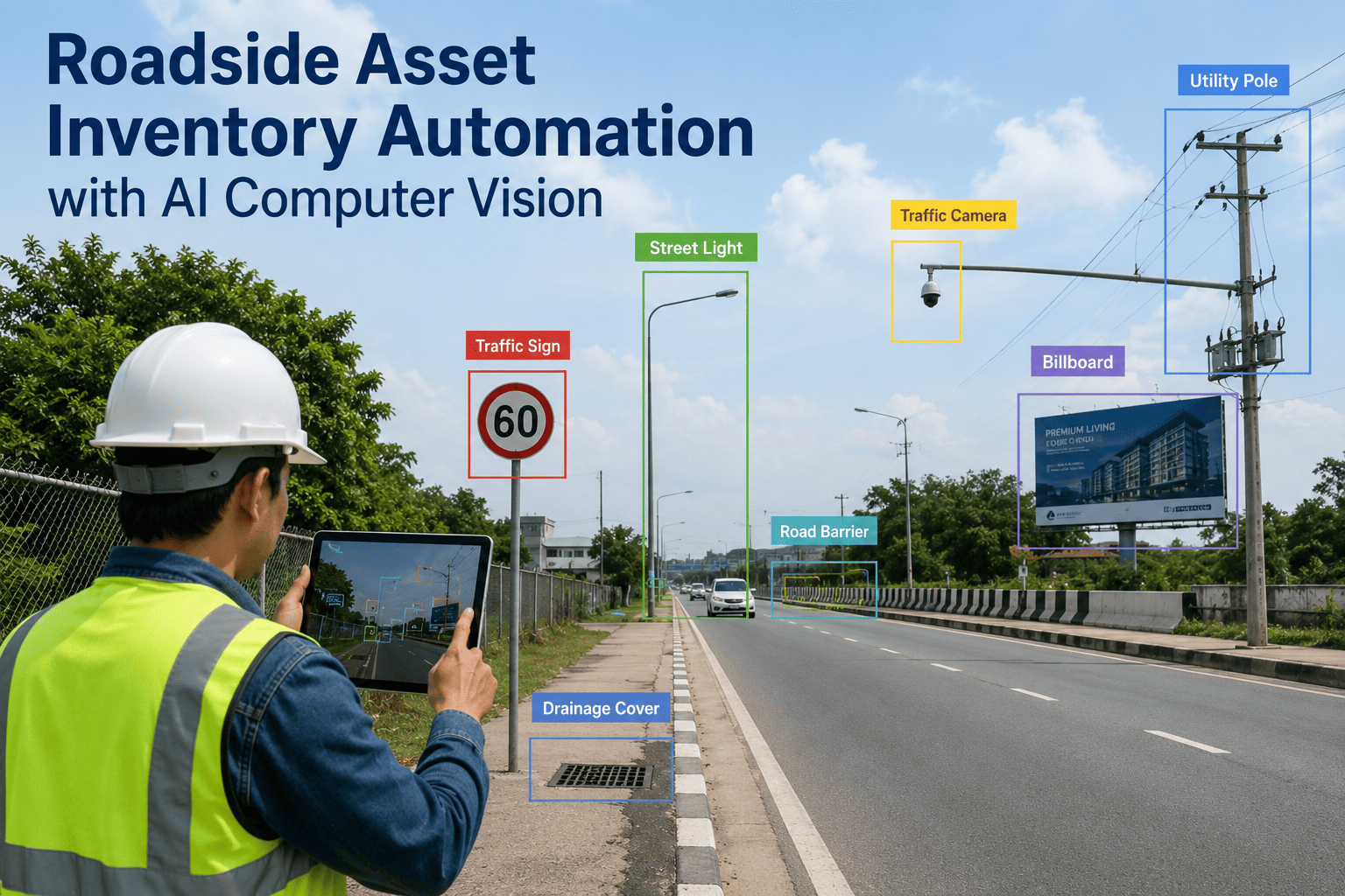
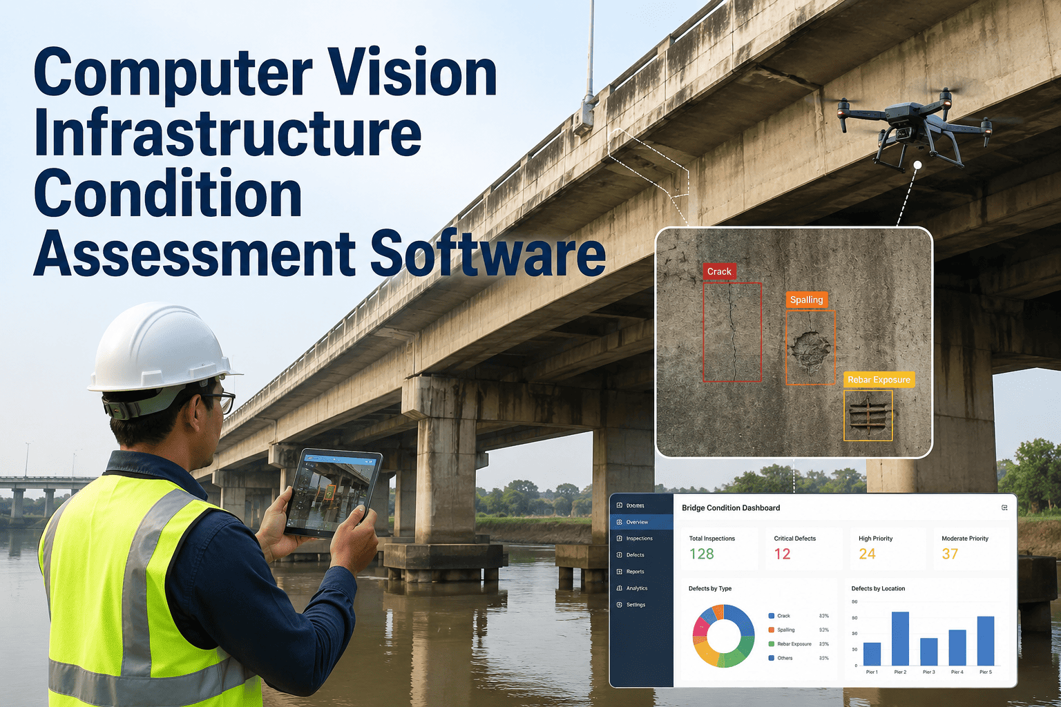
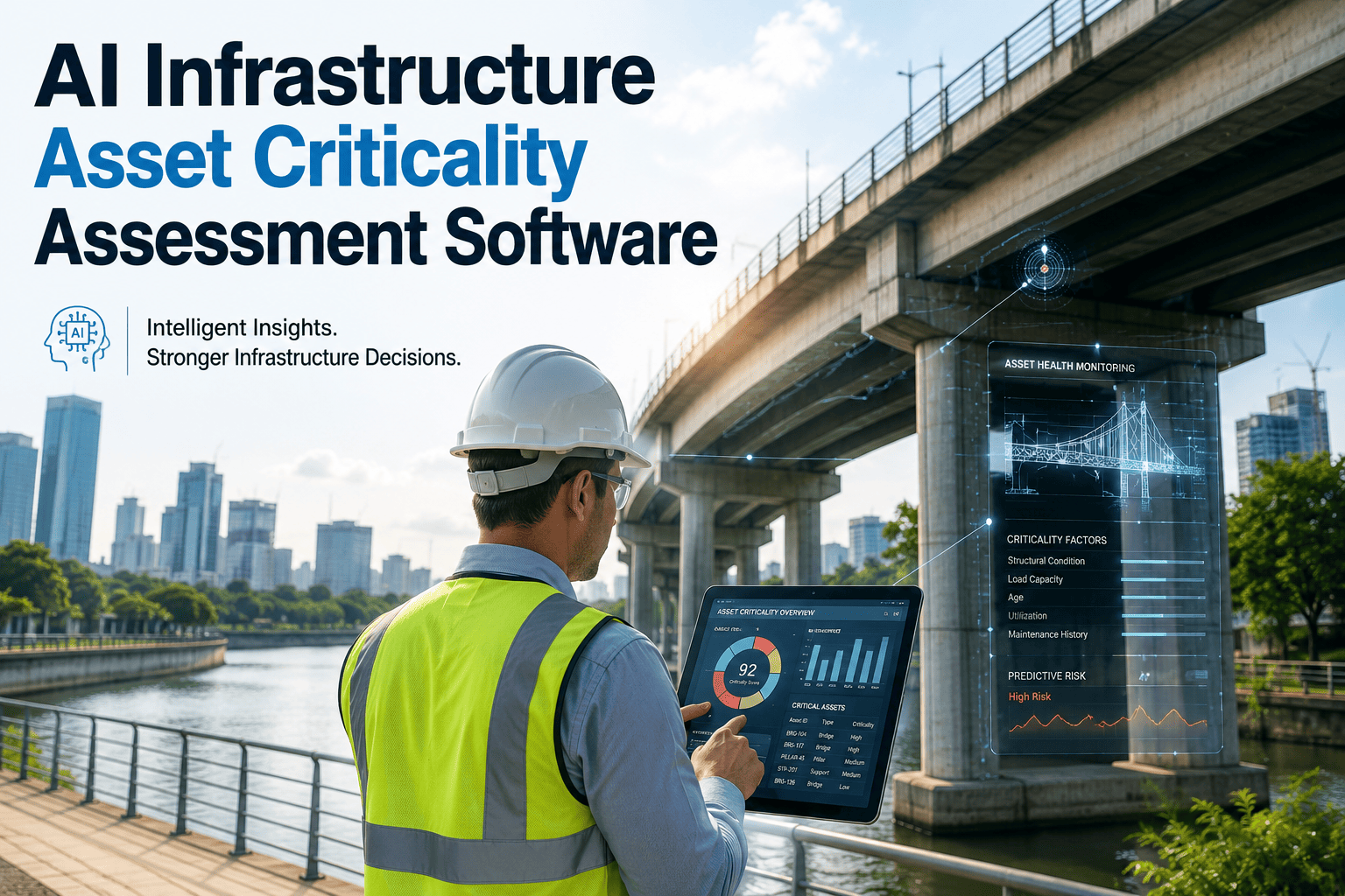
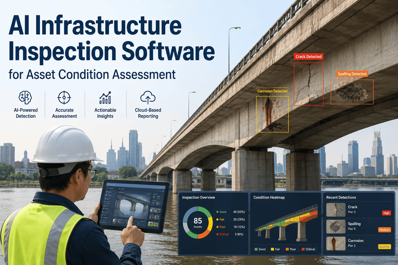
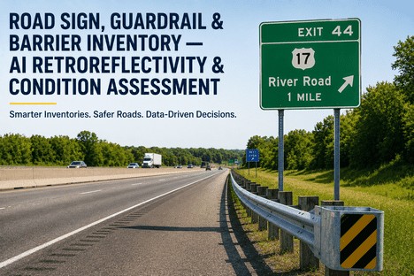
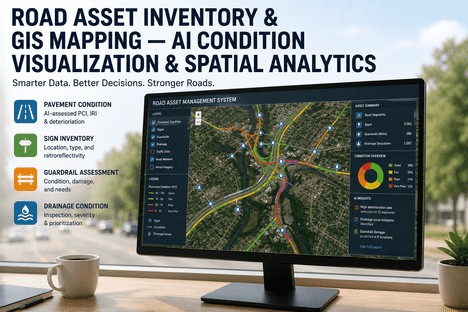
Roadside asset inventory has long been a critical but resource-intensive task for transportation departments and infrastructure managers. Traditional manual survey methods are not only slow and expensive but often result in outdated or incomplete databases by the time they're finished. With aging infrastructure and increasing maintenance demands, agencies are struggling to maintain accurate records of signs, guardrails, light poles, and other essential road furniture. AI-powered computer vision technology is revolutionizing this process by automatically identifying, classifying, and geolocating assets from simple video or image captures. This transformative approach eliminates the need for labor-intensive field work while delivering more comprehensive and current data. Explore how iFactory's cutting-edge solution can modernize your roadside asset management strategy.
ROAD INFRASTRUCTURE · AI COMPUTER VISION · ASSET MANAGEMENT
Transform Roadside Asset Inventory with AI Computer Vision
Automatically identify, classify, and map roadside infrastructure assets with unprecedented accuracy and speed using our AI-powered computer vision technology.
75%
Reduction in Inventory Time
THE CHALLENGE
The Hidden Costs of Manual Asset Inventory
Traditional roadside asset inventory methods present numerous challenges that impact both budget and operational efficiency. Manual surveys require personnel to physically inspect each asset, creating significant safety risks and consuming thousands of labor hours. The process is inherently slow, often taking months to complete comprehensive inventories, meaning data is outdated before it's even finalized. Human error further compounds these issues, with inconsistent classification standards leading to unreliable databases that undermine maintenance planning and regulatory compliance.
Time Consumption
Manual surveys of even moderate road networks typically require 3-6 months to complete, creating significant delays in maintenance planning and budget allocation.
High Labor Costs
Field crews, supervision, and data entry personnel represent 70-80% of total inventory expenses, with specialized knowledge required for proper asset classification.
Safety Risks
Personnel working alongside active roadways face significant injury risks, requiring traffic control measures that further increase costs and complexity.
Data Inconsistency
Different surveyors may classify identical assets differently, leading to fragmented databases that cannot reliably support maintenance decisions or regulatory reporting.
Incomplete Coverage
Difficult-to-access locations, adverse weather, and time constraints often result in missing assets, creating gaps in the inventory that persist until the next survey cycle.
Rapid Obsolescence
By the time a manual inventory is completed and processed, new assets have been installed and existing ones removed or modified, immediately outdated the data.
THE SOLUTION
AI Computer Vision: The Future of Asset Inventory
iFactory's AI-powered computer vision technology transforms roadside asset inventory from a labor-intensive manual process to an automated, efficient operation. Our system uses advanced machine learning algorithms trained on thousands of infrastructure asset examples to automatically detect, classify, and geolocate roadside features from video or image data collected by standard vehicle-mounted cameras. This approach delivers more accurate, comprehensive, and current asset data in a fraction of the time required by traditional methods, enabling transportation agencies to make better-informed maintenance decisions.
01
Data Collection
Standard vehicle-mounted cameras capture high-resolution video or images while driving normal routes at highway speeds.
02
AI Processing
Computer vision algorithms analyze each frame to identify potential assets, even in challenging lighting or weather conditions.
03
Classification
Detected objects are automatically categorized by type, subtype, and condition based on learned characteristics and industry standards.
04
Geolocation
GPS data is precisely correlated with identified assets to create accurate spatial references for GIS integration.
05
Database Integration
Processed asset information automatically populates GIS-enabled databases with standardized attributes and location data.
06
Reporting & Analysis
Custom dashboards and reports provide actionable insights on asset conditions, distribution, and maintenance priorities.
See AI Asset Detection in Action
Watch how our computer vision technology automatically identifies and classifies roadside assets from standard vehicle-mounted cameras with 97% accuracy.
KEY ADVANTAGES
Transformative Benefits of Automated Inventory
Organizations that implement AI-powered asset inventory experience immediate and measurable improvements across multiple operational dimensions. The technology not only reduces costs and time but also enhances data quality and safety while enabling previously impossible capabilities like continuous inventory updates and predictive maintenance planning. These benefits compound over time as the system learns and improves, delivering increasing value with each inventory cycle.
Complete comprehensive asset inventories in weeks instead of months, enabling more frequent updates and faster response to changing conditions.
Dramatically reduce labor, traffic control, and supervision expenses while eliminating costly data entry errors and rework.
Achieve consistent, standardized classification across all assets with machine precision that eliminates human variability and error.
Eliminate personnel exposure to traffic hazards by collecting data from moving vehicles without stopping or working alongside roadways.
DETECTION CAPABILITIES
Comprehensive Asset Identification
Our AI computer vision system is trained to recognize and classify a wide range of roadside infrastructure assets with high precision. The machine learning models have been developed using extensive datasets containing thousands of examples across diverse geographic regions, weather conditions, and lighting scenarios. This comprehensive training enables reliable detection even in challenging environments where traditional automated systems would fail.
Traffic Control Devices
Regulatory signs (stop, yield, speed limit)
Warning signs (curve, intersection, school)
Guide signs (directional, informational)
Traffic signals and controllers
Pavement markings and delineators
Safety Barriers
Guardrails and end treatments
Concrete barriers and median walls
Crash cushions and impact attenuators
Cable barriers and posts
Bridge rails and transition sections
Lighting & Electrical
Light poles and luminaires
High-mast lighting systems
Electrical cabinets and transformers
Underground conduit access points
Solar-powered equipment
Roadside Furniture
Mailboxes and newspaper boxes
Benches and trash receptacles
Fences and property boundaries
Utility poles and attachments
Drainage structures and inlets
IMPLEMENTATION PROCESS
From Assessment to Full Deployment
Implementing iFactory's automated asset inventory system follows a structured process designed to ensure successful integration with your existing workflows and systems. Our team works closely with your organization to understand specific requirements, customize the solution accordingly, and provide comprehensive training and support throughout the implementation journey. This approach minimizes disruption while maximizing the value delivered at each stage.
Phase 1
Needs Assessment
Identify inventory requirements, asset types of interest, existing systems for integration, and performance metrics for success.
Phase 2
System Configuration
Customize detection models for specific asset types, configure classification taxonomies, and establish data integration protocols.
Phase 3
Pilot Project
Test the system on representative road segments to validate accuracy, refine parameters, and demonstrate value to stakeholders.
Phase 4
Full Deployment
Scale to complete network coverage with optimized collection routes, processing workflows, and quality assurance procedures.
Phase 5
Training & Handoff
Enable your staff to operate the system independently with comprehensive training on collection, processing, and analysis capabilities.
Phase 6
Ongoing Support
Provide continuous improvement through model refinement, feature updates, technical support, and knowledge sharing.
COMPARISON
Manual vs. Automated Inventory Methods
Understanding the key differences between traditional manual inventory approaches and AI-powered automation helps organizations make informed decisions about modernization investments. The following comparison highlights the significant advantages of automated systems across critical operational dimensions, demonstrating why leading transportation agencies are rapidly transitioning to computer vision-based solutions.
| Factor |
Manual Inventory |
AI-Powered Automation |
| Time to Complete |
3-6 months for comprehensive network |
2-4 weeks for same coverage |
| Cost per Mile |
$150-$300 depending on asset density |
$45-$95 with consistent pricing |
| Detection Accuracy |
85-90% with human variability |
95-98% with machine consistency |
| Safety Risk |
High - personnel on active roadways |
Minimal - data from moving vehicles |
| Update Frequency |
Every 3-5 years due to cost |
Annually or as needed |
| Data Standardization |
Variable between surveyors |
Consistent classification standards |
| Scalability |
Limited by crew availability |
Easily scaled with additional vehicles |
| Weather Dependency |
Severely limited by conditions |
Functions in most weather conditions |
SUCCESS METRICS
Real-World Impact and Results
Transportation agencies and infrastructure managers who have implemented iFactory's automated asset inventory system report significant measurable improvements across operational, financial, and safety metrics. These results demonstrate the practical value of AI computer vision technology in real-world conditions, not just theoretical benefits. The following metrics represent average outcomes across our customer base, with some organizations achieving even more dramatic improvements in specific areas.
2,500
MILES
Roadway inventoried in just 3 weeks, compared to 5+ months with previous manual methods
12%
MORE ASSETS
Additional assets identified compared to previous manual inventory, revealing critical gaps
$1.2M
ANNUAL SAVINGS
Direct cost reduction from eliminated manual survey processes and improved maintenance planning
6
MONTHS
Payback period for complete system implementation, including all hardware and training
INTEGRATION CAPABILITIES
Seamless Connection to Your Existing Systems
iFactory's automated asset inventory solution is designed to integrate smoothly with your existing infrastructure management ecosystem, not replace it. Our system outputs standardized data formats compatible with leading GIS platforms, asset management systems, and maintenance planning tools. This approach ensures that the enhanced data quality and quantity from automated inventory immediately improves the value of your existing technology investments without requiring costly system replacements or workflow disruptions.
GIS Platform Integration
Direct data export to ESRI ArcGIS, QGIS, and other platforms with proper spatial references and attribute schemas.
Asset Management Systems
Automated population of asset management databases with standardized attributes for maintenance planning and lifecycle tracking.
Reporting & Visualization
Customizable dashboards and reports that highlight asset conditions, distribution patterns, and maintenance priorities.
Work Order Systems
Direct integration with maintenance management systems to automatically generate work orders based on detected conditions.
FREQUENTLY ASKED QUESTIONS
Common Questions About AI Asset Inventory
What types of roadside assets can the system detect and classify?
Our AI computer vision system is trained to detect and classify a comprehensive range of roadside infrastructure assets including traffic signs of all types, guardrails and safety barriers, light poles and lighting equipment, pavement markings, drainage structures, and various types of roadside furniture. The system can be customized to focus on specific asset categories based on your inventory priorities, and our models are continuously improved through ongoing training with new examples. For specialized asset types not currently in our standard library, we can develop custom detection models with a relatively small training dataset provided by your organization.
Schedule a demo to see detection capabilities for your specific asset types.
How accurate is the AI detection compared to manual surveys?
Our system achieves 95-98% detection accuracy for standard roadside assets, which is significantly higher than the 85-90% typical of manual surveys. More importantly, the AI system delivers consistent accuracy across the entire inventory, whereas manual surveys often show significant variability between different surveyors and over time as fatigue sets in. The system also provides confidence scores for each detection, allowing you to easily identify and review lower-confidence classifications. In head-to-head comparisons with manual surveys on the same road segments, our AI system has consistently identified 10-15% more assets while maintaining higher classification accuracy.
Contact our support team to discuss accuracy requirements for your specific application.
What equipment is needed to collect the data for processing?
The data collection requirements are intentionally minimal to leverage existing resources and reduce implementation costs. At minimum, you need a vehicle-mounted camera system capable of capturing high-resolution video or sequential images, along with a GPS receiver for precise location data. Many organizations already have suitable equipment from previous mapping or survey projects. For those that don't, we can recommend cost-effective camera systems starting at around $5,000 that meet all technical requirements. The system is designed to work with data collected at normal driving speeds, so no specialized vehicles or traffic control are needed during collection.
Book a demo to discuss equipment options that fit your budget.
How does the system integrate with existing GIS databases?
Our system outputs asset data in industry-standard formats that integrate directly with leading GIS platforms including ESRI ArcGIS, QGIS, and MapInfo. The output includes properly georeferenced point features with complete attribute tables matching your existing data schema requirements. We work with your GIS team during implementation to ensure the output format precisely matches your database structure, eliminating the need for manual data transformation or cleaning. For organizations with custom GIS implementations, we can develop specialized export routines to accommodate unique requirements. The integration process typically takes 1-2 weeks during the implementation phase, after which new inventory data flows directly into your existing systems without manual intervention.
Contact our support team to discuss integration with your specific GIS environment.
What is the typical return on investment for this technology?
Most organizations achieve full return on investment within 6-12 months of implementation, depending on the size of their roadway network and current inventory practices. The ROI calculation includes direct cost savings from eliminated manual survey processes (typically 60-70% reduction in inventory costs) plus indirect benefits from improved data quality that enables more efficient maintenance planning and resource allocation. For a mid-sized agency managing 2,000-3,000 miles of roadway, we typically see annual savings of $800,000-$1.5 million compared to previous manual inventory approaches. These savings compound over time as the system enables more frequent inventory updates that further improve maintenance efficiency and reduce emergency repair costs.
Book a demo to receive a customized ROI analysis for your organization.
Ready to Transform Your Asset Inventory Process?
Join leading transportation agencies that have already modernized their roadside asset inventory with AI computer vision technology. Our team is ready to demonstrate how automated detection can deliver more accurate data at a fraction of the cost and time of traditional methods.