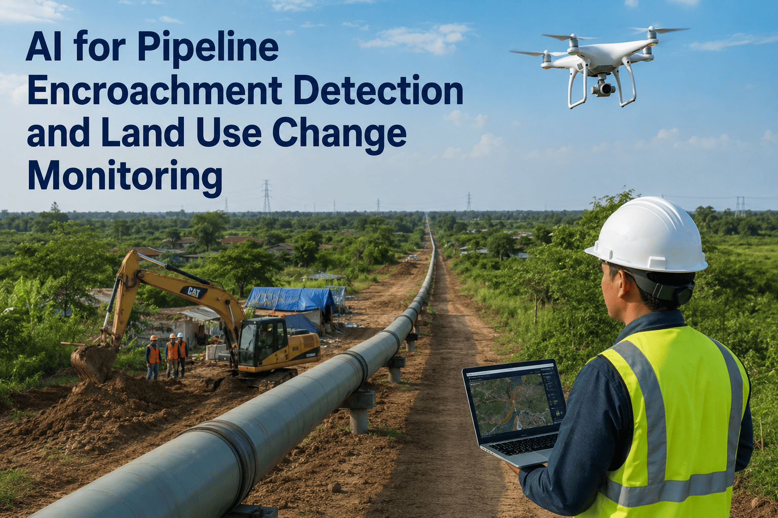
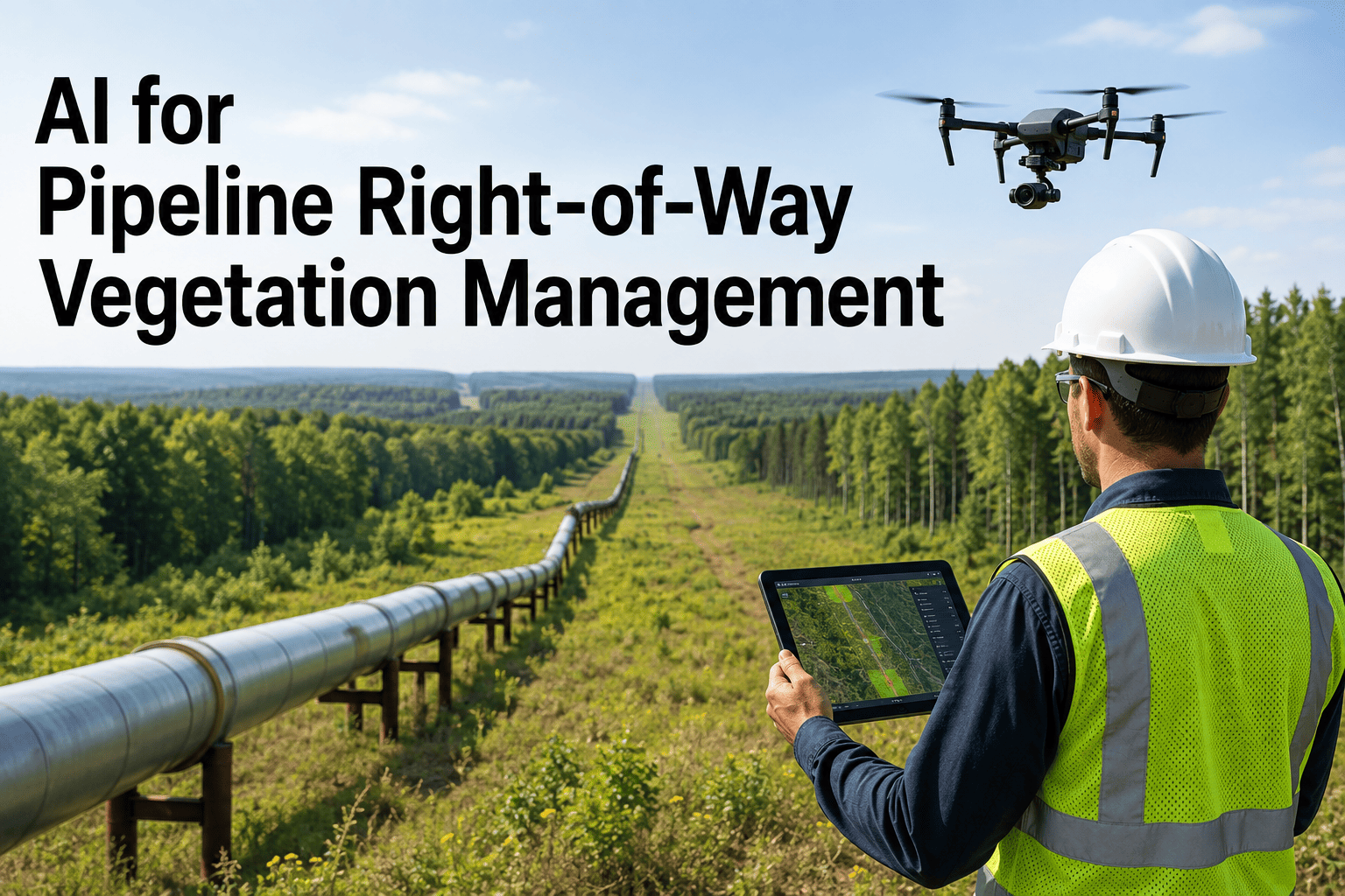
Third-party damage is the single largest cause of significant pipeline incidents in most jurisdictions, outpacing corrosion, equipment failure, and natural forces combined. Every year, excavators strike buried pipelines that were marked, that had one-call tickets filed, and that were supposed to be avoided, because the gap between a written procedure and a person operating a backhoe near a pressurized line is measured in inches and seconds. Right-of-way patrols, whether conducted from the air, on the ground, or through remote monitoring, are the last line of defense between that excavator bucket and the pipe wall. The challenge for pipeline operators is building a patrol and damage prevention program that actually catches unauthorized activity before contact occurs rather than simply documenting the damage after the fact. Explore how iFactory's ROW patrol management helps operators move from reactive documentation to proactive prevention.
Pipeline Damage Prevention
The Leading Cause of Pipeline Incidents Is Preventable
Right-of-way patrols, encroachment detection, one-call management, and public awareness programs working together to stop third-party damage before it reaches the pipe.
19%
Of significant incidents caused by excavation damage
60%+
Of third-party hits occur outside one-call process
Aerial
Patrol coverage for long transmission corridors
Ground
Patrol detail for high-consequence urban areas
Why Third-Party Damage Dominates Pipeline Incident Statistics
The pipeline industry has invested heavily in internal corrosion management, inline inspection, and integrity assessment over the past two decades, and the results show in the data. Corrosion-related incidents have declined significantly on pipelines with mature integrity management programs. Third-party damage has not followed the same trajectory because it is fundamentally an external threat that lives outside the operator's direct control. The pipeline operator does not choose where an excavator digs, whether a landowner clears trees along the right-of-way boundary, or whether a developer grades a lot that encroaches on the easement. These are decisions made by third parties who may not know the pipeline exists, may not understand the stakes of a contact, or may simply choose to ignore the marking and proceed with work.
The data from regulatory agencies in North America consistently shows that excavation damage accounts for a disproportionate share of significant incidents relative to other causes. What makes this pattern particularly frustrating for operators is that third-party damage is, in principle, the most preventable category. Unlike internal corrosion, which develops invisibly over years and requires sophisticated inspection to detect, a third-party strike is a physical event that occurs at a specific time and place where preventive action could have intervened. The prevention system, which includes one-call programs, pipeline marking, right-of-way patrols, and public awareness, has multiple layers, but each layer has gaps that allow damage to occur.
The Threat Categories That Live on Every Right-of-Way
Not all third-party threats look like an excavator working directly over the pipeline. The range of activities that can damage a pipeline extends well beyond construction excavation to include seemingly minor activities that incrementally reduce the protective buffer between the pipe and the surface, change the drainage patterns around the pipe, or introduce loads that the right-of-way was not designed to carry. A patrol program that only watches for active excavation is missing the majority of the threat spectrum.
Severe
Mechanical Excavation
Backhoes, trenchers, augers, and pile drivers working within the right-of-way or near the easement boundary. This is the highest-risk threat because a single contact can cause immediate rupture, and the energy involved in mechanical excavation makes even a glancing blow capable of compromising pipe integrity.
Severe
Unauthorized Boring or Drilling
Horizontal directional drilling, water well installation, or geotechnical borings that cross the pipeline corridor at depth without coordination. These threats are particularly dangerous because they may not be visible from the surface and can strike the pipeline without any surface indication that work is occurring.
High
Encroaching Structures
Buildings, sheds, fences, pools, or other permanent structures built within the easement boundary. Encroachment limits future access for patrol, inspection, and maintenance, and it introduces foundation loads or drainage changes that can affect the pipeline over time.
High
Vegetation Clearing and Grading
Landowners or developers clearing trees, grading land, or changing drainage within the right-of-way. Root removal can expose buried pipe, grading can reduce cover depth, and drainage changes can redirect water flow toward or away from the pipeline in ways that affect corrosion or stability.
Moderate
Agricultural Activity
Deep plowing, tile installation, or irrigation work that penetrates the soil near pipeline depth. Agricultural damage often occurs repeatedly in the same locations because farming operations follow seasonal patterns, making it a persistent rather than one-time threat.
Moderate
Vehicle and Equipment Traffic
Heavy equipment, trucks, or repeated vehicle traffic crossing the right-of-way where no crossing agreement exists. This can compact soil, reduce cover depth over time, or directly strike above-ground facilities such as valves or cathodic protection test stations.
Patrol Methods and What Each One Actually Catches
No single patrol method provides complete coverage of the threat spectrum. Aerial patrols cover long distances quickly but cannot see beneath tree canopy or detect subsurface activity. Ground patrols see detail that aircraft miss but cannot cover the mileage that transmission pipelines require. Remote monitoring through cameras, satellites, or landowner reports fills some gaps but introduces others related to data latency and verification. An effective program layers these methods so that the weaknesses of one are compensated by the strengths of another.
Aerial Patrol
Catches large-scale excavation, grading, new construction, major encroachment, and land-use changes visible from altitude
Coverage: 100+ miles per flight hour for fixed-wing, 40-60 miles for helicopter
Limitation: Cannot see beneath tree canopy, cannot detect subsurface activity, limited detail at altitude
Frequency: Weekly to biweekly for most transmission pipelines per regulatory requirements
Ground Patrol
Catches small-scale encroachment, marker damage, unauthorized crossing, cover depth reduction, erosion, and detailed condition visible at walking or driving speed
Coverage: 10-30 miles per day depending on terrain and access conditions
Limitation: Slow coverage rate, limited by road access and terrain, subject to observer fatigue and consistency
Frequency: Monthly to quarterly for most segments, more frequent in high-threat areas
Remote Monitoring
Catches construction activity through satellite imagery change detection, camera feeds at high-risk crossings, and landowner or public reports
Coverage: Continuous for camera-monitored points, periodic for satellite, event-driven for reports
Limitation: Satellite has days-to-weeks latency, cameras cover only fixed points, reports are unreliable and inconsistent
Frequency: Continuous at monitored points, variable for satellite and report-based detection
The Encroachment Escalation Timeline
Encroachment does not typically appear overnight as a full-blown structure sitting on the pipeline. It develops through a recognizable sequence of stages that starts with early indicators and escalates if not interrupted. A patrol program that is tuned to detect activity at the earliest stages has the best chance of preventing the encroachment from reaching the point where it affects pipeline safety or requires enforcement action. The timeline below shows the typical progression and the intervention opportunities at each stage.
How Encroachment Develops and Where Intervention Is Possible
Stage 1: Early Indicators
Survey stakes appear near the easement boundary. A contractor visits the site. Land clearing begins at the edge of the right-of-way. No work has crossed the easement line yet, but the pattern of activity suggests construction is planned adjacent to the pipeline.
Patrol detects and logs activity. Operator contacts landowner or contractor to verify scope and ensure pipeline awareness.
Stage 2: Boundary Crossing
Grading, clearing, or excavation crosses into the easement boundary. Soil is moved within the right-of-way. The pipeline marker posts may still be present but the activity has technically entered the protected zone even if it has not reached the pipe.
Patrol issues a stop-work notification. Operator verifies whether one-call was filed and whether pipeline locate was requested.
Stage 3: Cover Reduction
Activity progresses to a point where soil cover over the pipeline is reduced. The pipe may not be exposed yet, but the remaining cover is less than the minimum required for protection. This is a high-risk condition because any further excavation will reach the pipe directly.
Operator dispatches personnel to the site. Work is halted until the pipeline is exposed, inspected, and properly protected or backfilled to required depth.
Stage 4: Contact or Exposure
The pipeline is either physically struck by equipment or fully exposed by excavation. This is a damage event regardless of whether it results in an immediate leak. Coating damage, denting, or stress concentration from a near-miss all require engineering assessment and potential repair.
Emergency response procedures activated. Pipeline shutdown assessed. Damage investigated, documented, and reported per regulatory requirements.
Want to see how your patrol data maps against this escalation timeline? Book a 30-minute walkthrough with our ROW management team.
One-Call System Integration and Where It Falls Short
The one-call system, known as 811 in the United States and various provincial equivalents in Canada, is the foundational layer of third-party damage prevention. It requires anyone planning to excavate to call a central number before digging so that affected utility operators can be notified and can mark or locate their facilities. When the system works as intended, the excavator knows where the pipeline is before they break ground, and the operator has the opportunity to monitor the work. In practice, the one-call system has well-documented gaps that limit its effectiveness as a standalone prevention measure.
No Call Placed
Studies of pipeline strike data consistently show that a significant percentage of third-party damage events occur on excavations where no one-call ticket was filed at all. The excavator either did not know about the one-call requirement, chose not to call, or believed the work was too shallow to reach buried utilities. No notification system can protect against an excavation it does not know about.
Call Placed but Inaccurate
Tickets are filed with incorrect addresses, incomplete dig descriptions, or maps that do not accurately reflect where the work will occur. The operator marks the wrong location or does not mark at all because the ticket information does not place the dig near the pipeline, even though the actual excavation plan does cross the right-of-way.
Locate Marks Ignored or Disturbed
Even when the pipeline is accurately located and marked, excavators sometimes work outside the marked tolerance zone, fail to hand-dig within the tolerance zone as required, or allow marking paint to be obscured by weather, traffic, or subsequent construction activity before the excavation begins.
Work Scope Changes After Locate
The original excavation plan covered a limited area that did not cross the pipeline, but the scope expanded during construction to include additional work that does cross the right-of-way. Because the expanded scope was not included in the original one-call ticket, the operator has no opportunity to mark or monitor the new work area.
Building a Multi-Layer Prevention Program
Because no single prevention method catches all third-party threats, effective programs stack multiple layers so that a threat that penetrates one layer is caught by the next. The diagram below illustrates how these layers interact and where the gaps between layers create the residual risk that patrol programs must address directly.
Layered Defense Against Third-Party Damage
Public Awareness
Landowner outreach, school programs, mailings, and community engagement to ensure people near the pipeline know it exists and know how to report planned digging
One-Call and Locating
811 ticket management, locate marking, and pre-dig meetings to ensure excavators have accurate pipeline location information before work begins
Pipeline Marking
Marker posts, warning signs, and at-grade indicators placed along the right-of-way to provide continuous visual presence of the pipeline corridor
Right-of-Way Patrols
Aerial, ground, and remote monitoring to detect unauthorized activity that bypasses all upstream prevention layers and enters the easement undetected
Excavation Monitoring
On-site observation during high-risk excavations near the pipeline to ensure digging stays within safe limits and stop-work authority is exercised when needed
Each layer has gaps. The patrol layer is the only one that actively searches for threats that bypassed all prior prevention steps.
What Effective ROW Programs Deliver
The operational value of a well-structured right-of-way patrol and damage prevention program shows up in measurable outcomes that go beyond simple compliance counts. The results below represent what operators typically observe after implementing a data-driven patrol program that ties field observations to threat assessment, escalation procedures, and performance tracking rather than treating patrols as a routine checkbox exercise.
Earlier
Threat detection
Encroachment caught at the survey-stake stage rather than after grading crosses the easement boundary
Fewer
Unmonitored excavations
One-call gaps identified by patrol before the excavation reaches the pipe rather than discovered after a strike
Faster
Response to unauthorized activity
Field observations routed to the right person with location and photo data rather than buried in a patrol report
Documented
Patrol performance history
Every patrol pass, observation, and escalation logged with timestamp and location for regulatory audit and program improvement
Frequently Asked Questions
How often are pipeline right-of-way patrols required by regulation?
Regulatory patrol frequency requirements vary by jurisdiction and by pipeline class location. In the United States, federal pipeline safety regulations for gas transmission pipelines require patrols at intervals not exceeding 26 weeks, but many operators patrol more frequently based on risk assessments that factor in class location, population density, construction activity levels, and historical threat patterns. Liquid pipelines have similar general requirements but the specific intervals depend on the operator's integrity management program and the risk ranking of individual segments. High-consequence areas and segments with known high third-party activity typically receive more frequent patrol coverage than low-risk rural segments. The regulatory minimum is a floor, not a target, and operators with strong damage prevention programs often patrol at twice the regulatory frequency or more in high-threat areas.
Talk to our specialists about aligning your patrol frequency with your actual threat profile.
What should a patrol observer actually look for on a right-of-way?
An effective patrol observation goes well beyond looking for someone actively digging over the pipe. Observers should be trained to recognize early indicators of planned construction such as survey stakes, contractor vehicles parked near the easement, and cleared areas adjacent to the right-of-way. They should note changes in vegetation cover that might indicate unauthorized clearing, new structures or fences that encroach on the easement, changes in drainage patterns that could affect the pipeline, and any condition that reduces cover depth such as erosion, grading, or road maintenance activity. Marker post condition is also important because missing or damaged markers indicate either neglect or intentional interference. The most valuable patrol observations are the ones that catch threats at the planning stage before any ground is broken, which requires observers who understand construction sequencing and can interpret what they are seeing rather than simply reporting what is obviously wrong.
Schedule a consultation to review your patrol observation standards.
How does aerial patrol compare to drone-based patrol for pipeline monitoring?
Traditional aerial patrol using fixed-wing aircraft or helicopters provides fast coverage of long pipeline corridors and is well-established in regulatory frameworks, but it operates at altitudes and speeds that limit detail and provide only a snapshot in time at each pass. Drone-based patrol can fly lower and slower, capturing higher-resolution imagery and video that can be reviewed in detail after the flight. Drones can also be equipped with sensors such as thermal imaging or LiDAR that provide additional data beyond visual observation. However, drones have significant limitations in terms of range per flight, weather restrictions, regulatory airspace requirements, and the time required to process and analyze the imagery they collect. For most transmission pipeline operators, drones are currently most effective as a targeted tool for inspecting specific high-risk areas or following up on observations from routine aerial or ground patrols, rather than as a wholesale replacement for traditional patrol methods. As drone regulations, battery technology, and automated image analysis continue to evolve, the balance between manned and unmanned patrol will shift, but the fundamental requirement for systematic corridor coverage remains the same.
Can satellite imagery replace physical right-of-way patrols?
Satellite imagery has improved dramatically in resolution and revisit frequency over the past decade, and it can detect large-scale land-use changes, major construction activity, and significant encroachment along pipeline corridors. As a supplementary monitoring layer, satellite change detection is valuable because it provides periodic coverage of entire pipeline systems without dispatching personnel to the field. However, satellite imagery cannot replace physical patrols for several reasons. The revisit frequency of commercial satellites, even at weekly intervals in some cases, creates temporal gaps during which fast-moving construction activity can start and progress significantly before the next image capture. Spatial resolution, while much improved, still may not detect small-scale encroachment, minor grading, or activity beneath tree canopy. And satellite imagery provides no ability to intervene in real time when a threat is detected, since the image is typically processed and analyzed hours to days after capture. Satellite monitoring is a powerful addition to the patrol toolkit but it does not eliminate the need for observers on the ground or in the air who can detect, verify, and respond to threats in near real time.
Reach out to our team to discuss how satellite data fits into a layered patrol strategy.
What happens when a patrol observer finds unauthorized activity on the right-of-way?
The response to an unauthorized activity observation should follow a defined escalation procedure that matches the severity of the threat to the urgency of the response. For activity that has not yet crossed the easement boundary, such as survey stakes or contractor staging adjacent to the right-of-way, the typical response is to document the observation with photos and location data, contact the landowner or contractor to determine the scope of planned work, and verify whether one-call procedures have been followed. For activity that has entered the easement but has not reached the pipeline, the response escalates to a field visit by operator personnel, a stop-work request if the activity is active, and coordination with the excavator to ensure the pipeline is properly located and protected before work continues. For activity that has reduced cover, exposed the pipe, or made contact, the response follows emergency procedures that may include pipeline shutdown, immediate dispatch of field personnel, regulatory notification, and incident investigation. The effectiveness of the escalation procedure depends on how quickly field observations reach the right decision-maker, which is where patrol management systems that provide real-time data capture and routing add significant value over paper-based reporting.
Book a demo to see how patrol observations flow through an automated escalation workflow.
Pipeline Damage Prevention
See Your ROW Patrol Data on a Threat Map
Bring your patrol logs, one-call ticket data, and encroachment history. We will show how spatial analysis of your observation data identifies threat patterns, patrol gaps, and escalation opportunities that paper reports cannot reveal.
Multi-Method
Aerial, ground, and remote patrol data integrated
One-Call
Ticket cross-referencing against patrol observations
Escalation
Automated threat routing and response tracking
Audit-Ready
Complete patrol history with timestamps and locations