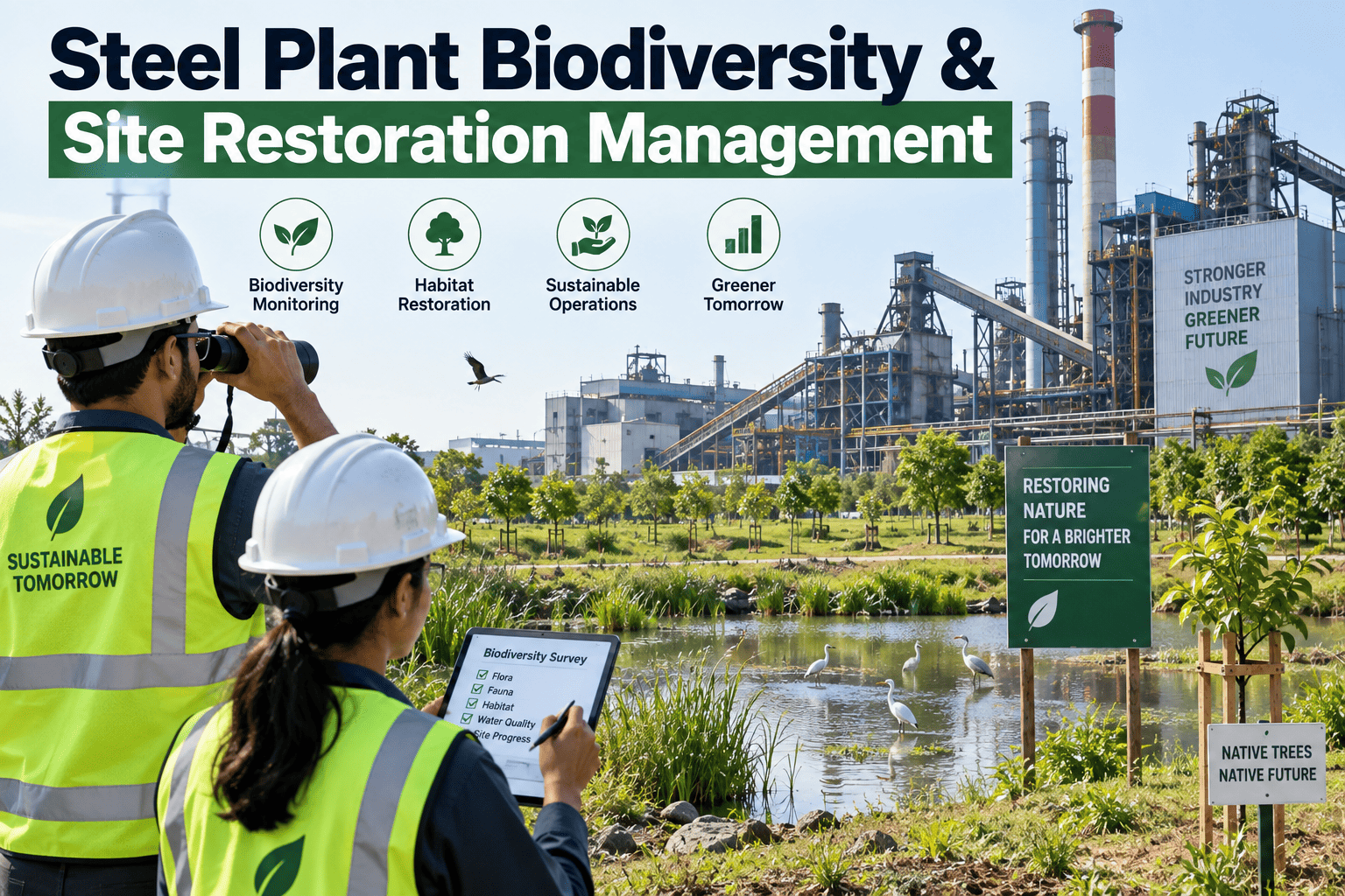
A steel plant's environmental footprint does not end at its emissions stack or effluent pipe — the land itself, the buffer zones, the green belts, and the eventual fate of the site once operations wind down are all part of the same environmental stewardship story that regulators, communities, and increasingly investors expect a plant to manage deliberately rather than as an afterthought. Biodiversity and site restoration planning used to be treated as a compliance checkbox tied narrowly to permit conditions, but plants that build a genuine habitat and land management program are finding it increasingly relevant to community relations, permit renewals, and long-term closure planning. Plants starting or auditing a site biodiversity program can begin with a conversation with iFactory's support team about tracking green belt condition and habitat data alongside the rest of the plant's environmental metrics.
The Land Around Your Plant Is Part of Its Environmental Record Too
Green belt condition, habitat health, and closure planning are increasingly part of how a plant is judged, not a side project. iFactory tracks site data alongside emissions and effluent so the whole environmental picture stays connected.
Why Biodiversity Management Belongs on the Same Dashboard as Emissions
Land condition around an industrial site changes slowly, which makes it easy to under-invest in monitoring relative to more immediately consequential metrics like emissions or effluent quality. But green belt degradation, habitat loss, or soil contamination migration are exactly the kind of slow-moving problems that become expensive and reputationally damaging once they are visible enough to draw regulatory or community attention, and by that point the corrective options are usually more limited and more costly than they would have been with earlier monitoring.
The Three Phases of a Site Stewardship Program
A mature program moves through three distinct phases, and a plant can be at a different stage in each depending on how long it has operated and what its closure timeline looks like.
Baseline Habitat Assessment
A documented survey of existing flora, fauna, and land condition around the site establishes the reference point every future assessment gets compared against, and skipping this step leaves later comparisons without a credible starting line.
Active Green Belt Management
Ongoing maintenance of buffer vegetation, monitoring for invasive species, and tracking canopy or ground cover condition keeps the green belt functioning as an actual buffer rather than a nominal one on a site map.
Post-Closure Restoration Planning
Long before a plant actually closes, a documented restoration plan for eventual land use, soil remediation, and habitat recovery gives regulators and communities confidence that closure will not simply abandon the site.
Bring Site Data Into the Same View as Everything Else
Book a 30-minute walkthrough of how iFactory tracks green belt and habitat condition alongside emissions and effluent data.
What a Habitat Assessment Actually Covers
A credible baseline assessment goes well beyond counting trees in the green belt, and the table below outlines the categories most assessment frameworks expect a plant to document.
| Assessment Category | What It Documents | Why It Matters |
|---|---|---|
| Vegetation Survey | Species present, canopy cover, invasive species presence | Establishes the baseline green belt condition to track against over time |
| Wildlife Corridor Mapping | Movement patterns and habitat connectivity around the site | Identifies whether plant infrastructure fragments existing habitat |
| Soil and Water Quality | Baseline contamination levels in surrounding land and waterways | Sets the reference point closure remediation targets will be measured against |
| Community Land Use | How surrounding land is used by nearby communities | Informs restoration planning around what future land use is actually desired |
Building Biodiversity Data Into Regular Environmental Reporting
Most environmental reporting cycles already track emissions, effluent, and waste data on a fixed cadence, and habitat and green belt condition benefits from the same discipline rather than sitting outside that cadence as a separate, less frequently reviewed activity.
Assign Clear Ownership
A named owner for green belt and habitat condition, distinct from whoever owns emissions or effluent reporting, ensures the land-based metrics get the same attention as the stack and pipe ones.
Set a Fixed Inspection Cadence
A scheduled walkthrough and condition assessment, tied to the calendar rather than triggered only by an upcoming permit review, is what catches degradation while it is still an easy fix.
Report Alongside Other Environmental Metrics
Including habitat condition in the same reporting package as emissions and effluent data keeps it visible to the same leadership audience that already reviews the rest of the environmental record.
A Composite Scenario: The Green Belt That Existed Only on Paper
A steel plant preparing for a permit renewal review discovered during a routine site walk that its designated green belt buffer, which had appeared adequately vegetated on the original site plan and had not been physically inspected in several years, had substantially degraded due to unmanaged invasive species growth crowding out the native vegetation that had originally provided the buffer function.
The gap had gone unnoticed because the green belt was treated as a static line item on the environmental permit documentation rather than something requiring ongoing physical inspection and condition tracking, similar to how emissions monitoring equipment is checked on a fixed schedule. Once identified, restoring the buffer with native species and instituting a scheduled inspection routine took a full growing season, and the plant used the incident to build vegetation condition tracking directly into its regular environmental reporting cadence going forward.
Mistakes That Undermine Site Stewardship Programs
Treating the Green Belt as a Static Site Plan Feature
Vegetation is a living system that changes without active management, and a green belt that looks adequate on a site map from years ago may bear little resemblance to its actual current condition.
Deferring Closure Planning Until Closure Is Imminent
Restoration and remediation planning done at the last minute rarely accounts properly for baseline conditions that should have been documented years earlier, weakening the credibility of the eventual plan.
Skipping Baseline Assessment Before Making Land Use Changes
Without a documented baseline, it becomes impossible to demonstrate whether a later land use change has actually degraded habitat condition or simply looks different from what someone remembers.
Excluding Community Input From Restoration Planning
A restoration plan built without input on how surrounding communities actually want to use the land after closure risks producing a technically compliant outcome that satisfies no one in practice.
Is Your Site Stewardship Program Actually Current
Green belt condition is physically inspected on a schedule, not assumed
A buffer zone that has not been walked and inspected recently can degrade significantly without appearing on any documentation until a permit review or community complaint forces the issue.
A documented habitat baseline exists and is dated
A baseline assessment with a clear date and methodology gives every future comparison a credible reference point, rather than relying on institutional memory of what the site used to look like.
Restoration planning is underway well ahead of any closure timeline
Starting restoration planning early, even decades before an anticipated closure, gives a plant time to build the baseline data and community relationships that a rushed last-minute plan cannot replicate.
Frequently Asked Questions
Why do permit renewals increasingly consider green belt and habitat condition?
Regulatory frameworks in many jurisdictions have expanded beyond narrow emissions and discharge compliance to include broader environmental stewardship expectations, reflecting community and regulatory interest in a plant's total environmental footprint rather than just its stack and pipe outputs. A plant that can demonstrate active, documented green belt management alongside its emissions compliance record generally has a stronger position during permit renewal review than one presenting emissions data alone.
When should a plant start post-closure restoration planning?
Restoration planning is best started well ahead of any anticipated closure date, ideally as soon as a plant has a documented baseline habitat assessment, since restoration targets are typically measured against pre-operational or early-operational baseline conditions that become harder to reconstruct credibly the longer a plant has been operating without that documentation. Many jurisdictions now expect a closure and restoration plan as a condition of the original operating permit rather than something developed only when closure becomes imminent.
What does an effective green belt buffer actually need to function properly?
An effective buffer needs ongoing management, not just initial planting, including monitoring for invasive species that can crowd out the native vegetation providing the actual buffer function, periodic replanting where vegetation has died or degraded, and inspection for erosion or drainage issues that can undermine the buffer's physical integrity over time. Treating the buffer as a one-time installation rather than an ongoing living system is the most common reason a green belt on paper diverges from a green belt on the ground.
How is habitat condition typically measured and tracked over time?
Vegetation surveys tracking species composition and canopy or ground cover, combined with periodic wildlife activity observation and soil or water quality sampling in and around buffer zones, are the most common methods used to build a comparable condition record over time. The key requirement is consistency in methodology and timing between assessments, since a habitat comparison built from inconsistent survey methods is difficult to interpret reliably regardless of how thorough any single assessment was. Book a demo to see how iFactory helps structure this kind of recurring assessment data.
How does community input factor into a site restoration plan?
Community input helps determine what future land use is actually desired once a site is restored, whether that is returning land to agricultural use, creating public green space, or preserving it as habitat, and a restoration plan built without this input risks meeting technical remediation standards while still failing to deliver an outcome the surrounding community actually values. Engaging community stakeholders early in the planning process, well before closure is imminent, generally produces a restoration outcome with broader support than one presented as a finished plan late in the process. Plants building out this kind of engagement process can reach iFactory support for guidance.
Keep Site Stewardship Data as Current as Everything Else You Track
iFactory brings green belt condition, habitat assessment, and restoration planning data into the same view as emissions and effluent monitoring. Book a walkthrough to see it running on a live environmental program.