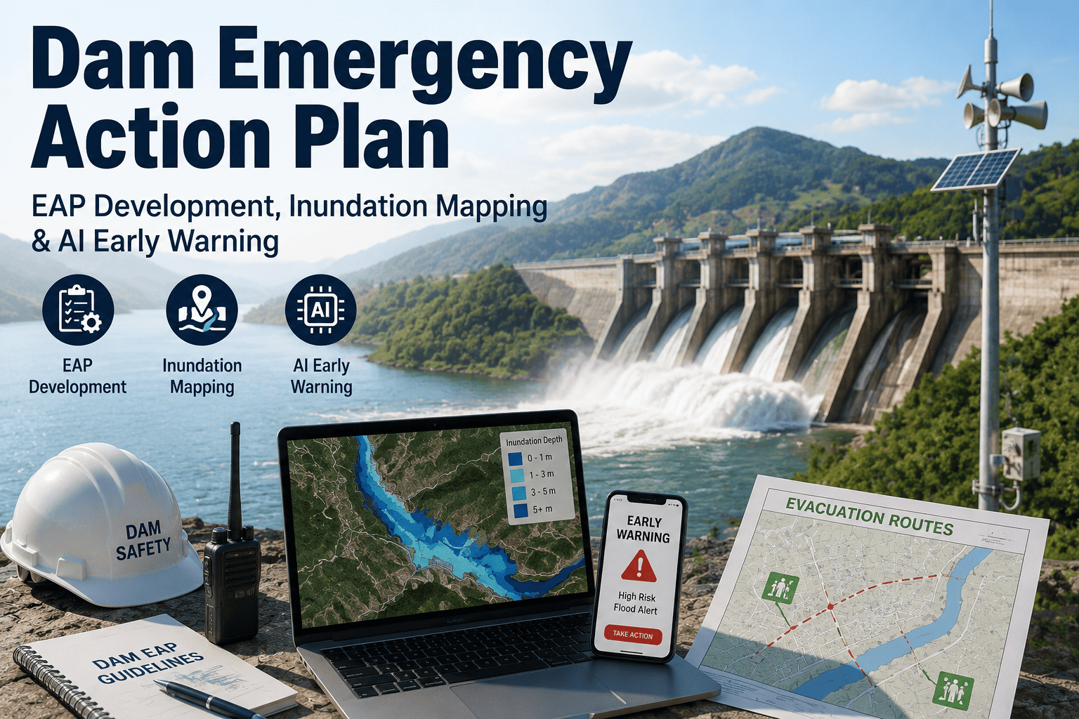
An Emergency Action Plan is only as good as the last time someone actually tested it. Most dam owners have a binder that satisfies the FEMA and state dam safety requirement on paper — detection procedures, a notification chain, inundation maps, a list of who calls whom — but a document that hasn't been exercised against real-time data is a plan built for the emergency someone imagined two years ago, not the one actually unfolding on the reservoir gauge right now. Inundation maps drawn from a single hydraulic study go stale the moment downstream development changes, and a notification chain that depends on a person recognizing a rate-of-rise trend on a paper chart is only as fast as that person's next check-in. See how iFactory keeps EAP detection, inundation mapping, and notification procedures running on live sensor data instead of a static binder.
Dam Emergency Action Plans Built on Live Data, Not a Binder That Gets Opened Once a Year
AI-powered inundation mapping and real-time early warning integration that keeps detection, notification, and mitigation procedures aligned with FEMA and state dam safety guidelines — and actually exercised, not just filed.
The Four Elements Every Compliant Emergency Action Plan Has To Cover
FEMA's federal guidelines and the state dam safety programs built around them are consistent on this point: an EAP is a formal document that identifies potential emergency conditions and specifies the actions to be taken to minimize loss of life and property damage, and it has to include detection and assessment guidance, defined mitigation actions, a notification procedure for downstream emergency management authorities, and inundation maps that identify population and infrastructure at risk. State dam safety offices reviewing an EAP for approval are checking each of these four elements individually, and a plan that's thin on any one of them — even if the other three are strong — typically comes back with revision requests rather than a sign-off. The checklist below is what a reviewing state dam safety office is actually looking for when an EAP crosses their desk, in roughly the order they tend to evaluate it.
A Static Inundation Map Describes One Scenario. Your Reservoir Rarely Behaves Like Just One Scenario.
Most inundation maps on file today were generated once, from a single breach study, at a single reservoir elevation, with downstream development frozen at whatever it looked like the year the study was commissioned. That's not a criticism of the original study — it's simply what a point-in-time hydraulic model can produce. The problem is that reservoirs don't operate at one elevation, watersheds don't stay at one inflow rate, and the population and infrastructure downstream of a dam rarely stay fixed for the years between formal revision cycles. AI-based flood detection changes that by pulling continuously from satellite imagery, ground-based sensors, and hydrological models to produce inundation maps that update as new data comes in, rather than sitting static in a binder until the next formal study cycle years later. The practical result for an operations director is a map that reflects the reservoir's actual current elevation and forecasted inflow on the day an incident begins, not the elevation the original consultant modeled.
From Sensor Reading to Downstream Notification, Without a Manual Handoff in the Middle
The value of an early warning system isn't the sensors themselves — it's how fast a reading turns into a decision a human can act on. A dam can have excellent instrumentation and still have a slow warning system, if every reading has to pass through a manual review step before anyone downstream is notified. This is the sequence that closes that gap, moving from raw sensor data to a notified Emergency Operations Center without a manual handoff sitting in the middle of it.
High-resolution, impact-based flood forecasting research has demonstrated lead times of roughly 17 hours ahead of a major flood event using this kind of continuously updated approach — time that a downstream emergency management authority can use to stage resources, confirm evacuation routes, and open communication with the public well before water is actually moving.
An EAP That Has Never Been Exercised Is a Draft, Not a Plan
State dam safety guidance is explicit that EAP exercises are what validate and improve the plan's effectiveness — identifying weaknesses in specified actions, notification procedures, and the adequacy of inundation maps before a real event does it instead. The table below reflects the exercise types most state programs expect to see documented on a recurring cycle.
| Exercise Type | What It Tests | Typical Cadence |
|---|---|---|
| Tabletop Exercise | Walks stakeholders through a hypothetical scenario to review roles, notification chain, and decision points | Annually |
| Functional Exercise | Tests actual notification procedures and communication flow under simulated time pressure, without physical deployment | Every 1–3 years |
| Full-Scale Exercise | Includes physical response actions and coordination with downstream emergency management authorities in the field | Every 3–5 years |
| Inundation Map Review | Confirms population-at-risk sites, critical infrastructure, and evacuation routes still reflect current downstream conditions | Following any significant downstream development change |
Keeping this cadence documented is only half the challenge — the harder part is making each exercise genuinely test the plan rather than rehearse it. A functional exercise that runs the same scripted scenario every cycle tends to validate whatever assumptions were baked into the plan originally, without ever surfacing the gap that only shows up when conditions deviate from the script. Running exercises against live or historical sensor data, rather than a written narrative, is one of the more effective ways state programs have found to actually stress-test a notification chain and confirm inundation maps still hold up.
FEMA Sets the Framework. Your State Dam Safety Office Decides the Details.
FEMA's federal guidelines establish the baseline structure every EAP is measured against, but the specific formatting requirements, submission cadence, and review criteria are set at the state level, and they vary more than most operations directors expect when managing dams across more than one jurisdiction. A notification template accepted by one state dam safety office may need restructuring for another, and exercise documentation requirements can differ meaningfully in how much detail is expected per event. A monitoring and mapping system built on live, structured data rather than a fixed document format tends to adapt to those state-level differences far more easily than rewriting a static plan every time a jurisdiction's requirements shift, since the underlying detection, mapping, and notification data stays the same even when the reporting format around it changes.
An Emergency Action Plan Should React as Fast as the Water Does
iFactory connects reservoir sensor data, inundation mapping, and EOC notification into one continuously updated system, so your EAP reflects current conditions instead of the conditions that existed when it was last filed.
Where AI Actually Closes Gaps in a Conventional EAP
Neither approach replaces the regulatory requirement to have a documented plan — the difference is whether that plan reflects a moment in time or the current state of the reservoir and everything downstream of it. For an operations director accountable for both regulatory compliance and actual public safety outcomes, that difference shows up in two places: how much confidence the plan deserves during a real event, and how much staff time gets spent maintaining it between formal review cycles.
- Inundation maps generated once from a single breach study and revised only on a multi-year cycle
- Detection relies on staff recognizing a trend on a manual chart or gauge reading during a scheduled check
- Notification chain depends on a person correctly identifying severity and calling the next name on the list
- Exercises happen on the required cadence but often walk through the same static scenario each time
- Inundation maps update continuously as reservoir level, inflow forecast, and downstream conditions change
- Rate-of-rise and level thresholds correlated with inflow forecasts trigger detection automatically, day or night
- Alerts route directly into the defined EOC notification chain with the current map and reading attached
- Exercises can be run against live historical event data, testing the plan against real conditions, not a script
Industry research on IoT-enhanced flood monitoring has found reductions in property damage of up to roughly 40% where continuous sensor data and AI-driven early warnings are in place, largely because response staging happens earlier and more accurately than a manual detection process allows. AI-driven flood detection also tends to reduce the false-alarm rate compared with manual chart-checking, since machine learning models can distinguish genuine floodwater signatures from other surface or sensor noise — which matters directly to an operations director, because a notification chain that cries wolf too often is one that emergency management authorities and the public eventually start to discount.
Every EAP I've reviewed technically meets the checklist. Detection, mitigation, notification, inundation maps — it's all there on paper. What's usually missing is the connection between that document and what's actually happening at the dam right now. An inundation map that's three years old and a notification chain that depends on someone noticing a chart isn't a failure of planning, it's a failure of the data behind the plan. Operations directors don't need a better binder. They need the binder to be alive.
Frequently Asked Questions
Make Your Emergency Action Plan React to the Reservoir, Not Just the Regulatory Calendar
iFactory keeps detection, inundation mapping, and EOC notification running on live data, so the EAP your team relies on during an actual event is the same one that's been current every day leading up to it.